Download
3D Flyover
Add to list
More
22.0 km
~6 hrs 16 min
1125 m
Out and Back
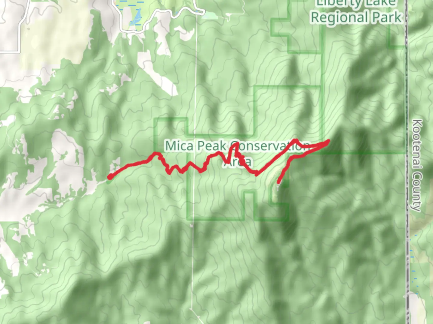
“Embark on the 22km California Creek Trail to Mica Peak for stunning views and historical intrigue.”
Starting near Spokane County, Washington, the California Creek Trail and Mica Peak trail is an invigorating out-and-back hike that spans approximately 22 kilometers (around 13.7 miles) with an elevation gain of about 1100 meters (3609 feet). This trail is rated as medium difficulty, making it suitable for moderately experienced hikers.
Getting There
To reach the trailhead, you can drive or use public transportation. If driving, head towards the Liberty Lake Regional Park, which is the nearest significant landmark. From Spokane, take I-90 East and exit at Liberty Lake. Follow E Appleway Ave and S Liberty Lake Rd to S Idaho Rd, where you will find parking near the trailhead. For those using public transport, take the Spokane Transit Authority (STA) bus route to Liberty Lake, and then a short taxi or rideshare will get you to the trailhead.
Trail Overview
The trail begins with a gentle ascent through dense forest, offering a cool and shaded start. As you progress, the trail becomes steeper, and you will encounter a series of switchbacks. At around 3 kilometers (1.9 miles) in, you will reach a small clearing with your first significant viewpoint, offering a glimpse of the Spokane Valley below.
Key Landmarks and Nature
Continuing on, the trail meanders through a mix of coniferous and deciduous trees. Around the 5-kilometer (3.1 miles) mark, you will cross California Creek via a sturdy wooden bridge. This is a great spot to take a break and enjoy the sound of the flowing water. Keep an eye out for local wildlife such as deer, black bears, and various bird species.
Historical Significance
As you ascend, you will pass through areas that were historically significant during the logging boom of the early 20th century. Remnants of old logging equipment and cabins can occasionally be spotted off the main trail. These relics serve as a reminder of the region's industrial past.
Reaching Mica Peak
The final push to Mica Peak is the most challenging part of the hike. The trail becomes rockier and steeper, with an elevation gain of about 300 meters (984 feet) in the last 2 kilometers (1.2 miles). Upon reaching the summit, you are rewarded with panoramic views of the surrounding mountains and valleys. On clear days, you can see as far as the Selkirk Mountains to the north and the Palouse to the south.
Navigation and Safety
Given the trail's moderate difficulty and varying terrain, it is advisable to use a reliable navigation tool like HiiKER to stay on track. The trail is well-marked, but having a digital map can be invaluable, especially in areas where the path may be less distinct.
Return Journey
The return journey follows the same path, allowing you to revisit the scenic spots and perhaps notice details you missed on the way up. Be cautious on the descent, as the rocky sections can be slippery, especially after rain.
This trail offers a blend of natural beauty, historical intrigue, and a rewarding physical challenge, making it a must-visit for hikers in the Spokane County area.

What to expect?
Activity types
Comments and Reviews
User comments, reviews and discussions about the California Creek Trail and Mica Peak, Washington.
4.23
average rating out of 5
13 rating(s)