Download
3D Flyover
Add to list
More
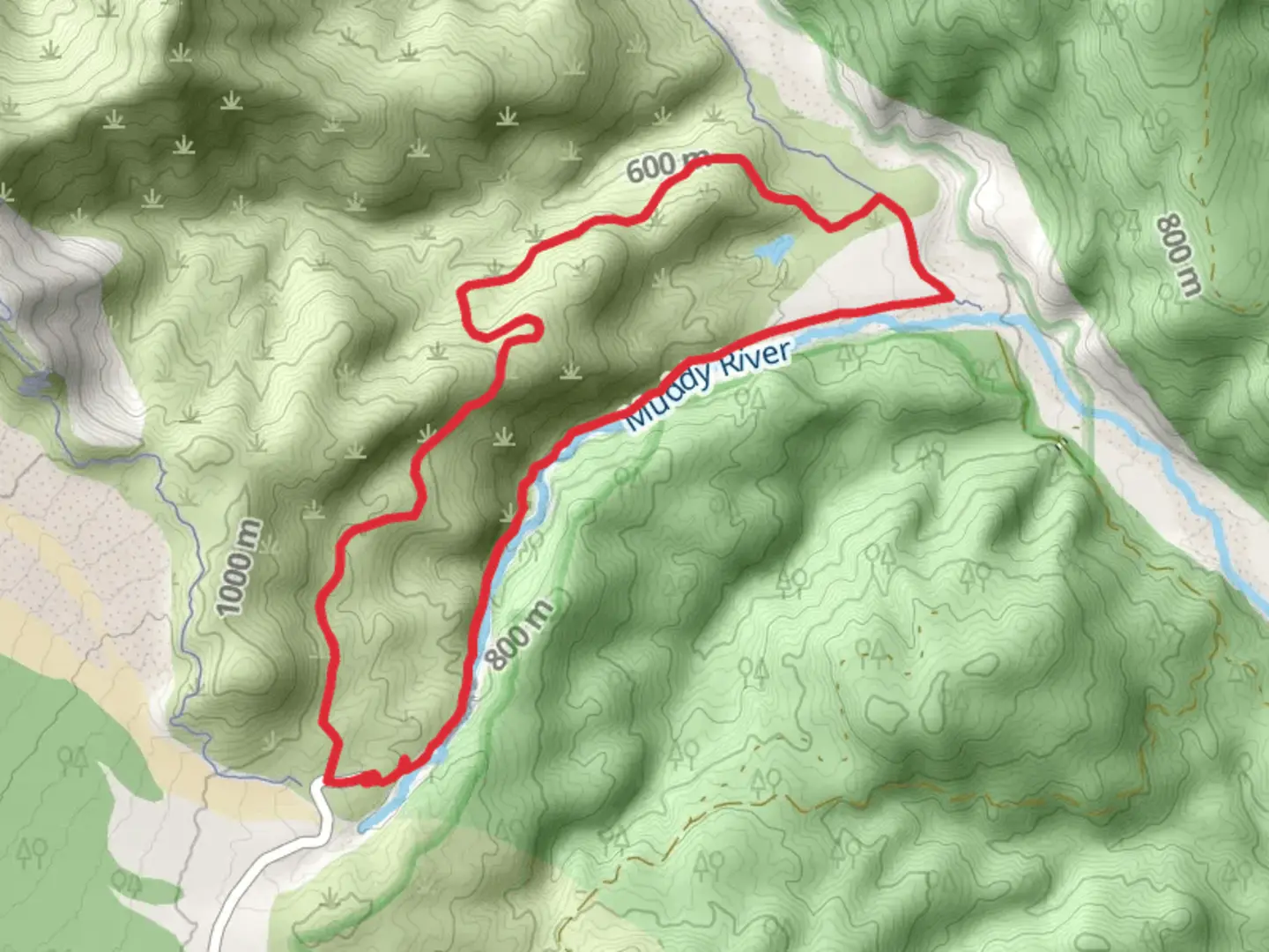
9.8 km
~2 hrs 53 min
555 m
Loop
“"Explore the mesmerizing volcanic landscapes of Lava Canyon Loop Trail, featuring waterfalls, suspension bridges, and diverse flora."”
Starting your adventure near Skamania County, Washington, the Lava Canyon Loop Trail offers a captivating journey through a landscape shaped by volcanic activity. This 10 km (6.2 miles) loop trail, with an elevation gain of approximately 500 meters (1,640 feet), is rated as medium difficulty, making it suitable for moderately experienced hikers.
Getting There
To reach the trailhead, you can drive to the Lava Canyon Trailhead, located near the Ape Cave Lava Tubes. If you're using public transport, the nearest major city is Portland, Oregon. From Portland, you can take a bus to Cougar, Washington, and then arrange for a local taxi or rideshare to the trailhead. The exact address for the trailhead is near Forest Road 83, Skamania County, WA 98616.
Trail Highlights
Volcanic Landscapes
The trail takes you through a dramatic landscape formed by the 1980 eruption of Mount St. Helens. As you hike, you'll encounter a variety of volcanic features, including lava flows, waterfalls, and deep canyons. The trail's unique geology is a testament to the powerful forces that shaped this region.
Waterfalls and Bridges
One of the most striking features of the Lava Canyon Loop Trail is the series of waterfalls you'll encounter. The first significant waterfall, located about 1.5 km (0.9 miles) from the trailhead, cascades down a rocky cliff, creating a mesmerizing sight. Further along, you'll cross several suspension bridges that offer breathtaking views of the canyon below. These bridges can be a bit challenging for those with a fear of heights, but they are sturdy and well-maintained.
Flora and Fauna
The trail is rich in diverse plant life, including ferns, mosses, and wildflowers that thrive in the moist, volcanic soil. Keep an eye out for local wildlife such as deer, elk, and various bird species. The lush vegetation provides a stark contrast to the rugged volcanic terrain, creating a unique and picturesque hiking experience.
Navigation and Safety
Given the trail's complexity, it's advisable to use a reliable navigation tool like HiiKER to stay on track. The trail is well-marked, but the rugged terrain and multiple junctions can be confusing. Make sure to download the trail map on HiiKER before you start your hike.
Elevation and Terrain
The trail's elevation gain of 500 meters (1,640 feet) is spread out over the 10 km (6.2 miles), with some steep sections that require careful footing. The terrain varies from smooth, well-trodden paths to rocky, uneven surfaces. Good hiking boots with ankle support are highly recommended.
Historical Significance
The Lava Canyon Loop Trail is not just a natural wonder but also a historical site. The area was dramatically altered by the 1980 eruption of Mount St. Helens, which reshaped the landscape and created the features you see today. The trail offers a unique opportunity to witness the power of volcanic activity and its lasting impact on the environment.
Practical Tips
- Water and Snacks: Ensure you carry enough water and high-energy snacks. There are no facilities along the trail.
- Weather: Check the weather forecast before you go. The trail can be slippery and dangerous in wet conditions.
- Permits: No special permits are required, but a Northwest Forest Pass is needed for parking at the trailhead.
Embark on this trail prepared, and you'll be rewarded with stunning views and a memorable hiking experience through one of Washington's most unique landscapes.

What to expect?
Activity types
Comments and Reviews
User comments, reviews and discussions about the Lava Canyon Loop Trail, Washington.
4.5
average rating out of 5
10 rating(s)