Download
Preview
Add to list
More
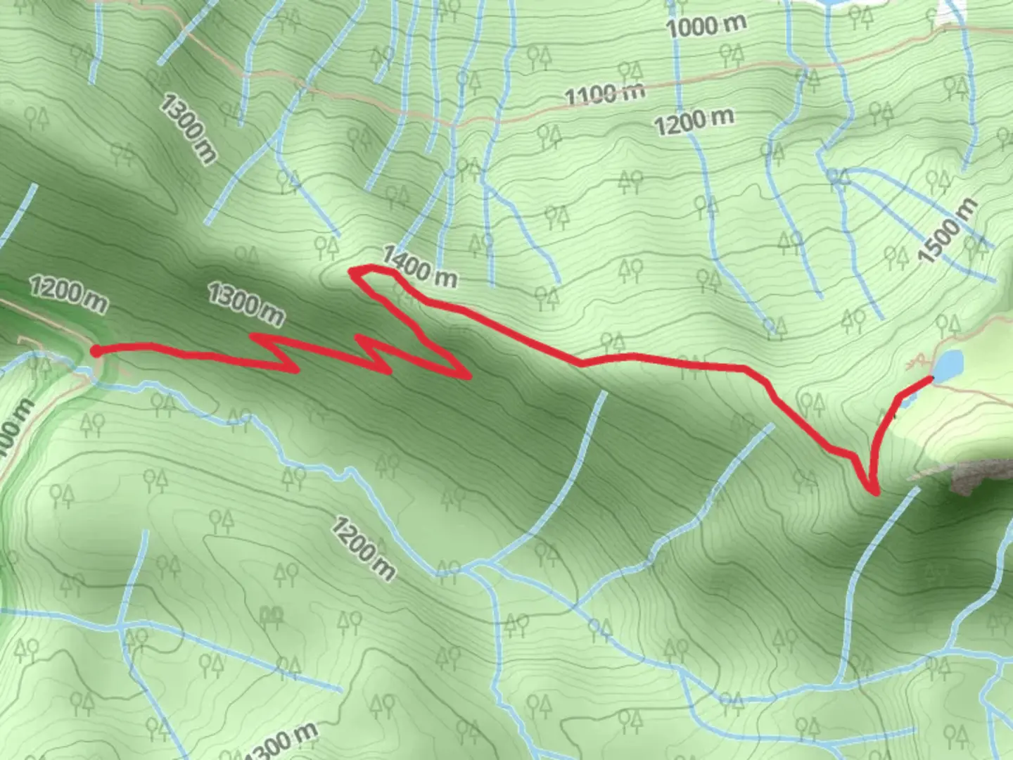
7.6 km
~2 hrs 25 min
545 m
Out and Back
“Embark on the St Andrews Creek Trail for stunning vistas, rich history, and vibrant flora and fauna.”
Starting your adventure near Pierce County, Washington, the St Andrews Creek Trail offers an invigorating hike with a distance of approximately 8 km (5 miles) and an elevation gain of around 500 meters (1,640 feet). This out-and-back trail is rated as medium difficulty, making it suitable for moderately experienced hikers.### Getting There To reach the trailhead, you can drive or use public transport. If driving, head towards the nearest significant landmark, Mount Rainier National Park, and follow signs to the trailhead. For those using public transport, the closest major city is Tacoma, Washington. From Tacoma, you can take a bus or shuttle service to Mount Rainier National Park, and then a short taxi ride will get you to the trailhead.### Trail Overview The trail begins with a gentle ascent through a lush forest of Douglas fir and western hemlock. As you progress, the path becomes steeper, offering a moderate challenge. The first significant landmark you'll encounter is a picturesque wooden bridge crossing St Andrews Creek, approximately 1.5 km (0.9 miles) from the trailhead. This is a great spot to pause and enjoy the sound of rushing water.### Flora and Fauna As you continue, the trail opens up to a meadow filled with wildflowers during the spring and summer months. Keep an eye out for local wildlife, including deer, black bears, and a variety of bird species. The area is also known for its vibrant fall foliage, making it a beautiful hike year-round.### Historical Significance The region around St Andrews Creek has a rich history. Native American tribes originally inhabited the area, and you may come across interpretive signs along the trail that provide insights into their way of life. Additionally, the trail was used by early settlers and loggers in the 19th century, adding a layer of historical intrigue to your hike.### Mid-Trail Highlights Around the 4 km (2.5 miles) mark, you'll reach a viewpoint offering stunning vistas of Mount Rainier and the surrounding valleys. This is the perfect spot for a break and some photography. The elevation gain to this point is about 300 meters (984 feet), so take your time and enjoy the scenery.### Final Stretch The last section of the trail involves a steeper climb, gaining the remaining 200 meters (656 feet) in elevation. The trail narrows and becomes rockier, so watch your footing. The endpoint offers a serene spot by the creek, ideal for a picnic or simply soaking in the natural beauty before heading back.### Navigation and Safety For navigation, it's highly recommended to use the HiiKER app, which provides detailed maps and real-time updates. Always carry sufficient water, snacks, and a first-aid kit. Weather can change rapidly, so dress in layers and be prepared for sudden shifts.### Return Journey The return journey follows the same path, allowing you to revisit the beautiful landscapes and perhaps notice details you missed on the way up. The descent is easier on the legs but still requires caution, especially on the steeper sections.By following these guidelines and being well-prepared, you'll have a memorable and enjoyable hike on the St Andrews Creek Trail.

What to expect?
Activity types
Comments and Reviews
User comments, reviews and discussions about the St Andrews Creek Trail, Washington.
4.29
average rating out of 5
7 rating(s)