Download
3D Flyover
Add to list
More
16.1 km
~5 hrs 55 min
1615 m
Loop
“The 16 km loop offers stunning views, diverse wildlife, and a challenging yet rewarding hike at Mount Rainier.”
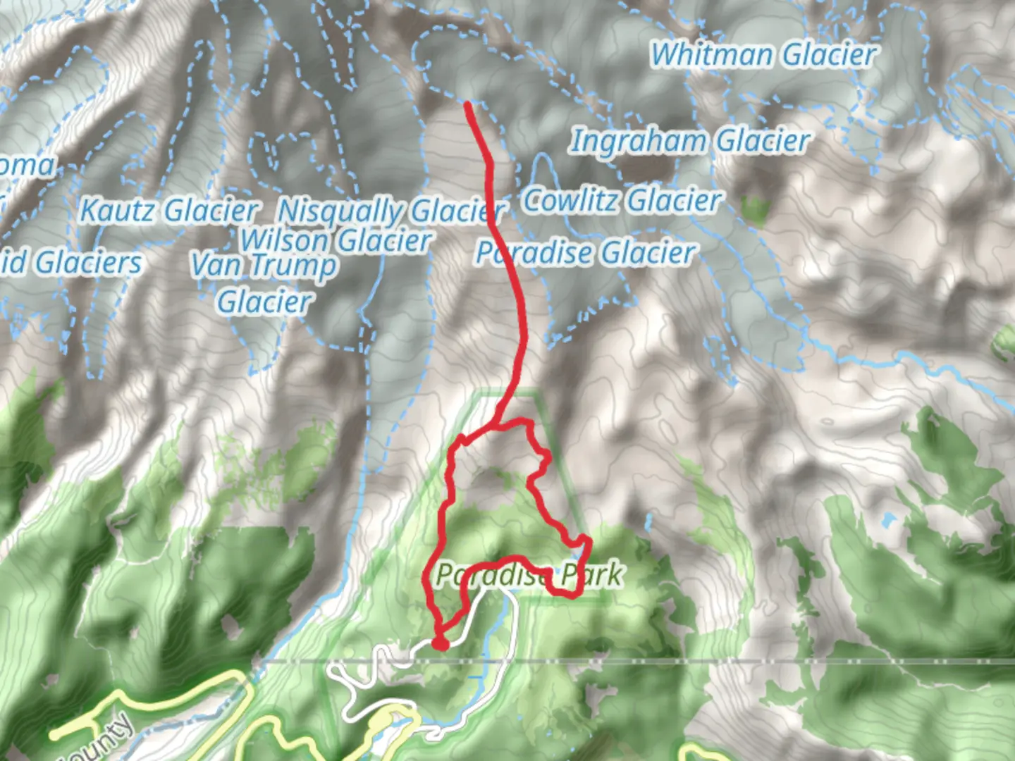
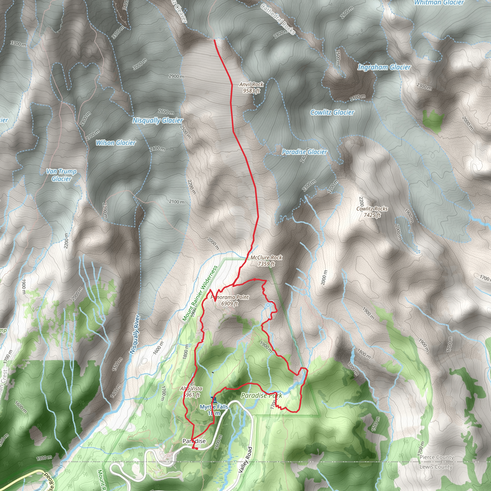
Starting near Pierce County, Washington, the Pebble Creek Trail and Upper Skyline Trail form a loop of approximately 16 km (10 miles) with an elevation gain of around 1600 meters (5250 feet). This trail is rated as medium difficulty, making it suitable for moderately experienced hikers.
Getting There
To reach the trailhead, you can drive or use public transportation. If driving, head towards Mount Rainier National Park, specifically the Paradise area. The nearest significant landmark is the Paradise Inn, located at 52807 Paradise Rd E, Ashford, WA 98304. Public transportation options are limited, but during peak seasons, shuttle services may be available from nearby towns like Ashford.
Trail Overview
The trail begins at the Paradise area, which is already at a high elevation, offering stunning views right from the start. As you ascend, you'll traverse through lush meadows filled with wildflowers during the summer months. The first significant landmark is the Pebble Creek, located about 3 km (1.9 miles) from the trailhead. This is a good spot to take a short break and enjoy the serene environment.
Flora and Fauna
The trail is rich in biodiversity. Keep an eye out for marmots and pikas scurrying among the rocks. Bird watchers will be delighted to spot species like the Clark's Nutcracker and the Mountain Bluebird. The meadows are often filled with lupines, Indian paintbrush, and avalanche lilies, creating a colorful tapestry against the backdrop of Mount Rainier.
Elevation Gain and Terrain
The elevation gain is significant, with the trail climbing steadily. After Pebble Creek, the trail becomes steeper and rockier as you approach the Muir Snowfield. This section can be challenging, especially if snow is still present. Proper footwear and trekking poles are recommended. The total elevation gain is around 1600 meters (5250 feet), so be prepared for a strenuous climb.
Historical Significance
Mount Rainier National Park, established in 1899, is one of the oldest national parks in the United States. The Paradise area has a rich history, with the Paradise Inn being a historic landmark built in 1916. The area was named "Paradise" by Martha Longmire, an early settler, who was struck by its beauty.
Upper Skyline Trail
After reaching the high point near the Muir Snowfield, the trail loops back via the Upper Skyline Trail. This section offers panoramic views of the surrounding peaks and valleys. On clear days, you can see as far as Mount St. Helens and Mount Adams. The descent is gradual, passing through alpine meadows and offering numerous photo opportunities.
Navigation and Safety
Given the elevation and potential for rapidly changing weather, it's crucial to be prepared. Use HiiKER for accurate trail maps and real-time updates. Always check the weather forecast before heading out and carry essentials like water, snacks, and a first aid kit. The trail can be snow-covered even in late summer, so be prepared for varying conditions.
Final Stretch
The final stretch of the trail brings you back to the Paradise area, completing the loop. This section is less strenuous, allowing you to enjoy the final views and reflect on the journey. The total distance covered is around 16 km (10 miles), making it a rewarding day hike for those prepared for the elevation gain and varying terrain.
What to expect?
Activity types
Comments and Reviews
User comments, reviews and discussions about the Pebble Creek Trail and Upper Skyline Trail, Washington.
4.38
average rating out of 5
8 rating(s)
