Download
3D Flyover
Add to list
More
12.1 km
~3 hrs 12 min
475 m
Out and Back
“The Mowich Lake via Grindstone Trail offers stunning scenery, moderate challenge, and rich history for seasoned hikers.”
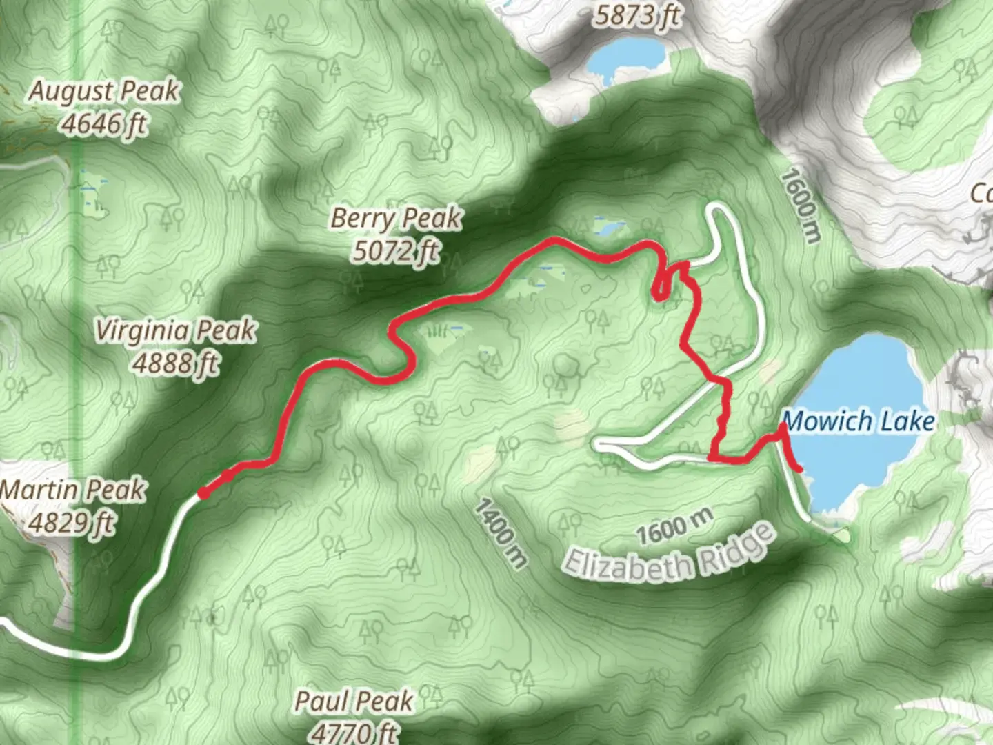
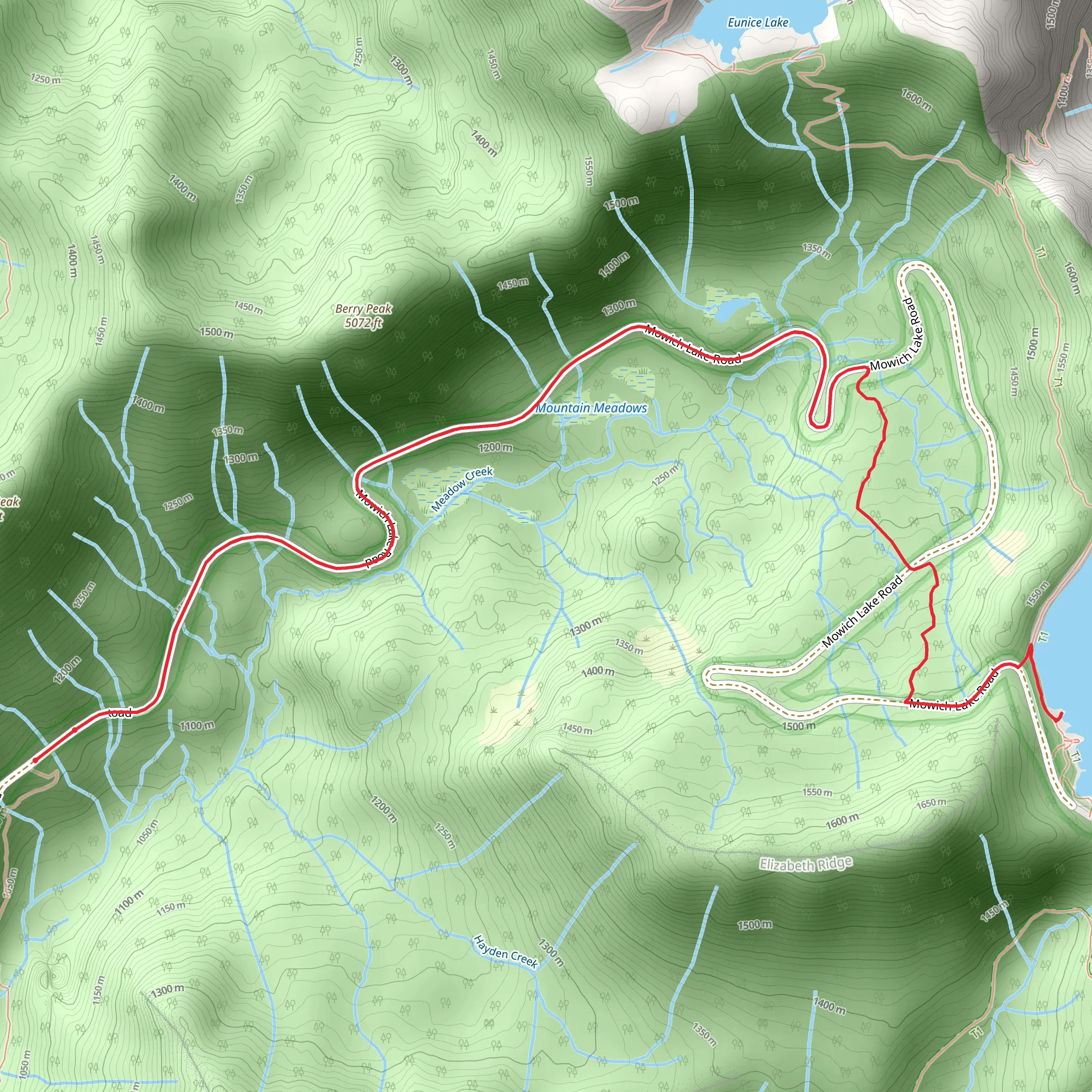
Starting near Pierce County, Washington, the Mowich Lake via Grindstone Trail is an out-and-back hike that spans approximately 12 kilometers (7.5 miles) with an elevation gain of around 400 meters (1,312 feet). This trail is rated as medium difficulty, making it suitable for moderately experienced hikers.
Getting There
To reach the trailhead, you can drive or use public transportation. If driving, head towards the Carbon River Entrance of Mount Rainier National Park. The nearest significant landmark is the Carbon River Ranger Station. From there, follow the signs to Mowich Lake. The trailhead is located near the Mowich Lake Campground. For those using public transport, the closest major city is Tacoma, Washington. From Tacoma, you can take a bus to the Carbonado area and then arrange for a taxi or rideshare to the trailhead.
Trail Overview
The trail begins at the Mowich Lake Campground, which sits at an elevation of approximately 1,600 meters (5,249 feet). The initial section of the trail is relatively flat, winding through dense forest and offering a serene start to your hike. As you progress, the trail begins to ascend gradually.
Key Landmarks and Points of Interest
- Mowich Lake: At the very start, Mowich Lake itself is a stunning glacial lake with crystal-clear waters. It's a great spot for a quick photo or a moment of reflection before you begin your ascent.
- Grindstone Mountain: As you climb, you'll get glimpses of Grindstone Mountain. The trail skirts the base of this mountain, offering impressive views of its rugged terrain.
- Wildflower Meadows: Around the 4-kilometer (2.5-mile) mark, you'll encounter beautiful wildflower meadows, especially vibrant in late spring and early summer. Look out for lupines, Indian paintbrush, and avalanche lilies.
- Waterfalls: Approximately 6 kilometers (3.7 miles) into the hike, you'll come across a series of small waterfalls. These are perfect spots to take a break and enjoy the soothing sounds of cascading water.
Wildlife and Nature
The trail is home to a variety of wildlife. Keep an eye out for black bears, deer, and marmots. Birdwatchers will also enjoy spotting species like the Steller's jay and the mountain bluebird. The dense forest sections are primarily composed of Douglas fir, western hemlock, and red cedar, providing ample shade and a cool environment even on warmer days.
Historical Significance
The region around Mowich Lake has a rich history. It was originally inhabited by the Puyallup and Nisqually tribes, who used the area for hunting and gathering. The name "Mowich" itself is derived from the Chinook jargon word for deer. In the early 20th century, the area became part of Mount Rainier National Park, preserving its natural beauty for future generations.
Navigation and Safety
Given the moderate difficulty of the trail, it's advisable to use a reliable navigation tool like HiiKER to keep track of your progress and ensure you stay on the correct path. The trail is well-marked, but weather conditions can change rapidly, especially at higher elevations. Always carry a map, compass, and sufficient water and snacks.
Final Stretch
The final section of the trail offers a gentle descent back to Mowich Lake, providing a relaxing end to your hike. The return journey allows you to revisit some of the stunning vistas and natural features you encountered on your way up.
This trail offers a balanced mix of natural beauty, moderate physical challenge, and historical context, making it a rewarding experience for any hiker.
What to expect?
Activity types
Comments and Reviews
User comments, reviews and discussions about the Mowich Lake via Grindstone Trail, Washington.
4.64
average rating out of 5
11 rating(s)
