
Download
3D Flyover
Add to list
More
10.5 km
~3 hrs 21 min
756 m
Out and Back
“Discover the natural beauty and historical richness of Mount Bonaparte on this rewarding 10-kilometer hike.”
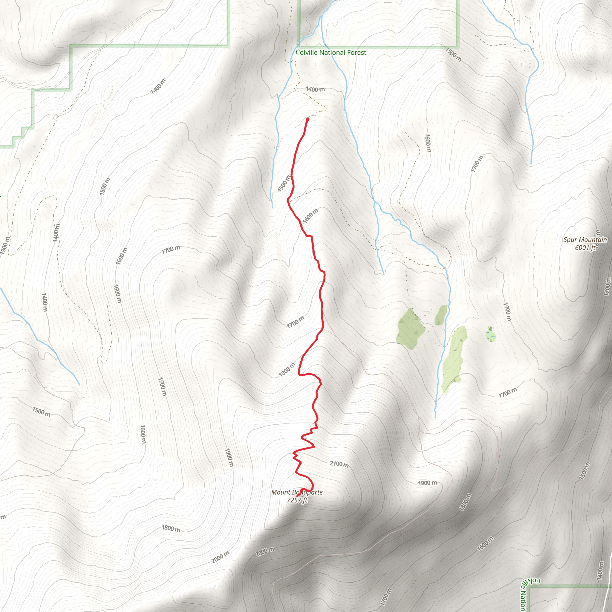
Starting your adventure near Okanogan County, Washington, the Mount Bonaparte trail offers a rewarding out-and-back hike that spans approximately 10 kilometers (6.2 miles) with an elevation gain of around 700 meters (2,300 feet). This medium-difficulty trail is perfect for those looking to experience the natural beauty and historical significance of the region.
Getting There
To reach the trailhead, you can drive or use public transport. If driving, head towards the town of Tonasket, Washington. From Tonasket, take the Loomis-Oroville Road and follow signs to the Bonaparte Lake Campground. The trailhead is located near the campground, making it a convenient starting point. For those using public transport, the nearest bus stop is in Tonasket, from where you can arrange a taxi or rideshare to the campground.
Trail Overview
The trail begins at the Bonaparte Lake Campground, situated at an elevation of approximately 1,200 meters (3,937 feet). The initial section of the trail is relatively gentle, winding through dense forests of pine and fir. As you progress, the trail becomes steeper, offering a moderate challenge as you ascend.
Key Landmarks and Points of Interest
- Bonaparte Lake: Just a short distance from the trailhead, Bonaparte Lake is a serene spot perfect for a quick rest or a picnic before you start your ascent.
- Wildlife Viewing: Keep an eye out for local wildlife, including deer, black bears, and various bird species. The area is rich in biodiversity, making it a haven for nature enthusiasts.
- Historical Significance: The region around Mount Bonaparte has a rich history, with the mountain itself named after Napoleon Bonaparte. The area was historically inhabited by Native American tribes, and you may come across interpretive signs that provide insights into their way of life.
Elevation Gain and Terrain
As you climb, the trail gains approximately 700 meters (2,300 feet) in elevation. The terrain varies from forested paths to rocky outcrops, offering diverse scenery and a good workout. The trail is well-marked, but it's advisable to use a reliable navigation tool like HiiKER to ensure you stay on track.
Reaching the Summit
At around the 5-kilometer (3.1-mile) mark, you'll reach the summit of Mount Bonaparte, standing at an elevation of approximately 1,900 meters (6,234 feet). The summit offers panoramic views of the surrounding Okanogan-Wenatchee National Forest and, on clear days, you can see as far as the Canadian border. This is a perfect spot to take a break, enjoy the views, and snap some photos.
Descent
The return journey follows the same path, allowing you to enjoy the scenery from a different perspective. The descent is generally easier but requires caution, especially on the steeper sections.
Tips for Hikers
- Weather: The weather can change rapidly in this region, so be prepared with layers and waterproof gear.
- Water and Snacks: Carry sufficient water and high-energy snacks to keep you fueled throughout the hike.
- Wildlife Safety: Be aware of your surroundings and follow guidelines for wildlife encounters, especially if you come across bears.
Final Preparations
Before setting out, make sure to check trail conditions and any advisories. Using HiiKER can provide real-time updates and additional information to help you plan your hike effectively.
What to expect?
Activity types
Comments and Reviews
User comments, reviews and discussions about the Mount Bonaparte, Washington.
4.63
average rating out of 5
16 rating(s)
