
Download
3D Flyover
Add to list
More
6.8 km
~1 hrs 42 min
203 m
Out and Back
“The Maryhill Loops Road offers a scenic, moderately challenging hike with stunning Columbia River Gorge views and historical significance.”
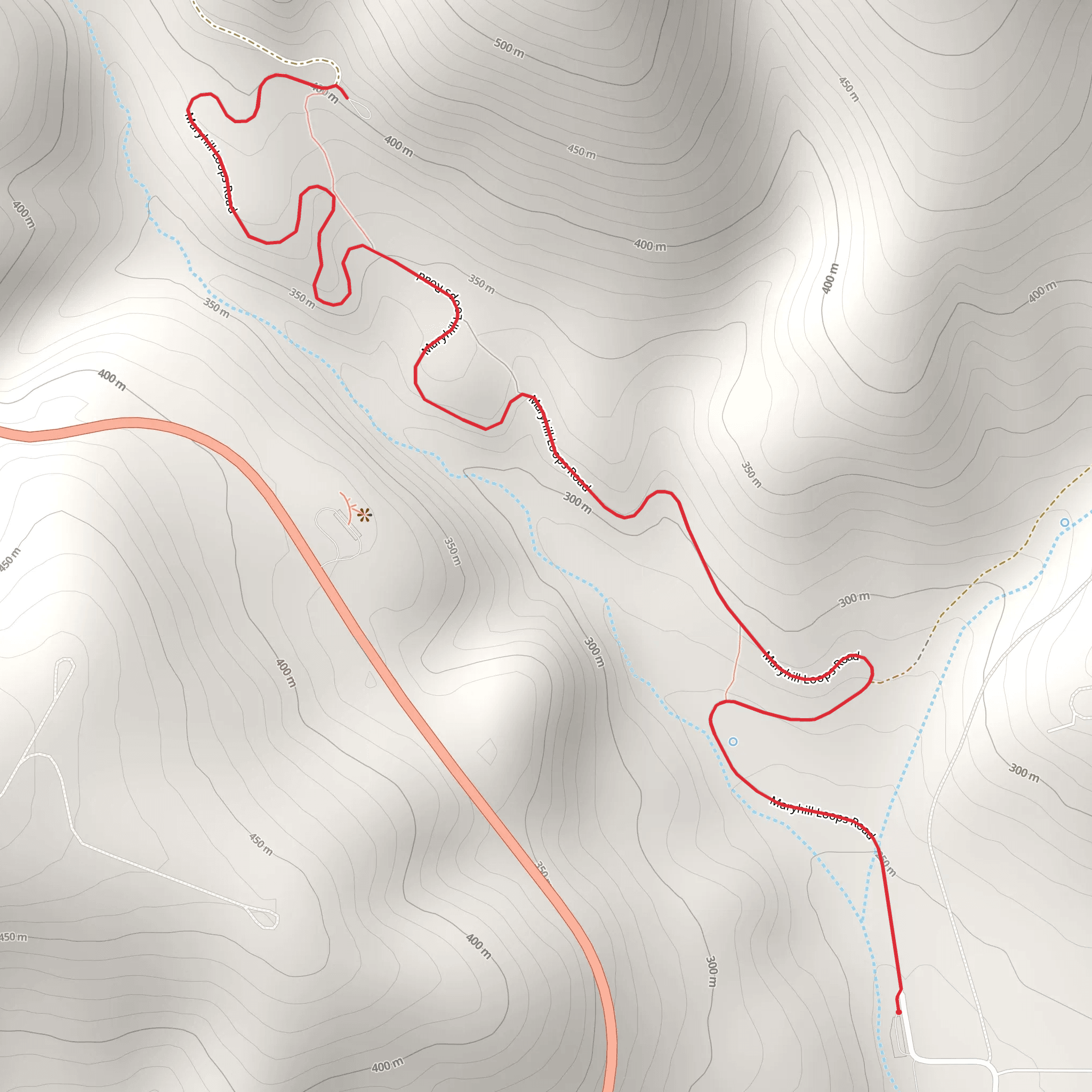
The Maryhill Loops Road is a fascinating trail that stretches around 7 km (approximately 4.3 miles) with an elevation gain of about 200 meters (656 feet). This out-and-back trail is located near Klickitat County, Washington, and offers a medium difficulty rating, making it suitable for moderately experienced hikers.
Getting There
To reach the trailhead, you can drive or use public transportation. If you're driving, the nearest significant landmark is the Maryhill Museum of Art, located at 35 Maryhill Museum Dr, Goldendale, WA 98620. From there, it's a short drive to the trailhead. For those relying on public transport, the nearest bus stop is in Goldendale, WA, from where you can take a taxi or rideshare service to the trailhead.
Trail Overview
The Maryhill Loops Road is historically significant as it was the first asphalt-paved road in the Pacific Northwest, constructed in the early 20th century. Originally designed by Samuel Hill, a prominent road builder and advocate for modern road construction, the road was a marvel of engineering at the time. Today, it serves as a scenic hiking trail that offers a glimpse into the past while providing stunning views of the surrounding landscape.
What to Expect
The trail begins near the Maryhill Museum of Art and quickly ascends, offering panoramic views of the Columbia River Gorge. The initial 1 km (0.6 miles) involves a steady climb, gaining about 50 meters (164 feet) in elevation. As you hike, you'll notice the road's unique design, featuring numerous hairpin turns that were originally intended to make the steep terrain more navigable for early automobiles.
Landmarks and Nature
Around the 2 km (1.2 miles) mark, you'll come across a viewpoint that offers breathtaking vistas of the Columbia River and the rolling hills of the gorge. This is an excellent spot for a short break and some photography. The trail continues to wind its way up, and at approximately 3.5 km (2.2 miles), you'll reach the highest point of the hike, having gained the full 200 meters (656 feet) in elevation.
The area is rich in flora and fauna. Depending on the season, you might encounter wildflowers such as lupines and balsamroots. Wildlife sightings can include deer, hawks, and occasionally, bald eagles soaring above the gorge.
Navigation and Safety
Given the historical nature of the trail, it's well-marked and easy to follow. However, it's always a good idea to have a reliable navigation tool. The HiiKER app is highly recommended for this purpose, as it provides detailed maps and real-time location tracking.
Return Journey
The return journey follows the same path, allowing you to enjoy the views from a different perspective. The descent is much easier on the legs, and you'll find yourself back at the trailhead in no time.
Final Tips
- Wear sturdy hiking boots, as the trail can be uneven in places.
- Bring plenty of water, especially during the warmer months.
- Check the weather forecast before you go, as conditions can change rapidly in the gorge.
- A camera is a must to capture the stunning landscapes and historical features of the trail.
The Maryhill Loops Road offers a unique blend of natural beauty and historical significance, making it a rewarding hike for those looking to explore the rich heritage and scenic vistas of the Pacific Northwest.
What to expect?
Activity types
Comments and Reviews
User comments, reviews and discussions about the Maryhill Loops Road, Washington.
4.43
average rating out of 5
14 rating(s)
