
Bitterrot and Desert Parsley and Atwood Road Loop Trail
Download
3D Flyover
Add to list
More
7.9 km
~2 hrs 19 min
447 m
Loop
“Embark on an 8 km scenic hike through Klickitat County's vibrant flora and historic landscapes.”
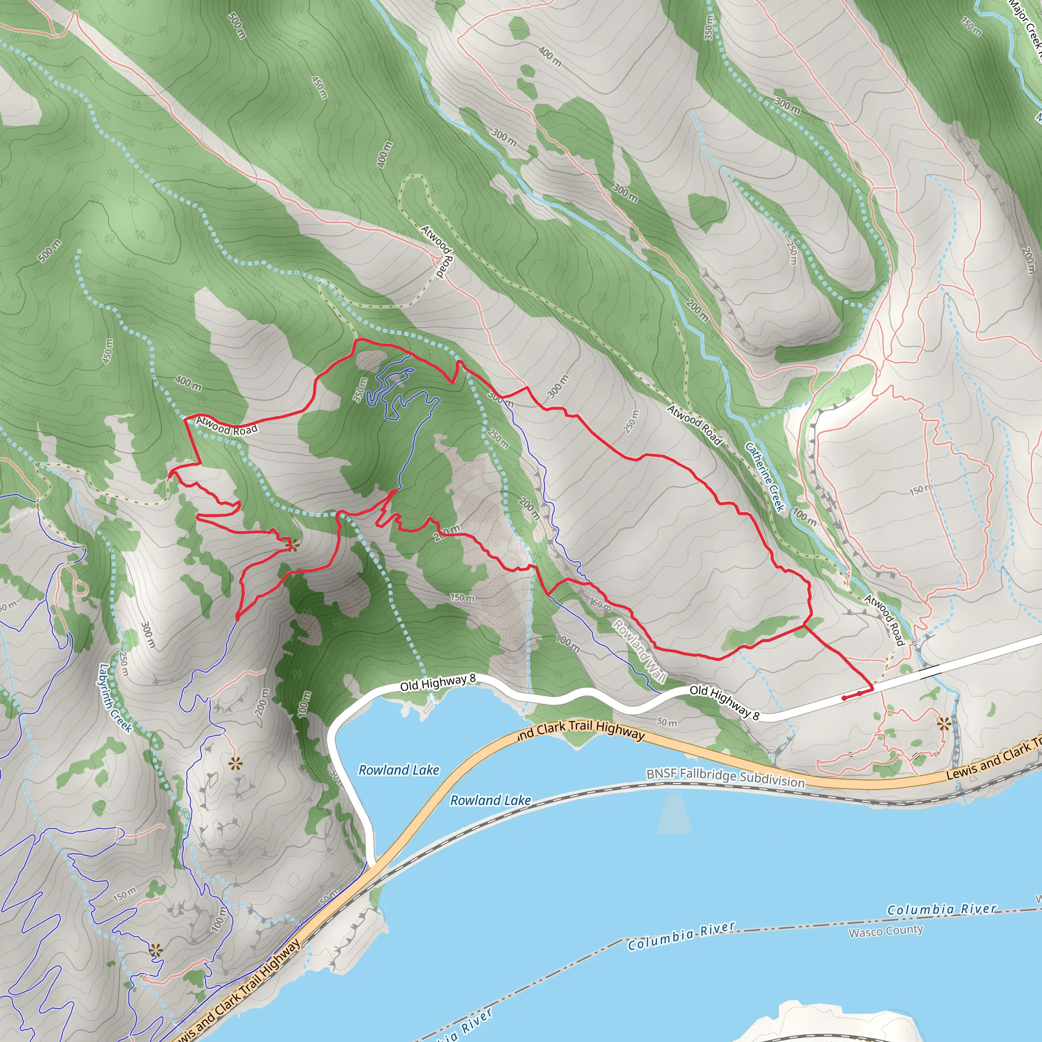
Starting your adventure near Klickitat County, Washington, the Bitterrot and Desert Parsley and Atwood Road Loop Trail offers an 8 km (approximately 5 miles) journey with an elevation gain of around 400 meters (about 1,312 feet). This loop trail is rated as medium difficulty, making it suitable for moderately experienced hikers.
Getting There
To reach the trailhead, you can drive or use public transportation. If driving, head towards Klickitat County and look for parking near the intersection of Atwood Road and the nearest major road, which is Highway 142. For those using public transport, the nearest bus stop is in the town of Klickitat, from where you can take a local taxi or rideshare service to the trailhead.
Trail Navigation
For navigation, it’s highly recommended to use the HiiKER app, which provides detailed maps and real-time updates. This will help you stay on track and make the most of your hike.
Trail Highlights
The trail begins with a gentle ascent through a forested area rich with Bitterroot and Desert Parsley, the plants that give the trail its name. These native species are particularly vibrant in the spring, offering a colorful display of wildflowers.
Historical Significance
As you hike, you’ll pass through areas that were historically significant to the indigenous tribes of the region. The Klickitat people have long inhabited this area, and you may come across interpretive signs that provide insights into their history and culture.
Wildlife and Nature
Keep an eye out for local wildlife, including deer, foxes, and a variety of bird species. The trail also offers several viewpoints where you can take in panoramic views of the surrounding landscape, including the Columbia River Gorge.
Key Landmarks
At approximately 3 km (1.86 miles) into the hike, you’ll reach a notable viewpoint known as "Eagle’s Perch," which offers stunning views of the Columbia River. This is a great spot to take a break and enjoy the scenery.
Elevation and Terrain
The trail continues to climb gradually, reaching its highest point at around 4 km (2.5 miles) with an elevation gain of 400 meters (1,312 feet). The terrain varies from forested paths to open meadows, providing a diverse hiking experience.
Final Stretch
As you descend, the trail loops back towards Atwood Road, passing through a serene section of pine forest. This part of the trail is relatively easy, allowing you to cool down and enjoy the final leg of your hike.
Practical Tips
- Water and Snacks: Make sure to bring enough water and snacks, as there are no facilities along the trail.
- Footwear: Wear sturdy hiking boots, as the terrain can be uneven in places.
- Weather: Check the weather forecast before you go, as conditions can change rapidly in this region.
By following these guidelines and using the HiiKER app for navigation, you’ll be well-prepared to enjoy the Bitterrot and Desert Parsley and Atwood Road Loop Trail.
What to expect?
Activity types
Comments and Reviews
User comments, reviews and discussions about the Bitterrot and Desert Parsley and Atwood Road Loop Trail, Washington.
4.45
average rating out of 5
11 rating(s)
