
Download
3D Flyover
Add to list
More
17.8 km
~5 hrs 14 min
1001 m
Out and Back
“Embark on a scenic, moderately challenging 18 km hike through lush forests, serene creeks, and historic landscapes to Navaho Pass.”
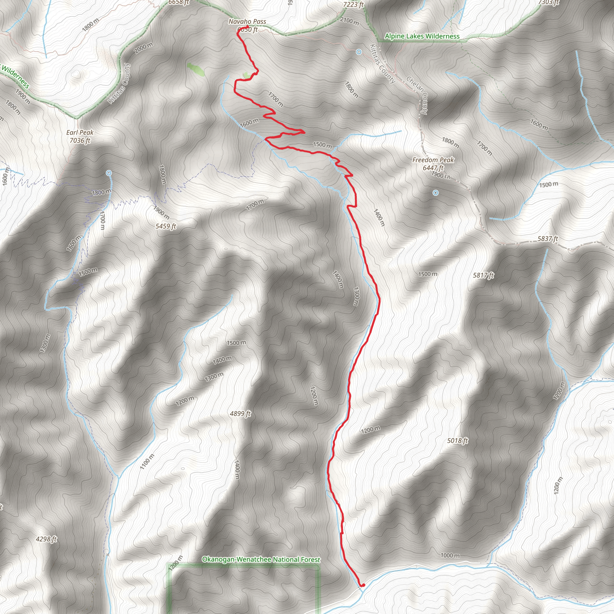
Starting your journey near Kittitas County, Washington, the Navaho Pass via Stafford Creek Trail offers an invigorating 18 km (11.2 miles) out-and-back adventure with an elevation gain of approximately 1000 meters (3280 feet). This trail is rated as medium difficulty, making it suitable for moderately experienced hikers looking for a rewarding challenge.
Getting There
To reach the trailhead, you can drive to the Stafford Creek Trailhead, located near the town of Cle Elum. If you're using public transport, the nearest significant landmark is the Cle Elum Ranger Station. From there, you may need to arrange a taxi or rideshare service to the trailhead, as public transport options are limited in this remote area.
Trail Overview
The trail begins with a gentle ascent through a dense forest of Douglas fir and ponderosa pine. As you progress, the path becomes steeper and rockier, so sturdy hiking boots are recommended. The first 3 km (1.9 miles) offer a relatively easy hike with an elevation gain of about 200 meters (656 feet), making it a good warm-up for the more challenging sections ahead.
Significant Landmarks and Nature
Around the 5 km (3.1 miles) mark, you'll encounter the first significant landmark: a picturesque creek crossing. This is Stafford Creek, which you'll follow for a good portion of the hike. The sound of flowing water adds a serene backdrop to your journey. Keep an eye out for local wildlife such as deer, marmots, and various bird species.
Mid-Trail Ascent
As you approach the 8 km (5 miles) point, the trail becomes steeper and more rugged. This section involves an elevation gain of approximately 400 meters (1312 feet) over 3 km (1.9 miles). The forest begins to thin out, offering stunning views of the surrounding peaks and valleys. This is a good spot to take a break and hydrate.
Historical Significance
The region around Navaho Pass has a rich history. It was traditionally used by Native American tribes for hunting and gathering. The area is also known for its mining history in the late 19th and early 20th centuries. Remnants of old mining equipment can sometimes be spotted off the trail, adding a historical dimension to your hike.
Final Ascent and Navaho Pass
The last 2 km (1.2 miles) to Navaho Pass are the most challenging, with an elevation gain of about 400 meters (1312 feet). The trail becomes narrow and rocky, requiring careful footing. Upon reaching Navaho Pass, you'll be rewarded with panoramic views of the Stuart Range and the Enchantments. This is a perfect spot for a well-deserved rest and some photography.
Navigation and Safety
Given the trail's moderate difficulty and varying terrain, it's advisable to use a reliable navigation tool like HiiKER to keep track of your progress and ensure you stay on the correct path. Always carry a map, compass, and sufficient water, especially during the summer months when temperatures can rise significantly.
Return Journey
The return journey follows the same path back to the trailhead. While descending, take your time to enjoy the scenery and perhaps spot some wildlife you may have missed on the way up. The descent is generally easier but still requires caution, especially on the steeper sections.
This trail offers a mix of natural beauty, historical intrigue, and physical challenge, making it a rewarding experience for those who undertake it.
AI Planner
Days planned around your pace, with somewhere to stay each night.
What to expect?
Activity types
Comments and Reviews
User comments, reviews and discussions about the Navaho Pass via Stafford Creek Trail, Washington.
4.57
average rating out of 5
14 rating(s)
