Download
3D Flyover
Add to list
More
4.4 km
~1 hrs 5 min
121 m
Loop
“The South Kitsap Regional Park Loop offers a scenic 4 km hike through forests, meadows, and moderate elevations.”
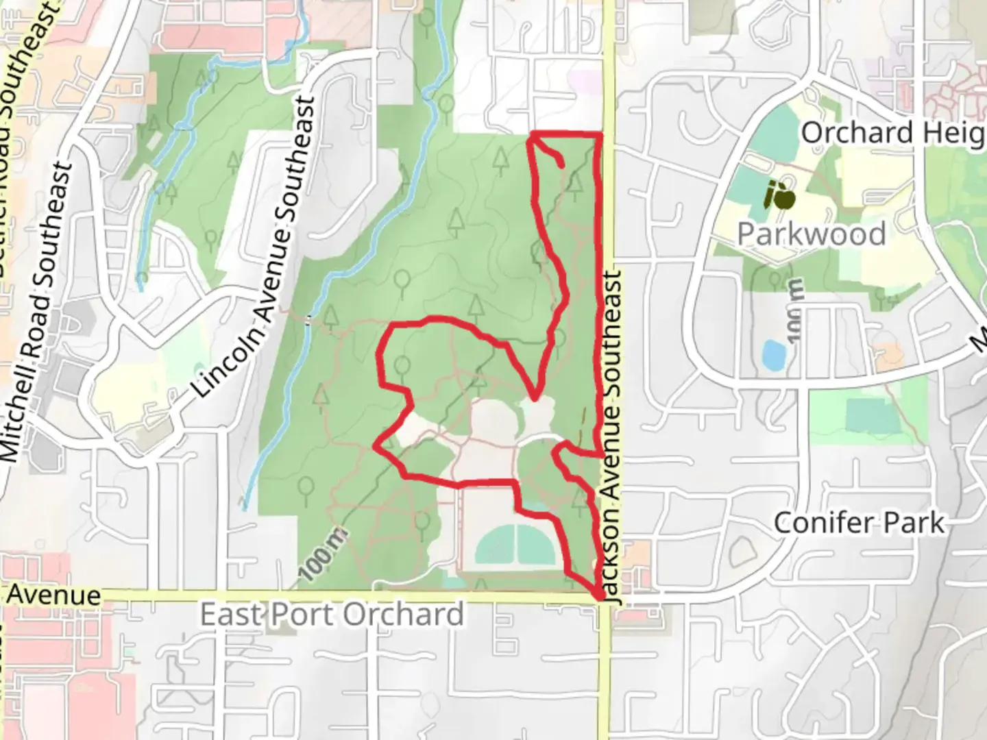
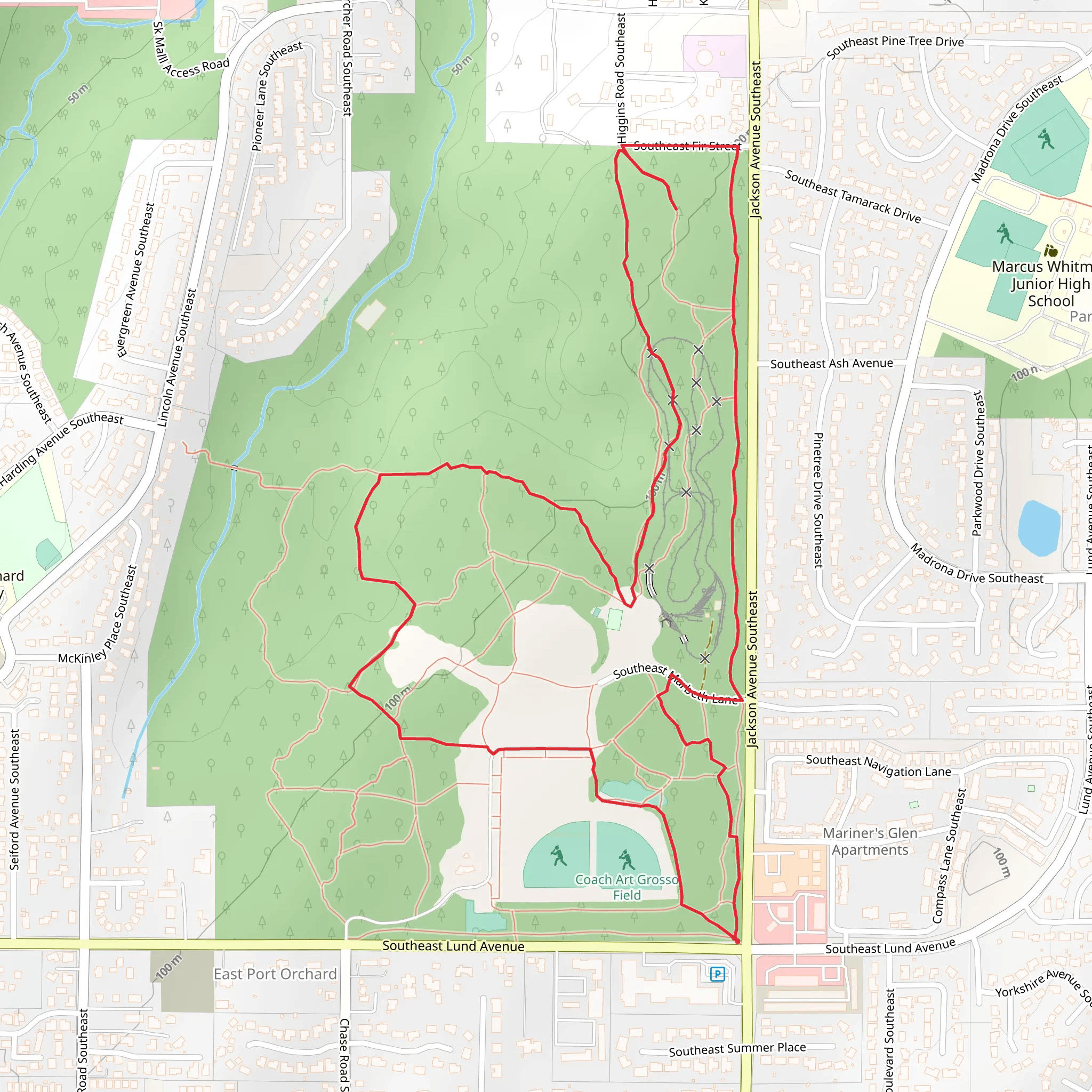
Starting near Kitsap County, Washington, the South Kitsap Regional Park Loop is a delightful 4 km (2.5 miles) trail with an elevation gain of approximately 100 meters (328 feet). This loop trail is rated as medium difficulty, making it accessible for most hikers with a moderate level of fitness.
Getting There
To reach the trailhead, you can drive or use public transportation. If driving, set your GPS to South Kitsap Regional Park, located near the intersection of Jackson Avenue SE and Lund Avenue SE in Port Orchard, Washington. For those using public transport, Kitsap Transit offers bus services that stop near the park. The closest bus stop is at the intersection of Jackson Avenue SE and Lund Avenue SE, just a short walk from the trailhead.
Trail Navigation
For navigation, HiiKER is an excellent tool to use. It provides detailed maps and real-time updates to ensure you stay on track throughout your hike.
Trail Features and Landmarks
As you embark on the South Kitsap Regional Park Loop, you'll find yourself immersed in a lush, forested environment. The trail is well-marked and winds through a mix of dense woods and open meadows, offering a variety of scenery.
Flora and Fauna
The park is home to a diverse range of plant life, including towering Douglas firs, western red cedars, and bigleaf maples. In the spring and summer, the underbrush is adorned with vibrant wildflowers such as trilliums and bleeding hearts. Keep an eye out for local wildlife, including deer, raccoons, and a variety of bird species like woodpeckers and owls.
Historical Significance
South Kitsap Regional Park has a rich history dating back to the early 20th century. Originally developed as a community gathering space, the park has evolved over the years but still retains elements of its historical roots. You may come across remnants of old structures and interpretive signs that provide insights into the park's past.
Trail Sections
The loop can be divided into several sections, each offering unique experiences:
Forest Canopy (0-1 km / 0-0.6 miles): The initial part of the trail takes you through a dense forest canopy. The path is relatively flat, making it a good warm-up for the more challenging sections ahead.
Meadow Crossing (1-2 km / 0.6-1.2 miles): As you exit the forest, you'll enter a picturesque meadow. This section is slightly more open and offers beautiful views of the surrounding landscape. It's a great spot for a quick rest or a picnic.
Elevation Gain (2-3 km / 1.2-1.9 miles): The trail begins to ascend here, gaining most of the 100 meters (328 feet) of elevation. The incline is steady but manageable, with switchbacks that make the climb less strenuous.
Descent and Return (3-4 km / 1.9-2.5 miles): After reaching the highest point, the trail descends back towards the starting point. This section is a mix of gentle slopes and flat terrain, allowing you to cool down as you complete the loop.
Tips and Recommendations
- Footwear: Wear sturdy hiking boots with good traction, as some sections can be muddy, especially after rain.
- Water and Snacks: Bring enough water and snacks to keep your energy levels up, particularly during the elevation gain section.
- Weather: Check the weather forecast before heading out. The trail can be slippery in wet conditions, so plan accordingly.
- Wildlife: Be respectful of wildlife and maintain a safe distance. Do not feed the animals.
The South Kitsap Regional Park Loop offers a rewarding hike with a mix of natural beauty and historical intrigue, making it a must-visit for anyone in the area.
What to expect?
Activity types
Comments and Reviews
User comments, reviews and discussions about the South Kitsap Regional Park Loop, Washington.
4.5
average rating out of 5
22 rating(s)
