
Southeast 188th Street, Elk Range and Carey Creek Loop Trail
Download
3D Flyover
Add to list
More
12.9 km
~3 hrs 24 min
503 m
Loop
“Explore the Southeast 188th Street, Elk Range, and Carey Creek Loop Trail for 8 miles of scenic, moderately challenging adventure.”
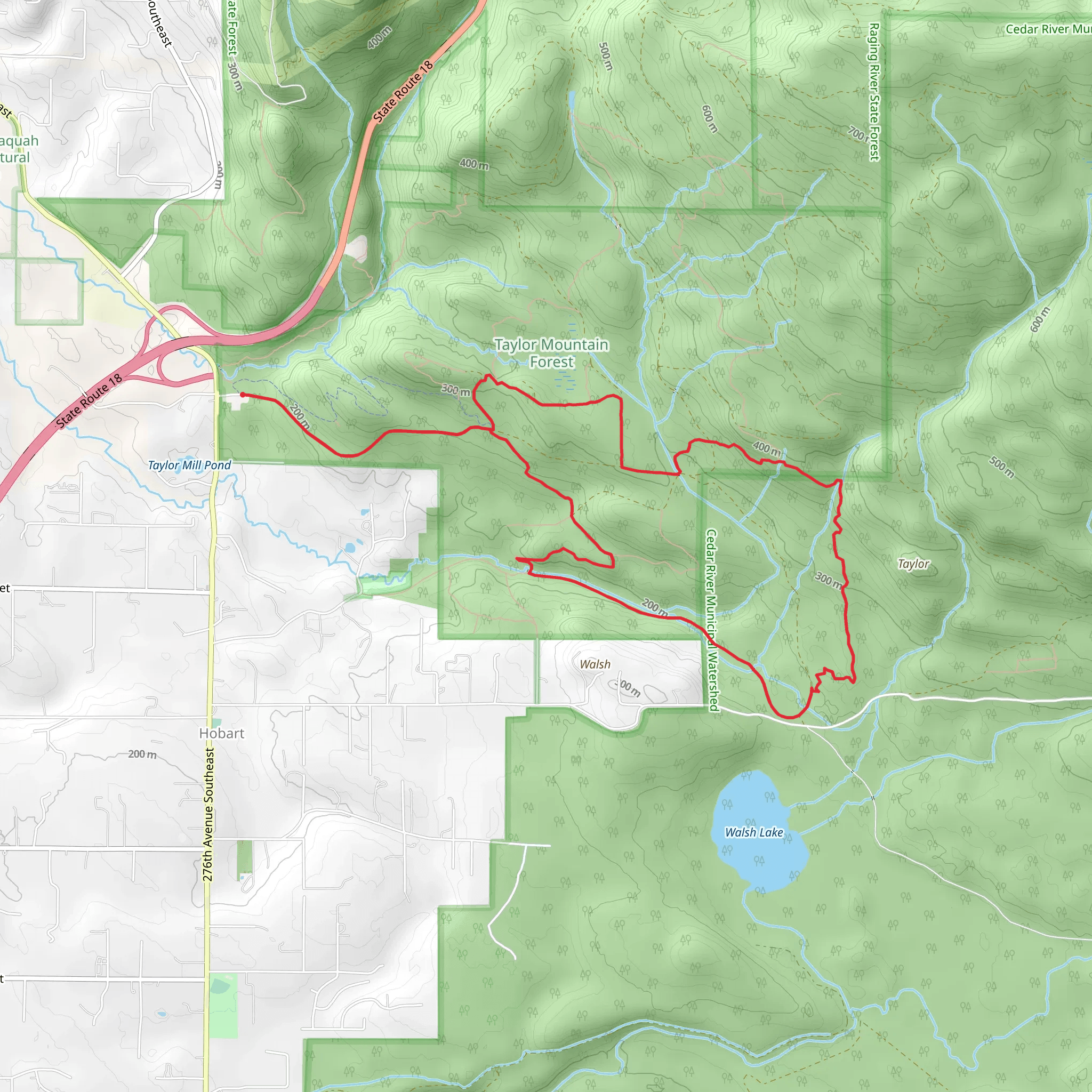
Starting near King County, Washington, the Southeast 188th Street, Elk Range and Carey Creek Loop Trail offers a rewarding 13 km (approximately 8 miles) journey with an elevation gain of around 500 meters (1,640 feet). This loop trail is rated as medium difficulty, making it suitable for moderately experienced hikers.
Getting There
To reach the trailhead, you can drive or use public transportation. If driving, head towards the vicinity of Southeast 188th Street, which is accessible from major roads in King County. For those using public transport, the nearest significant landmark is the Renton Transit Center. From there, you can take a local bus or rideshare service to get closer to the trailhead.
Trail Overview
The trail begins with a gentle ascent through dense forest, where you'll be surrounded by towering Douglas firs and western hemlocks. Early in the hike, you'll cross Carey Creek, a serene spot perfect for a brief pause to enjoy the sound of flowing water. The first 2 km (1.2 miles) of the trail are relatively easy, with a gradual elevation gain of about 100 meters (328 feet).
Elk Range Section
As you continue, the trail becomes steeper, leading you into the Elk Range section. This part of the hike is more challenging, with an elevation gain of approximately 200 meters (656 feet) over the next 3 km (1.9 miles). Keep an eye out for elk, which are often seen grazing in this area, especially during the early morning or late afternoon. The Elk Range offers stunning views of the surrounding valleys and distant mountains, making it a great spot for photography.
Historical Significance
The region has a rich history, with evidence of Native American tribes who once traversed these lands. Artifacts and old trails used by indigenous peoples can still be found, adding a layer of historical intrigue to your hike. The area was also a significant logging site in the early 20th century, and you may notice remnants of old logging equipment and rail tracks along the way.
Carey Creek Loop
After reaching the highest point of the trail, you'll begin your descent into the Carey Creek Loop. This section is less strenuous, with a gradual decline of about 200 meters (656 feet) over 4 km (2.5 miles). The trail meanders alongside Carey Creek, offering multiple opportunities to spot local wildlife such as deer, raccoons, and various bird species. The lush vegetation and the sound of the creek create a peaceful atmosphere, perfect for a leisurely walk.
Final Stretch
The last 4 km (2.5 miles) of the trail bring you back towards the starting point, with a gentle descent of around 100 meters (328 feet). This part of the trail is well-marked and easy to navigate, making it a pleasant end to your hike. Be sure to use HiiKER for real-time navigation and updates on trail conditions.
Preparation Tips
Given the medium difficulty rating, it's advisable to bring plenty of water, snacks, and a good pair of hiking boots. Weather can be unpredictable, so layers are recommended. Always check the trail conditions on HiiKER before heading out, and consider bringing a map or downloading the trail route for offline use.
This trail offers a mix of natural beauty, wildlife, and historical significance, making it a fulfilling experience for any hiker.
What to expect?
Activity types
Comments and Reviews
User comments, reviews and discussions about the Southeast 188th Street, Elk Range and Carey Creek Loop Trail, Washington.
4.46
average rating out of 5
13 rating(s)
