Download
3D Flyover
Add to list
More
20.7 km
~6 hrs 18 min
1301 m
Out and Back
“"Experience a challenging 21-km hike through lush forests, historical landmarks, and panoramic views in Washington's King County."”
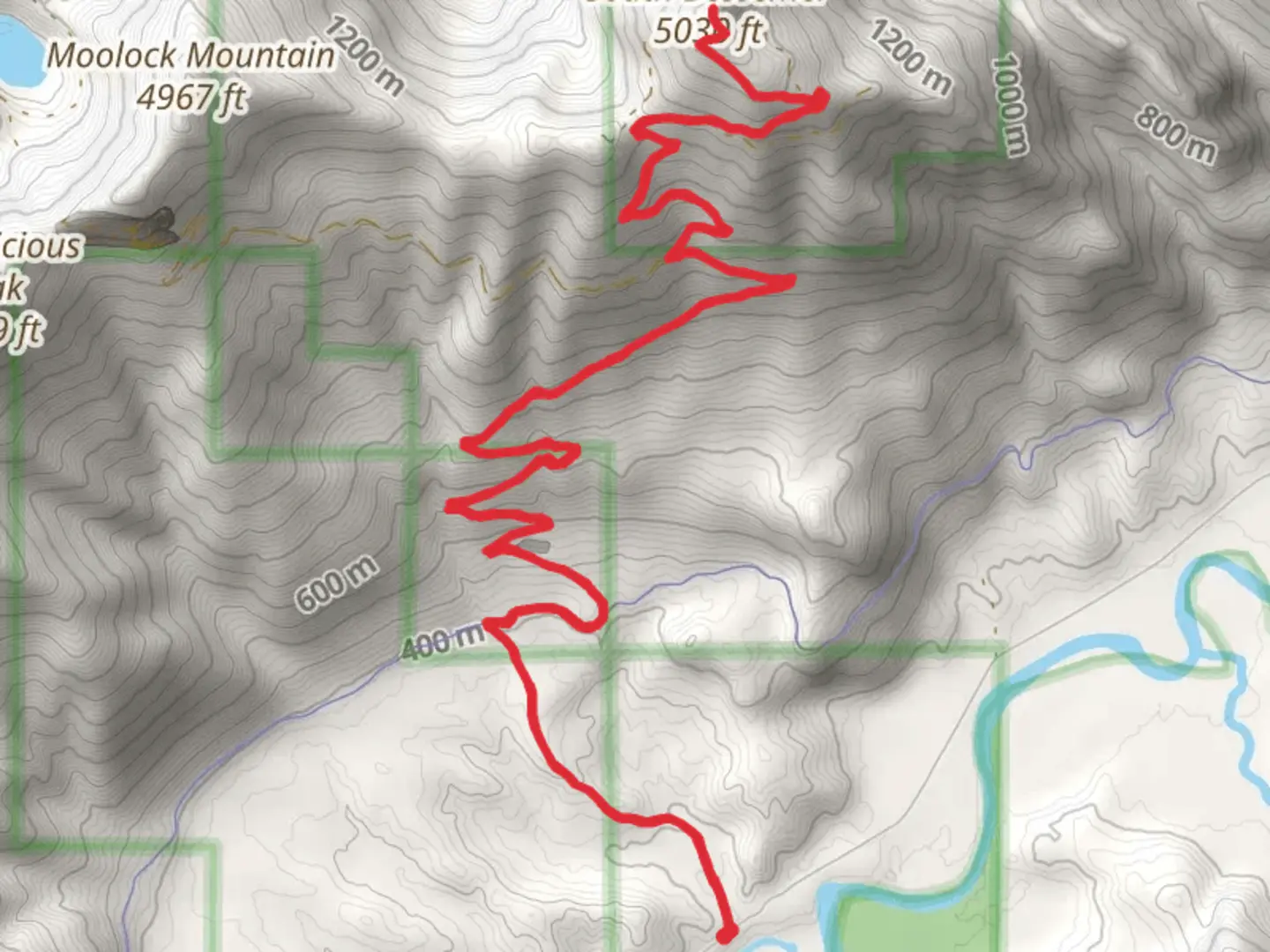
Starting near King County, Washington, the South Bessemer via Bessemer Road trail offers a challenging yet rewarding hike. This out-and-back trail spans approximately 21 kilometers (13 miles) with an elevation gain of around 1300 meters (4265 feet). The trailhead is accessible by car, with parking available near the intersection of North Bend Way and SE 108th Street. For those using public transport, the nearest bus stop is at North Bend Park & Ride, from where you can take a short taxi ride to the trailhead.
Initial Ascent and Terrain
The hike begins with a steady ascent along Bessemer Road, a former logging road that has now become a popular trail. The initial 3 kilometers (1.9 miles) are relatively gentle, gaining about 200 meters (656 feet) in elevation. The path is wide and well-maintained, making it suitable for hikers of varying skill levels. As you progress, the trail becomes steeper and more rugged, with loose rocks and occasional muddy patches, especially after rain.
Flora and Fauna
As you ascend, you'll pass through dense forests of Douglas fir, western hemlock, and red cedar. Keep an eye out for local wildlife, including black-tailed deer, black bears, and various bird species such as the northern flicker and Steller's jay. The forest floor is often carpeted with ferns and moss, adding to the lush, green ambiance.
Midway Point and Views
Around the 10-kilometer (6.2-mile) mark, you'll reach a clearing that offers stunning views of the surrounding Cascade Range. This is a great spot to take a break and enjoy the scenery. The elevation gain at this point is approximately 800 meters (2625 feet). From here, the trail becomes more challenging, with steeper inclines and narrower paths.
Historical Significance
The Bessemer Road has historical significance as it was originally constructed for logging operations in the early 20th century. Remnants of old logging equipment and structures can still be seen along the trail, offering a glimpse into the region's industrial past. The area was also used by early settlers and miners, adding another layer of historical interest.
Final Ascent and Summit
The final 3 kilometers (1.9 miles) to the summit are the most strenuous, with an elevation gain of about 500 meters (1640 feet). The trail narrows significantly and becomes rocky, requiring careful footing. Upon reaching the summit, you'll be rewarded with panoramic views of the Snoqualmie Valley, Mount Si, and the distant peaks of the Cascade Range.
Navigation and Safety
Given the trail's varying conditions, it's advisable to use a reliable navigation tool like HiiKER to stay on track. The trail is well-marked, but the dense forest and multiple intersecting paths can be confusing. Always carry enough water, snacks, and a first-aid kit. Weather can change rapidly in this region, so be prepared for sudden rain or temperature drops.
Return Journey
The return journey follows the same path back to the trailhead. While descending, take your time to enjoy the different perspectives and perhaps spot some wildlife you missed on the way up. The descent is easier but still requires caution due to the steep and rocky sections.
This trail offers a mix of natural beauty, historical intrigue, and physical challenge, making it a fulfilling adventure for those prepared to tackle its demands.

What to expect?
Activity types
Comments and Reviews
User comments, reviews and discussions about the South Bessemer via Bessemer Road, Washington.
4.53
average rating out of 5
15 rating(s)