Download
Preview
Add to list
More
12.1 km
~2 hrs 59 min
343 m
Out and Back
“Explore lush forests, historical remnants, and stunning Franklin Falls on this moderately challenging 12 km hike.”
Starting near King County, Washington, this 12 km (7.5 miles) out-and-back trail offers a moderate challenge with an elevation gain of around 300 meters (984 feet). The trailhead is conveniently accessible by car, with parking available at the Franklin Falls Trailhead. For those using public transport, the nearest significant landmark is the town of North Bend, from where you can take a taxi or rideshare service to the trailhead.
Trail Overview
The trail begins with a gentle ascent through a lush forest of Douglas firs and western hemlocks. The first 1.5 km (0.9 miles) is relatively easy, with a well-maintained path that is suitable for families and less experienced hikers. As you progress, the trail becomes steeper and rockier, requiring more attention to footing.
Significant Landmarks
At approximately 3 km (1.9 miles) into the hike, you'll encounter the first significant landmark: a wooden bridge crossing the South Fork Snoqualmie River. This is a great spot to take a break and enjoy the serene surroundings. The bridge also marks the beginning of a more challenging section of the trail, with a steeper incline and more rugged terrain.
Nature and Wildlife
The trail is rich in biodiversity. Keep an eye out for native wildlife such as black-tailed deer, Douglas squirrels, and a variety of bird species including the Steller's jay and the American dipper. The flora is equally impressive, with seasonal wildflowers like trillium and lupine adding splashes of color to the landscape.
Historical Significance
The area around Franklin Falls has a rich history tied to the early logging industry in Washington State. Remnants of old logging roads and equipment can still be seen along the trail, offering a glimpse into the region's past. The falls themselves were named after Franklin, a small logging community that once thrived in the area.
Reaching Franklin Falls
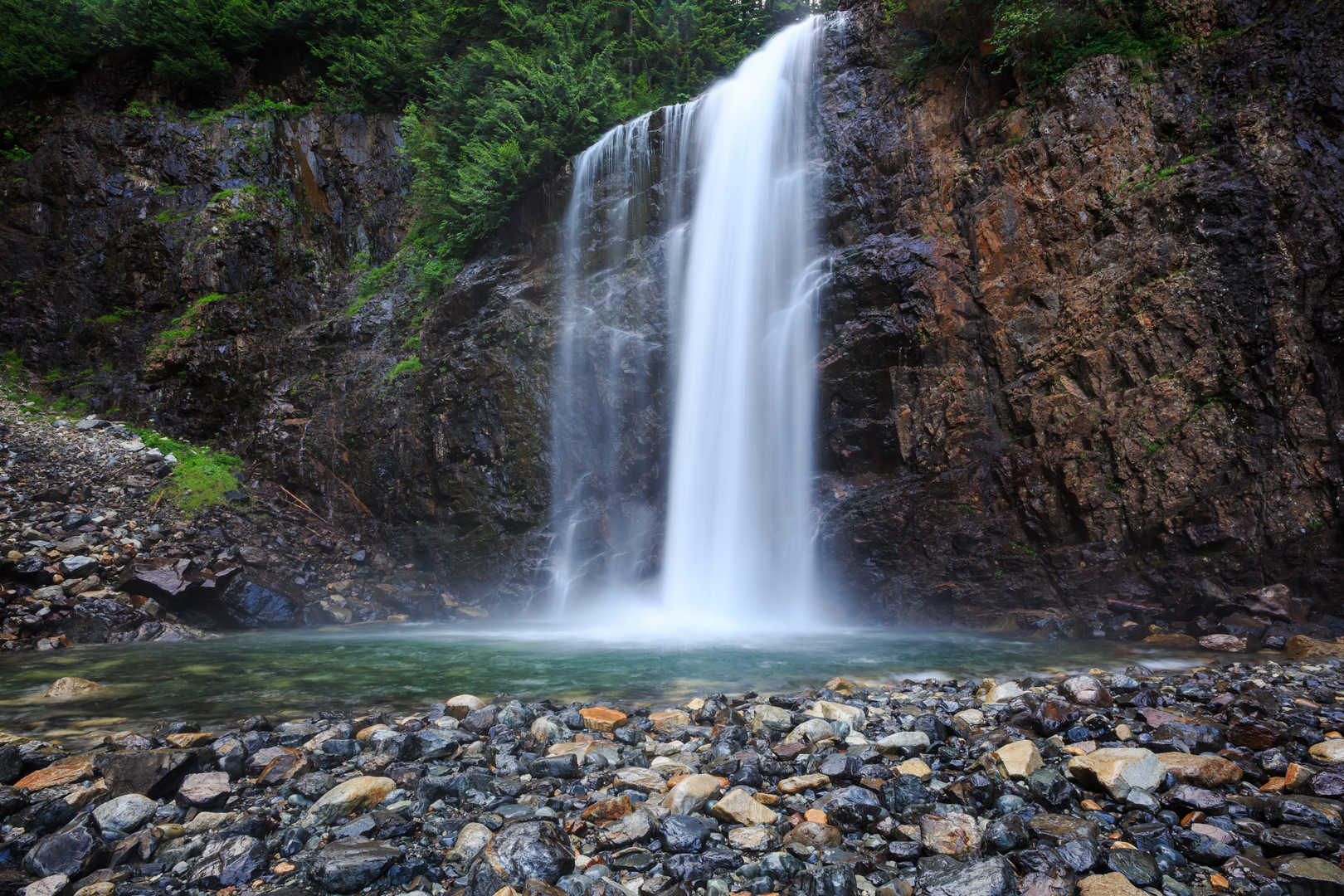
At around 5 km (3.1 miles), you'll reach the highlight of the hike: Franklin Falls. The waterfall cascades down a 21-meter (70-foot) drop, creating a picturesque scene that is especially stunning in the spring and early summer when water flow is at its peak. There is a viewing platform that provides a safe vantage point for photographs and relaxation.
Navigation and Safety
For navigation, it's recommended to use the HiiKER app, which provides detailed maps and real-time updates. The trail is well-marked, but weather conditions can change rapidly, so always check the forecast before heading out. The final section near the falls can be slippery, especially after rain, so exercise caution.
Return Journey
The return journey follows the same path back to the trailhead, offering a chance to revisit and appreciate the landmarks and natural beauty from a different perspective. The descent is generally easier, but still requires careful navigation, particularly on the steeper sections.
This trail offers a rewarding experience for those prepared for a moderate hike, with stunning natural beauty and a touch of historical intrigue.

What to expect?
Activity types
Comments and Reviews
User comments, reviews and discussions about the Franklin Falls, Washington.
4.75
average rating out of 5
4 rating(s)