Download
3D Flyover
Add to list
More
5.2 km
~1 hrs 17 min
145 m
Loop
“Embark on a 5 km adventure through lush forests and historic remnants, perfect for nature enthusiasts.”
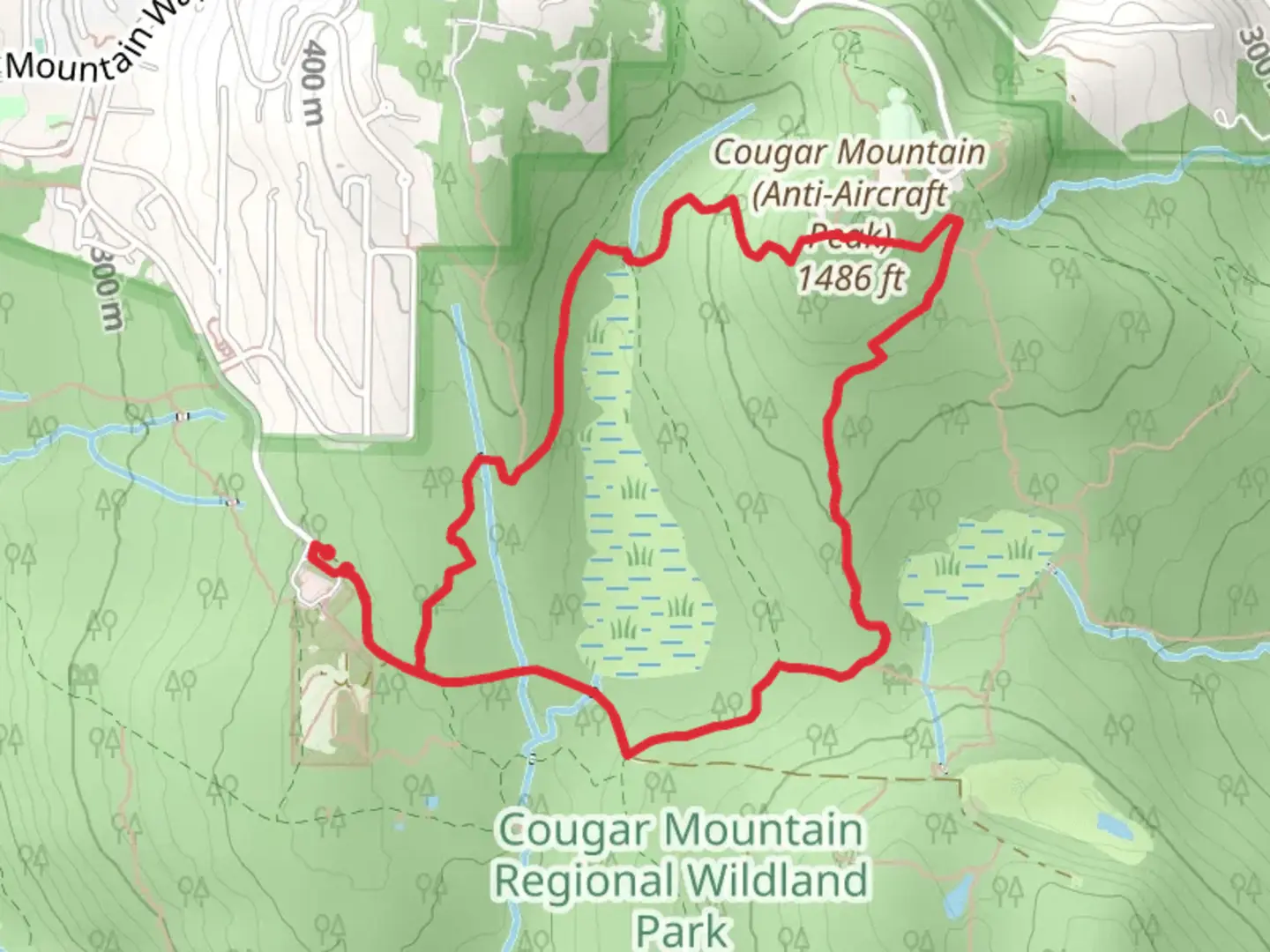
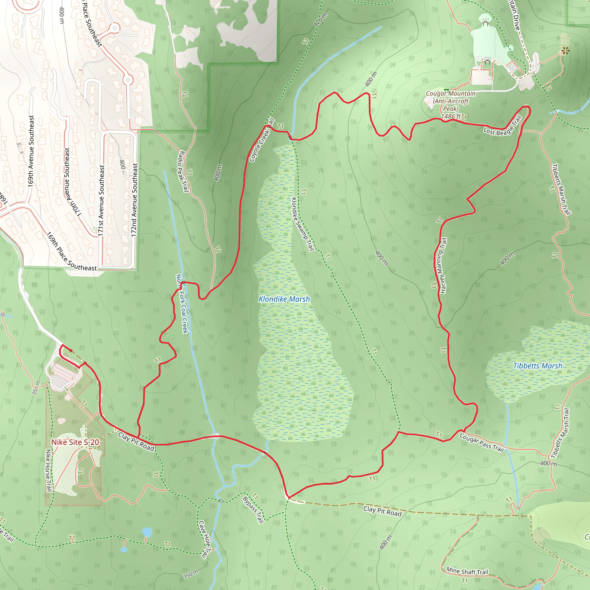
Starting your adventure near King County, Washington, the Coyote Creek Trail and Harvey Manning Trail offer a delightful 5 km (3.1 miles) loop with an elevation gain of approximately 100 meters (328 feet). This medium-difficulty trail is perfect for those looking to immerse themselves in the natural beauty of the Pacific Northwest.
Getting There
To reach the trailhead, you can drive or use public transportation. If driving, head towards the Cougar Mountain Regional Wildland Park, specifically near the Red Town Trailhead. For those using public transport, take a bus to the Issaquah Transit Center and then a short taxi or rideshare to the trailhead.
Trail Overview
The trail begins at the Red Town Trailhead, a well-known starting point for various trails in the Cougar Mountain area. As you embark on your journey, you'll first encounter the Coyote Creek Trail. This section of the trail is relatively flat and meanders through lush forested areas, offering a serene environment filled with the sounds of chirping birds and rustling leaves.
Flora and Fauna
Keep an eye out for the diverse flora and fauna. The trail is home to towering Douglas firs, western red cedars, and a variety of ferns and mosses that carpet the forest floor. Wildlife enthusiasts might spot deer, raccoons, and a variety of bird species, including woodpeckers and owls.
Historical Significance
As you continue, you'll come across remnants of the area's mining history. The Cougar Mountain area was once a bustling coal mining region in the late 19th and early 20th centuries. Look for old mining equipment and interpretive signs that provide a glimpse into the past.
Harvey Manning Trail
Approximately 2.5 km (1.55 miles) into your hike, you'll transition onto the Harvey Manning Trail. Named after the renowned conservationist and author, this trail section offers a moderate climb, adding to the overall elevation gain. The trail winds through dense forest and opens up to occasional clearings, providing stunning views of the surrounding landscape.
Navigation and Safety
For navigation, it's highly recommended to use the HiiKER app, which provides detailed maps and real-time updates. The trail is well-marked, but having a reliable navigation tool ensures you stay on track.
Points of Interest
Around the 4 km (2.5 miles) mark, you'll reach a viewpoint that offers panoramic views of the Issaquah Alps and the distant Seattle skyline. This is a perfect spot to take a break, snap some photos, and enjoy the scenery.
Final Stretch
The final stretch of the trail loops back towards the Red Town Trailhead. This section is a gentle descent, allowing you to cool down and reflect on the natural beauty and historical significance of the area.
Practical Tips
- Wear sturdy hiking boots as the trail can be muddy, especially after rain.
- Bring plenty of water and snacks.
- Check the weather forecast and dress in layers.
- Be mindful of wildlife and maintain a safe distance.
This 5 km loop offers a perfect blend of natural beauty, historical intrigue, and moderate physical challenge, making it a rewarding experience for hikers of all levels.
What to expect?
Activity types
Comments and Reviews
User comments, reviews and discussions about the Coyote Creek Trail and Harvey Manning Trail, Washington.
4.63
average rating out of 5
16 rating(s)
