
Download
3D Flyover
Add to list
More
35.8 km
~2 days
2061 m
Loop
“Constance Pass via Dosewallips River Trail: A 36 km adventure through lush forests, alpine meadows, and rugged peaks.”
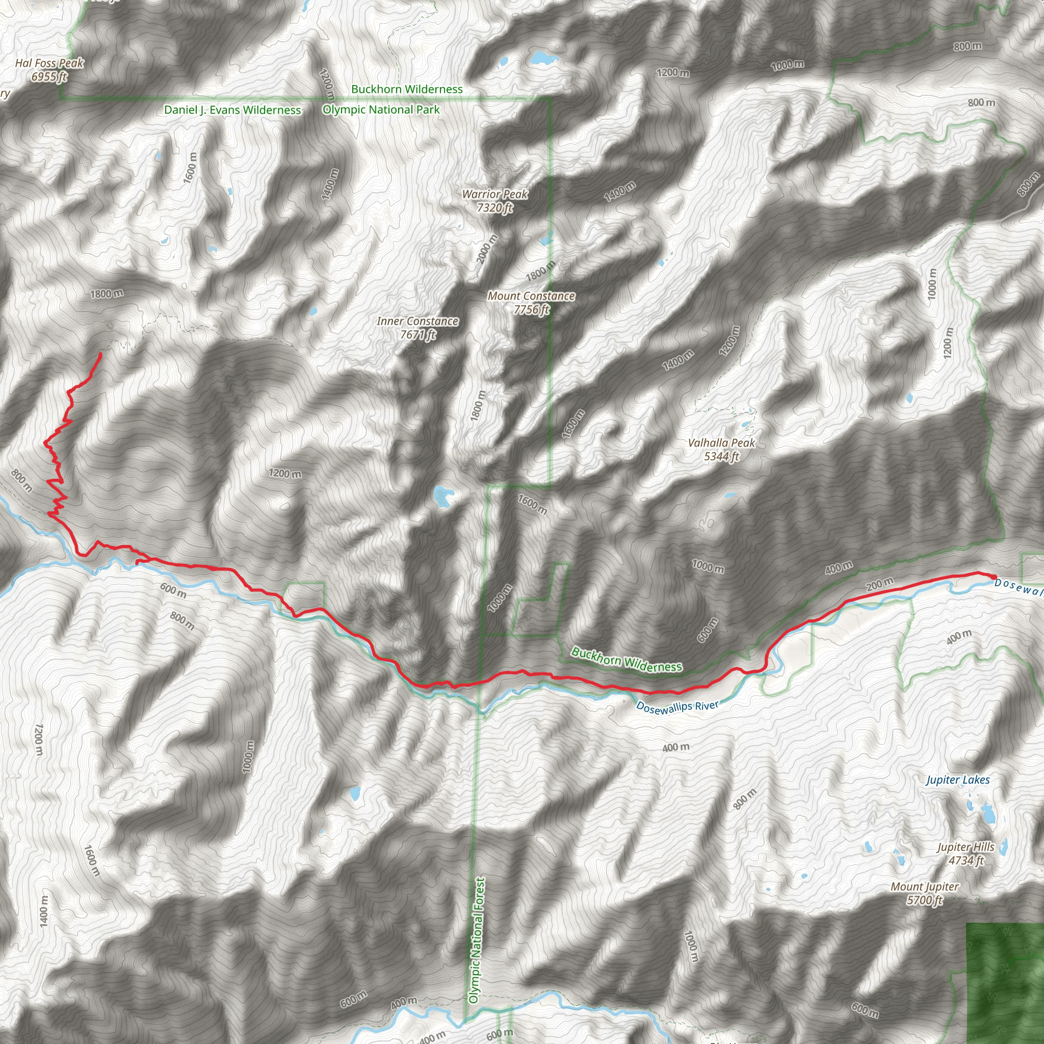
Starting your adventure near Jefferson County, Washington, the Constance Pass via Dosewallips River Trail offers a challenging yet rewarding experience. This loop trail spans approximately 36 kilometers (22.4 miles) with an elevation gain of around 2000 meters (6562 feet). The trailhead is accessible by car, and the nearest significant landmark is the Dosewallips Campground. For those relying on public transport, the closest major city is Seattle, from where you can take a bus to Brinnon and then arrange for a local taxi or shuttle service to the campground.
Trail Overview
The trail begins at the Dosewallips Campground, where you can park your vehicle. From here, you'll embark on a journey through lush forests, alpine meadows, and rugged mountain terrain. The initial section of the trail follows the Dosewallips River, offering a relatively gentle ascent. This part of the trail is well-shaded and features a variety of flora, including Douglas firs, western hemlocks, and red cedars. Keep an eye out for wildlife such as black-tailed deer, black bears, and various bird species.
Significant Landmarks and Elevation
At around 8 kilometers (5 miles) in, you'll reach the Dose Forks, where the trail splits. Take the left fork to continue towards Constance Pass. The trail becomes steeper here, gaining significant elevation as you ascend through dense forest. Approximately 12 kilometers (7.5 miles) from the trailhead, you'll encounter the first major landmark, the Dose Meadows. This is a great spot to take a break, enjoy the open meadows, and perhaps spot some elk grazing.
Continuing on, the trail climbs steadily, and you'll soon find yourself above the treeline. The views open up, offering stunning vistas of the surrounding peaks and valleys. At around 18 kilometers (11 miles), you'll reach Constance Pass, the highest point of the trail. The pass provides panoramic views of Mount Constance and the Olympic Range. This is a perfect spot for a longer rest and to take in the breathtaking scenery.
Historical Significance
The region around Constance Pass has a rich history. It was originally inhabited by the Klallam and Chimacum tribes, who used the area for hunting and gathering. In the late 19th and early 20th centuries, the trail was used by miners and loggers. Remnants of old mining equipment and logging camps can still be found along the trail, offering a glimpse into the area's past.
Descent and Return
From Constance Pass, the trail descends steeply into the Dosewallips Valley. This section can be challenging, especially if the weather is wet, so take care with your footing. After descending for about 6 kilometers (3.7 miles), you'll re-enter the forest and follow the river back towards the trailhead. The final stretch is relatively flat and offers a pleasant walk through the forest, bringing you back to the Dosewallips Campground.
Navigation and Preparation
Given the trail's length and elevation gain, it's essential to be well-prepared. Ensure you have a detailed map and consider using the HiiKER app for real-time navigation and updates. The trail is generally well-marked, but there are sections where the path can be less clear, especially near the pass.
Water sources are plentiful along the trail, particularly in the first half, but it's always wise to carry a filter or purification tablets. Weather can be unpredictable, so pack layers and be prepared for sudden changes.
This trail offers a mix of natural beauty, challenging terrain, and historical intrigue, making it a must-do for any avid hiker.
What to expect?
Activity types
Comments and Reviews
User comments, reviews and discussions about the Constance Pass via Dosewallips River Trail, Washington.
4.57
average rating out of 5
7 rating(s)
