Download
3D Flyover
Add to list
More
12.7 km
~2 hrs 54 min
220 m
Point-to-Point
“Explore diverse landscapes and rich history on the moderately challenging 13 km Burnt Bridge Creek Trail.”
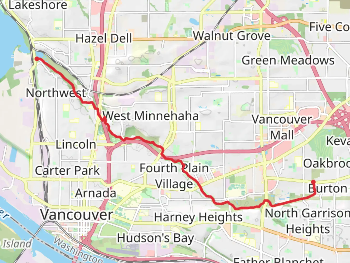
Starting near Clark County, Washington, the Burnt Bridge Creek Trail spans approximately 13 kilometers (8 miles) with an elevation gain of around 200 meters (656 feet). This point-to-point trail is rated as medium difficulty, making it suitable for moderately experienced hikers.
Getting There
To reach the trailhead, you can drive or use public transportation. If driving, head towards the nearest significant landmark, which is the Vancouver Mall in Vancouver, WA. From there, it's a short drive to the trailhead. For those using public transport, several bus routes service the Vancouver Mall area, making it a convenient starting point.
Trail Overview
The Burnt Bridge Creek Trail meanders through a variety of landscapes, including urban areas, wetlands, and forested sections. The trail is well-marked and maintained, making navigation straightforward. For precise navigation, consider using the HiiKER app, which provides detailed maps and real-time updates.
Key Sections and Landmarks
Urban Start (0-2 km / 0-1.2 miles): The trail begins in a more urban setting, passing through residential neighborhoods and parks. This section is relatively flat and easy, providing a gentle introduction to the hike.
Wetlands and Wildlife (2-6 km / 1.2-3.7 miles): As you progress, the trail enters a wetland area. Here, you can expect to see a variety of bird species, including herons and ducks. The terrain becomes slightly more challenging with minor elevation changes.
Forested Area (6-10 km / 3.7-6.2 miles): The trail then transitions into a forested section, offering shade and a more secluded atmosphere. This part of the trail features moderate elevation gains and some steeper sections, making it the most challenging part of the hike.
Creekside Path (10-13 km / 6.2-8 miles): The final stretch runs alongside Burnt Bridge Creek, providing picturesque views and a tranquil environment. This section is relatively flat, allowing for a relaxing end to the hike.
Historical Significance
The Burnt Bridge Creek area has a rich history. It was originally inhabited by Native American tribes who utilized the creek for fishing and transportation. In the 19th century, the area saw increased settlement and development, which led to the construction of bridges and infrastructure. The name "Burnt Bridge Creek" is believed to originate from an incident where a bridge was burned down during a conflict in the early days of settlement.
Preparation and Safety
Given the medium difficulty rating, it's advisable to wear sturdy hiking boots and bring plenty of water, especially during warmer months. The trail is accessible year-round, but conditions can vary, so check the weather forecast and trail conditions on HiiKER before setting out. Wildlife is abundant, so be mindful of your surroundings and follow Leave No Trace principles to preserve the natural beauty of the area.
Final Tips
Parking is available near the trailhead, but it can fill up quickly on weekends and holidays. Arrive early to secure a spot. Restrooms and picnic areas are available at several points along the trail, making it convenient for breaks. Enjoy the diverse landscapes and rich history as you hike the Burnt Bridge Creek Trail.

What to expect?
Activity types
Comments and Reviews
User comments, reviews and discussions about the Burnt Bridge Creek Trail, Washington.
4.38
average rating out of 5
16 rating(s)