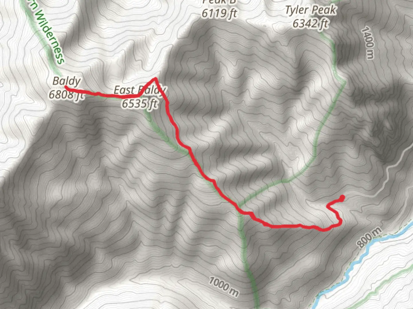
Baldy and East Baldy via Lower Maynard Burn Trail
Download
Preview
Add to list
More
10.7 km
~4 hrs 15 min
1268 m
Out and Back
“"Experience a challenging yet rewarding 11-km hike with stunning views and rich history on Baldy Trail."”
Starting your adventure near Clallam County, Washington, the Baldy and East Baldy via Lower Maynard Burn Trail offers a challenging yet rewarding hike. This out-and-back trail spans approximately 11 kilometers (around 6.8 miles) with an elevation gain of about 1200 meters (3937 feet), making it a medium difficulty hike suitable for those with a good level of fitness.### Getting There To reach the trailhead, you can drive to the nearest significant landmark, which is the town of Sequim, Washington. From Sequim, head south on Palo Alto Road and follow signs to the trailhead. Public transport options are limited, so driving is the most convenient way to access the trail.### Trail Overview The trail begins with a steep ascent through dense forest, where you'll be surrounded by towering Douglas firs and western hemlocks. The initial 3 kilometers (1.9 miles) are the most strenuous, with an elevation gain of approximately 600 meters (1968 feet). As you climb, keep an eye out for the diverse flora and fauna, including deer, black bears, and a variety of bird species.### Significant Landmarks At around the 4-kilometer (2.5-mile) mark, you'll reach a clearing that offers your first panoramic views of the Olympic Mountains. This is a great spot to take a break and hydrate. Continuing on, the trail becomes less steep but remains challenging as you approach the summit of Baldy. The final push to the top involves navigating rocky terrain, so be sure to have sturdy hiking boots.### Summit Experience Upon reaching the summit of Baldy, you'll be rewarded with breathtaking 360-degree views. On a clear day, you can see as far as Mount Rainier to the southeast and the Strait of Juan de Fuca to the north. From here, you can continue to East Baldy, which is about 1 kilometer (0.6 miles) further along the ridge. The trail between Baldy and East Baldy is less defined, so using a navigation tool like HiiKER is highly recommended.### Historical Significance The region has a rich history, with the Olympic Mountains being home to the Klallam and other Native American tribes for thousands of years. The area was also explored by early European settlers in the 19th century, adding layers of historical significance to your hike.### Return Journey The descent follows the same path back to the trailhead. While descending, take your time to enjoy the forest scenery and perhaps spot some wildlife you might have missed on the way up. The return trip is easier on the legs but still requires caution due to the steep sections.### Preparation Tips Given the elevation gain and the rugged terrain, it's essential to bring plenty of water, snacks, and layers of clothing to adapt to changing weather conditions. Trekking poles can also be helpful for both the ascent and descent. Always check the weather forecast before heading out and let someone know your hiking plans.This trail offers a mix of challenging climbs, stunning views, and a touch of historical intrigue, making it a must-do for any avid hiker.

What to expect?
Activity types
Comments and Reviews
User comments, reviews and discussions about the Baldy and East Baldy via Lower Maynard Burn Trail, Washington.
4.33
average rating out of 5
6 rating(s)