Download
3D Flyover
Add to list
More
25.7 km
~2 days
1941 m
Out and Back
“Embark on the Upper and Lower Snow Lake Trail for a challenging, scenic, and historically rich adventure.”
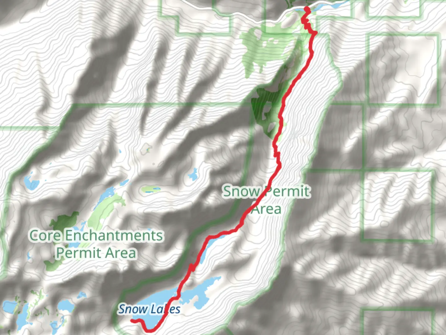
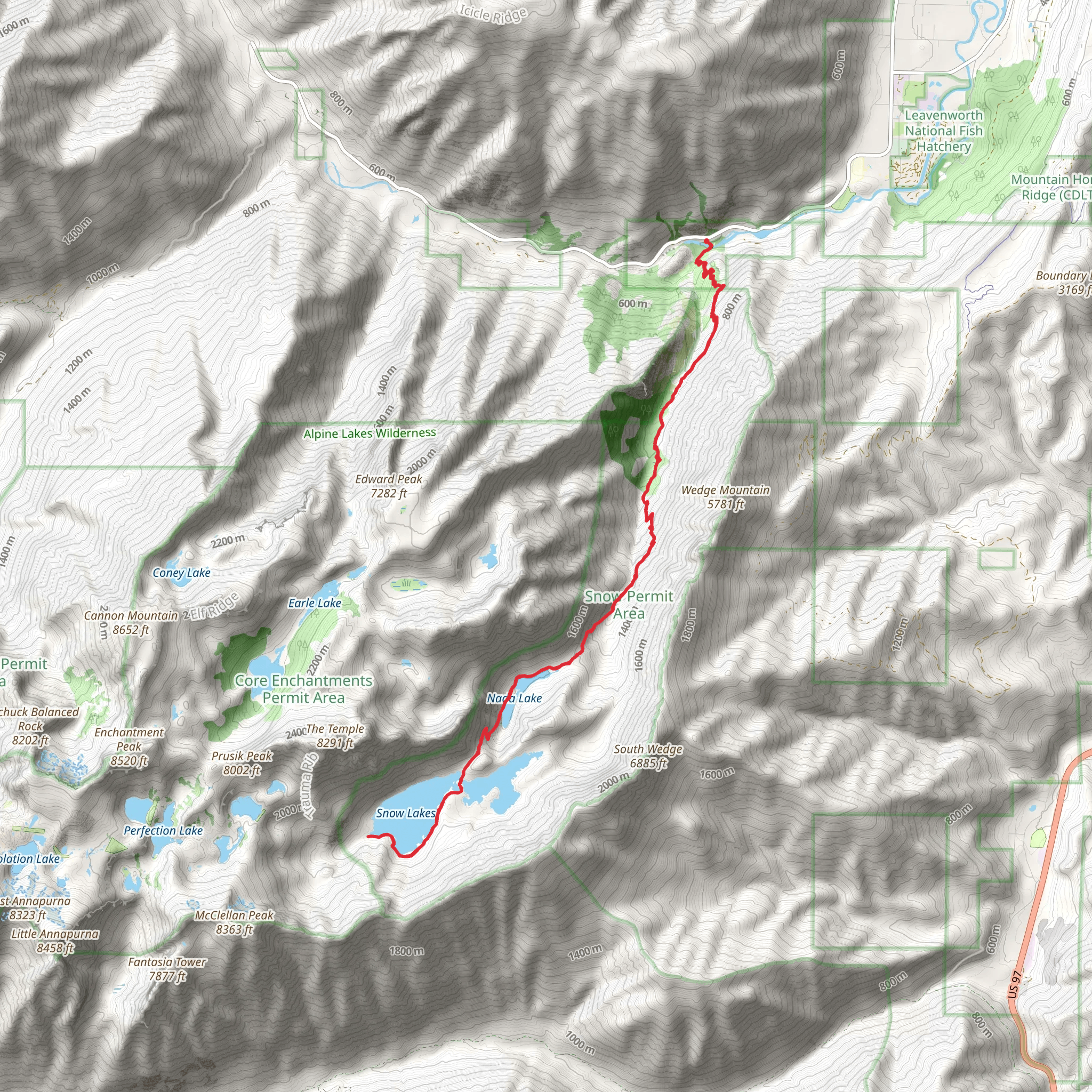
Starting your adventure near Chelan County, Washington, the Upper and Lower Snow Lake Trail offers a challenging yet rewarding experience. This out-and-back trail spans approximately 26 kilometers (16 miles) with an elevation gain of around 1900 meters (6234 feet). The trailhead is conveniently located near the Snow Lakes Trailhead, accessible by car via Icicle Road. For those relying on public transport, the nearest major town is Leavenworth, from where you can arrange a taxi or rideshare to the trailhead.
Trail Overview
The trail begins with a moderate ascent through dense forest, providing ample shade and a cool environment, especially during the summer months. As you progress, the path becomes steeper and rockier, requiring careful footing. The first significant landmark you'll encounter is Nada Lake, approximately 6 kilometers (3.7 miles) from the trailhead, sitting at an elevation of about 1500 meters (4921 feet). This serene lake is an excellent spot for a short break and offers stunning reflections of the surrounding peaks.
Upper Snow Lake
Continuing onward, the trail ascends more steeply towards Upper Snow Lake. This section is particularly challenging, with a series of switchbacks that test your endurance. After about 10 kilometers (6.2 miles) from the start and an elevation gain of roughly 1000 meters (3281 feet), you'll reach Upper Snow Lake. The lake is nestled in a granite basin, surrounded by towering cliffs and alpine meadows. The crystal-clear waters are fed by melting snow, making it a picturesque spot for photography and a well-deserved rest.
Lower Snow Lake
From Upper Snow Lake, the trail descends slightly to Lower Snow Lake, which is connected by a narrow channel. This part of the trail is less strenuous, allowing you to enjoy the breathtaking scenery. Lower Snow Lake is equally beautiful, with its turquoise waters and abundant wildflowers during the summer months. The total distance to Lower Snow Lake from the trailhead is approximately 13 kilometers (8 miles).
Wildlife and Flora
The area is rich in wildlife, including black bears, mountain goats, and various bird species. Keep an eye out for marmots and pikas in the rocky areas. The flora is equally diverse, with lush forests of Douglas fir and western hemlock at lower elevations, transitioning to alpine meadows filled with wildflowers such as lupine and Indian paintbrush as you climb higher.
Historical Significance
The region holds historical significance as part of the traditional lands of the Wenatchi people, who have lived in the area for thousands of years. The trail itself has been used for centuries, initially by Native American tribes and later by European settlers and miners. The Snow Lakes area was also part of the early 20th-century efforts to establish the Alpine Lakes Wilderness, a protected area aimed at preserving the natural beauty and ecological integrity of the region.
Navigation and Safety
Given the trail's length and elevation gain, it's crucial to be well-prepared. Ensure you have a detailed map and GPS, and consider using the HiiKER app for real-time navigation and trail updates. Weather conditions can change rapidly, so pack layers, rain gear, and sufficient food and water. Always inform someone of your hiking plans and expected return time.
Embarking on the Upper and Lower Snow Lake Trail promises a memorable adventure filled with natural beauty, challenging terrain, and a touch of historical significance.
What to expect?
Activity types
Comments and Reviews
User comments, reviews and discussions about the Upper and Lower Snow Lake Trail, Washington.
4.55
average rating out of 5
11 rating(s)
