
Download
3D Flyover
Add to list
More
5.1 km
~1 hrs 26 min
247 m
Loop
“A brisk Sugar Loaf loop with airy ridges, sweeping valley views, and a satisfyingly wild feel.”
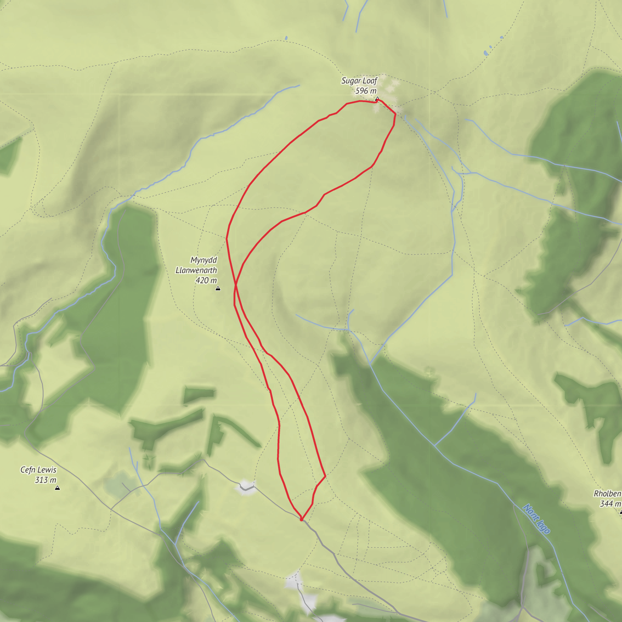
This medium-grade loop on the lower flanks of Sugar Loaf gives you a compact hill walk with big rewards: open ridge walking, broad views over Abergavenny and the Usk Valley, and a steady but manageable climb of about 5 km / 3.1 miles with roughly 200 m / 656 ft of ascent. The route is short enough for a half-day outing, but it still feels like a proper mountain walk because the ground rises quickly from the start and the upper slopes are exposed to wind and weather. Sugar Loaf itself stands above Abergavenny in Monmouthshire, on the edge of Bannau Brycheiniog National Park, and the mountain’s distinctive profile dominates the local skyline. (nationaltrust.org.uk)
The usual start for a loop of this length is the Llanwenarth / Sugar Loaf car park on the Abergavenny–Skenfrith road, the main access point used for walks onto the hill. If you are converting the trailhead to a practical landmark, the nearest well-known reference is Sugar Loaf car park near Abergavenny, Monmouthshire, with Fairfield car park, Abergavenny NP7 5SG often suggested as an alternative when the upper parking area is busy. The upper Llanwenarth parking area is small and reached by narrow lanes, and local authorities have introduced parking controls on the approach road because roadside parking became a safety issue. (nationaltrust.org.uk)
If arriving by public transport, Abergavenny railway station is the main rail gateway for the walk, and from town you can continue by taxi or local bus toward Llanwenarth. Some local walking guidance for Llanwenarth notes bus links including the 3 and X4 toward the area, though services should always be checked before travel. Abergavenny is the obvious base for supplies, cafés, and last-minute kit before heading up to the start. (stpetersllanwenarth.org.uk)
What the route feels like
From the car park, expect the walk to begin on a clear hill path or stony track, climbing gradually at first before steepening on the open hillside. On a route of around 5 km / 3.1 miles, the ascent is concentrated enough that it can feel more demanding than the distance suggests, especially if the ground is wet or if there is a strong crosswind. The path is generally straightforward in good visibility, but the upper mountain can become misty very quickly, so this is the kind of short route where carrying an offline route in HiiKER is still sensible. (komoot.com)
As you gain height, the landscape opens out over the Usk Valley, with views toward Abergavenny and the surrounding hills. National Trust information highlights the three ridge-like spurs associated with Sugar Loaf—Llanwenarth, Rholben and Deri—which shape the mountain and help create the wooded valleys below, including St Mary’s Vale and the Cibi Valley. That gives this loop more variety than a simple up-and-down summit walk: even on a shorter circuit, you move between open grassy slopes, ridge shoulders, and outlooks over enclosed valleys and farmland. (nationaltrust.org.uk)
The climb is rarely technical, but it is exposed. In dry weather the paths are usually uncomplicated; after rain, expect slick grass, muddy patches, and some loose stone. In colder months, wind chill can be severe on the upper section, and low cloud can flatten the terrain visually, making junctions less obvious than they appear on a clear day. Good boots or trail shoes with grip are more useful here than the modest distance might suggest.
Landmarks, views, and terrain
The standout landmark is Sugar Loaf itself, known in Welsh as Mynydd Pen-y-fâl, a prominent summit above Abergavenny. Even if this shorter loop does not linger long on the very top, the mountain’s shape and position are central to the walk. The summit and upper slopes give wide views across Monmouthshire and toward neighboring hills, and on clearer days the sense of elevation is much bigger than the numbers on paper suggest. (komoot.com)
Lower down, the route’s character is shaped by the mountain’s broad shoulders rather than craggy drama. This is a landscape of rounded upland forms, sheep-grazed grassland, and pockets of woodland in the valleys beneath. The contrast between the open hill and the enclosed, wooded folds below is one of the most distinctive features of the area. Because the route starts fairly high compared with valley walks, you reach panoramic ground quickly, which makes this a strong option when you want a shorter outing with immediate scenery. (nationaltrust.org.uk)
##
What to expect?
Surfaces
Dirt
Unknown
Comments and Reviews
User comments, reviews and discussions about the Mynydd Llanwenarth and Sugar Loaf Loop, Wales.
average rating out of 5
0 rating(s)


