
Download
3D Flyover
Add to list
More
5.7 km
~1 hrs 17 min
82 m
Loop
“Estuary light, marsh textures, hilltop views and castle ruins make this Laugharne loop richly atmospheric.”
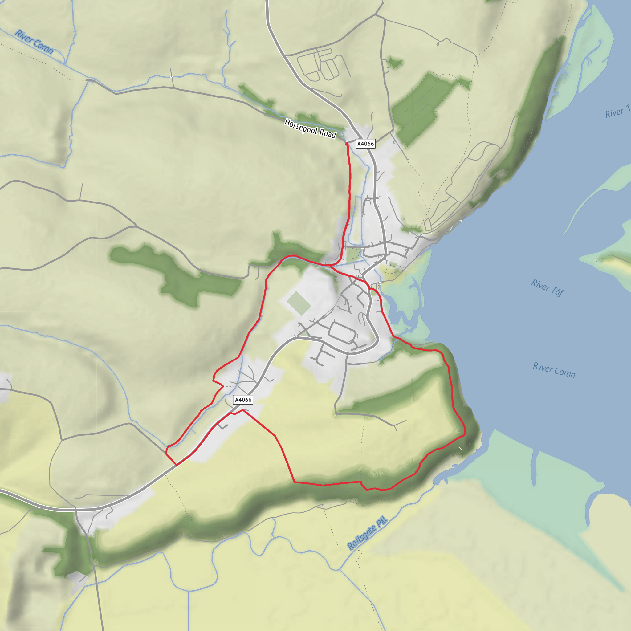
This easy loop of around 6 km / 3.7 miles with roughly 100 m / 328 ft of ascent explores the marshy edge of the Taf estuary, the rise of Sir John’s Hill, and the evocative ruins of Roche Castle near Laugharne in Carmarthenshire. It is a short walk, but it packs in a surprising variety of scenery: tidal inlets, open estuary views, grassy hill paths, low-lying reclaimed marsh, and one of the area’s most atmospheric historic sites. The terrain is generally manageable for most walkers, though the hill section, a few uneven grassy stretches, and potentially muddy ground mean it feels more varied than a simple promenade. The nearest significant landmark for the start is Laugharne Castle Car Park, Laugharne, Carmarthenshire, which local walking information identifies as the starting point for the Sir John’s Hill walk. That same source notes the car park can flood on the highest tides, so tide and weather awareness are worth factoring into your plans. (discovercarmarthenshire.com)
The route begins close to Laugharne’s historic core, where the estuary and the town’s medieval past are tightly intertwined. Expect a gentle opening before the walk starts to climb and contour around Sir John’s Hill. The ascent is not long, but it is enough to lift you above the marshes and give broad views over the Taf estuary and out toward the coast. Carmarthenshire’s official walking page describes this section as hillier in nature, with a short flight of steps, grassy tracks, fields to cross, and a short section of country lane, which is useful to know if you are deciding between trail shoes and lighter walking footwear. (discovercarmarthenshire.com)
What the route feels like on the ground
For much of the loop, the walking is on a mix of grassy paths, field-edge tracks, and minor lanes rather than rugged upland trail. In dry conditions, it should feel straightforward and relaxed; after rain, the marsh-side and field sections can become soft underfoot. Because the route stays relatively low except for the hill, the climbing tends to come in short bursts rather than one sustained pull. The overall elevation gain of about 100 m / 328 ft is modest, but some of the steeper little rises may feel sharper than the total figure suggests.
The most memorable visual element is the contrast between enclosed inland sections and the open estuary outlook. From the higher ground near Sir John’s Hill, there are excellent views back along the Taf estuary and out toward the coast. Local route notes specifically highlight viewpoints toward Wharley Point, Cover Cliff, and Black Scar Ferry. (discovercarmarthenshire.com)
Navigation should be uncomplicated for experienced walkers in clear weather, but the mix of paths, stiles, and field crossings means it is still worth having the route loaded in HiiKER before setting out.
Landmarks, wildlife, and local character
One of the key natural features on this walk is Laugharne Marsh, an area of land reclaimed from the sea over many centuries. The marsh landscape is not dramatic in a mountainous sense, but it is rich in texture and history: sea walls, drainage patterns, and old agricultural shaping all tell the story of people steadily modifying the estuary edge. The local walking guide notes that late 18th-century ploughing ridges can still be seen clearly in places, which adds another layer of interest if you enjoy reading the landscape as much as simply passing through it. (discovercarmarthenshire.com)
Birdlife is often one of the highlights in estuarine settings like this. Depending on season and tide, walkers should keep an eye out for waders, gulls, and other water-associated birds using the mudflats, saltmarsh, and creek edges. The tidal character of the area also means the scene can change noticeably over the course of a single walk.
The route also passes through land tied to Laugharne’s old civic traditions. The Lees, described in local heritage material as low-lying common land divided into shares belonging to the Corporation of Laugharne, reflect medieval rights and boundaries that still shape the landscape today. Another point of interest is the Corporation Boundary marker, where an inscription on rock can be found near a stile. (discovercarmarthenshire.com)
Then there is Roche Castle, the ruined stronghold that gives the loop much of its historic atmosphere. It is distinct from the better-known Roch Castle in Pembrokeshire; here, the site is associated with Laugharne and Sir John Perrot. Walking Englishman notes the tradition that Sir John Perrot planned a house on St John’s Hill to watch for pirate activity, and that local people later gathered among the castle ruins for recreation. While that account is secondary rather than official, it helps explain why the hill and castle remain so embedded in local storytelling. (walkingenglishman.com)
Historical significance of the area
Laugharne has deep Norman and medieval roots. Carmarthenshire’s official walking information explains that in the late 11th century the Normans
Surfaces
Unknown
Asphalt
Gravel
Unpaved
Comments and Reviews
User comments, reviews and discussions about the Railsgate Pill, Sir John's Hill and Roche Castle Loop, Wales.
average rating out of 5
0 rating(s)

