
Download
3D Flyover
Add to list
More
8.2 km
~2 hrs 11 min
335 m
Loop
“A wild Mid Wales loop: sweeping moorland, far-flung views, and a return demanding care.”
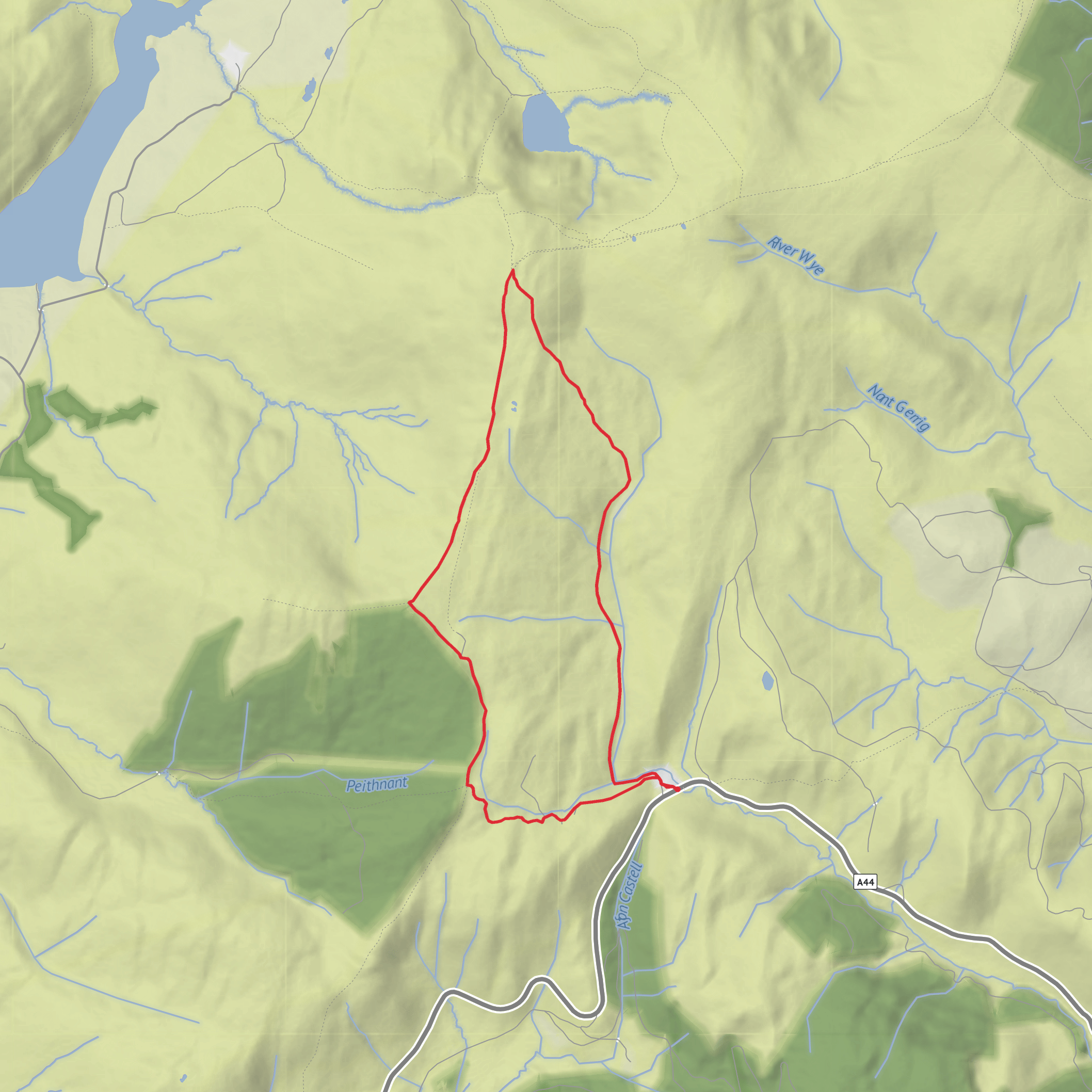
This medium-grade loop on the Pumlumon massif gives you a compact taste of Mid Wales upland walking: a steady climb onto broad, open moorland, a high summit with far-reaching views, and a quieter return over Pen y Drawsallt. At around 8 km / 5 miles with roughly 300 metres / 985 feet of ascent, it is not especially long, but it feels serious because the terrain is exposed, the weather can change quickly, and sections can be wet, rough, and indistinct underfoot. Pumlumon Fawr itself rises to 752 metres / 2,467 feet and is the highest point in the Cambrian Mountains. (ceredigion.gov.uk)
The start is most commonly associated with the high ground near Eisteddfa Gurig on the A44, a well-known roadside access point for Pumlumon routes, though some other circuits in the area begin nearer Nant-y-Moch Reservoir. For this Pen y Drawsallt loop, Eisteddfa Gurig is the most useful landmark to plan around if your route is about 8 km. If you are driving, expect a remote mountain approach with exposed roadside parking or small parking areas depending on the exact line you follow. If you are relying on public transport, the practical hub is Aberystwyth, which has rail and coach connections; from there, local buses and taxis are the usual onward options into the Pumlumon area, though services into the uplands are limited and should be checked carefully in advance. (gps-routes.co.uk)
The walk begins with a gradual but persistent rise from the roadside into open country. Early on, the route usually feels straightforward enough, but the landscape quickly becomes more expansive and less sheltered. You are moving into classic Cambrian uplands: broad backs of grass and heath, peatier patches, and a sense of space that can make the mountain feel bigger than the mileage suggests. In clear weather, the ascent is rewarding almost immediately, with the surrounding ridges opening out behind you and the higher dome of Pumlumon Fawr drawing you onward. (ceredigion.gov.uk)
Terrain and navigation
This is a route where conditions matter as much as distance. The ground can be boggy after rain, and even on a dry day you should expect damp patches, uneven trods, and some soft peaty sections. Mist is a major factor here: Pumlumon is specifically noted for rugged, uninhabited terrain and rapidly changing weather, so a short loop can become much more committing if cloud drops over the plateau. Good waterproofs, warm layers, and confident route-finding are important even in summer. If you are using digital navigation, plan the route in HiiKER before setting out and do not assume every section will be waymarked on the ground. (ceredigion.gov.uk)
A useful way to think about the effort is in three parts: roughly the first 3 km / 1.9 miles are mostly ascent, the middle section around the summit ridge is more exposed than steep, and the final 3 to 4 km / 1.9 to 2.5 miles over Pen y Drawsallt and back down require care because tired legs meet rougher footing and less obvious lines. The climb is only about 300 metres / 985 feet overall, but it is spread across open mountain rather than tidy engineered trail.
Landmarks and what to expect
The main landmark is the summit of Pen Pumlumon Fawr, usually marked by cairn features and the broad, high feel typical of the massif. On a clear day, this is one of the best viewpoints in Mid Wales, with views reported toward Cardigan Bay, Cadair Idris, Snowdonia, the Preseli Hills, and Pen y Fan. That range of visibility gives a good sense of just how central and elevated Pumlumon is within Wales. (ceredigion.gov.uk)
From the main top, the loop’s character changes as you swing toward Pen y Drawsallt. This section is often quieter
Surfaces
Unknown
Asphalt
Comments and Reviews
User comments, reviews and discussions about the Pen Pumlumon Fawr and Pen y Drawsallt Loop, Wales.
average rating out of 5
0 rating(s)
