
Download
3D Flyover
Add to list
More
17.3 km
~4 hrs 35 min
682 m
Out and Back
“A steady ridge-to-ridge ramble over Lick and Broad Run, with forest hush and winter view-glimpses.”
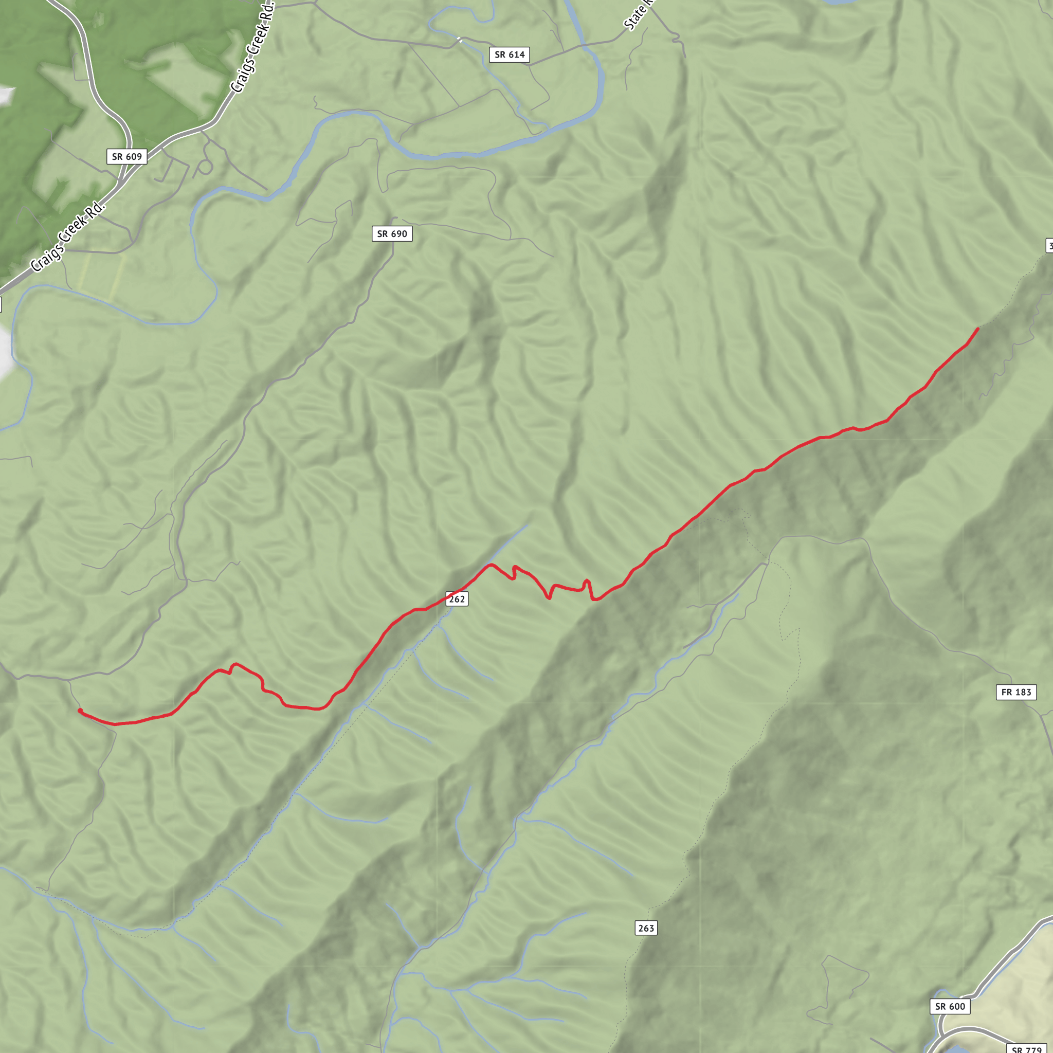
This is a longer ridge-and-hollow outing of about 17 km (10.6 mi) with roughly 700 m (2,300 ft) of climbing, linking two prominent Shenandoah-area ridgelines—Lick Mountain and Broad Run Mountain—via the Ferrier Trail. Expect sustained uphill work, a few steeper pitches, and a mix of shaded forest walking with periodic ridge openings and winter views.
Because your “Hike head: near …” and the hike type are incomplete, I can’t reliably convert the start point to a nearest address/landmark yet. If you paste the trailhead coordinates (lon/lat) or the parking/trailhead name, I’ll pin it to the closest recognized landmark/address and tailor the driving/transit directions precisely.
What the route feels like (pace, effort, and terrain)
- Overall effort: Medium, but it will feel upper-medium if the tread is wet/leaf-covered or if you’re carrying extra water. The climbing is spread out rather than one single wall, so it’s a steady “keep moving” day.
- Footing: Typical Blue Ridge/Shenandoah foothills tread—packed dirt, leaf litter, embedded rocks, and occasional loose stone. After rain, low spots can hold mud and the leaf layer can hide ankle-rolling rocks.
- Grade: You’ll likely see long moderate ascents with a couple of shorter, steeper ramps as you gain the ridges and transition between drainages and spurs.
- Time planning: Many hikers will take 5–7 hours moving time for 17 km (10.6 mi) with 700 m (2,300 ft) gain, plus breaks. Short winter days can make timing tight.
Route breakdown with approximate distances (km/mi) and climbing (m/ft)
Exact splits vary depending on the trailhead used and how the loop/connector segments are arranged, but for planning a 17 km / 700 m day, this is a realistic structure:
1) Trailhead to first sustained climb (0–3 km / 0–1.9 mi)
A warm-up section that’s often gentler: forested walking, stream-side or hollow travel depending on the approach.
- Gain: ~100–200 m (330–650 ft) gradually.
2) Ferrier Trail climb to the ridge (3–7 km / 1.9–4.3 mi)
This is where the day “starts.” Expect a steady climb with intermittent rocky steps and a few switchbacks or contouring traverses.
- Gain: ~350–450 m (1,150–1,475 ft) over this block.
3) Ridge travel: Lick Mountain toward Broad Run Mountain (7–13 km / 4.3–8.1 mi)
Once you’re up high, the grade usually eases into rolling ridge walking with short punchy ups/downs. This is often the most scenic-feeling portion: quieter woods, occasional openings, and long stretches away from roads.
- Gain: ~150–250 m (490–820 ft) in smaller increments.
4) Descent and return (13–17 km / 8.1–10.6 mi)
The final leg is typically a sustained downhill back into the hollow/approach corridor. Downhills here can be deceptively tiring—leaf litter over rock can be slick, and knees take a beating.
- Loss: most of your elevation back to the trailhead; plan careful footing.
Landmarks, scenery, and what to watch for
- Ridge character: Lick Mountain and Broad Run Mountain ridges tend to be oak–hickory dominated with mountain laurel and occasional pine, depending on aspect and elevation. In cooler months, leaf-off views can open up dramatically.
- Hollows and drainages: Lower sections often feel more humid and shaded, with ferns, mossy rocks, and small stream crossings (seasonal). After storms, expect blowdowns and small washouts.
- Viewpoints: Even when there aren’t formal overlooks, ridgelines often have thin-canopy windows—look for rock outcrops or sparse stands where the forest opens briefly.
Wildlife and seasonal conditions
- Black bears: Present in the broader Shenandoah region. Encounters are usually brief; keep food secured and avoid surprising animals in dense laurel.
- White-tailed deer, turkey, and small mammals: Common; dawn and dusk are most active.
- Snakes and ticks: In warm months, watch for timber rattlesnakes/copperheads in rocky sunlit areas and ticks in brushy edges. Use repellent, do tick checks, and stay alert stepping over logs.
- Hunting season: If any portion is on or near state forest/WMA/private lands, wear blaze orange in fall. (Once you share the exact start point/land manager, I can tell you what’s typical for that specific area.)
- Water: Streams can be seasonal. For a 17 km / 700 m day, many hikers carry 2–3 liters depending on temperature and whether reliable refill points exist. If you plan to filter, confirm water sources on HiiKER before you go.
Navigation and trail-finding
This route can involve multiple junctions and ridge connectors where it’s easy to follow the “most worn” path the wrong way, especially under leaf cover. - Download the route on HiiKER
AI Planner
Days planned around your pace, with somewhere to stay each night.
Surfaces
Dirt
Unknown
Comments and Reviews
User comments, reviews and discussions about the Lick Mountain and Broad Run Mountain via Ferrier Trail, Virginia.
average rating out of 5
0 rating(s)
