Download
3D Flyover
Add to list
More
2.1 km
~35 min
99 m
Out and Back
“A brief woodland climb culminates in a dramatic fire tower panorama over Vermont’s layered ridgelines.”
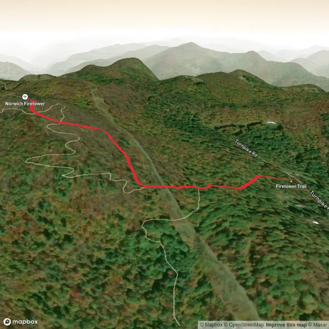
This short climb on Gile Mountain packs a lot into a small outing. The main hiking route is about 0.68 miles (1.1 km) each way, so most hikers cover roughly 1.4 miles (2.2 km) round trip, with about 413 feet (126 m) of elevation gain to the summit ridge and fire tower. Although the mileage is modest, the grade becomes steeper in the upper section, which is why a medium difficulty rating makes sense for many walkers rather than calling it purely easy. (norwich.vt.us)
The trail begins from a small parking area on Turnpike Road in Norwich, Vermont, near the end of the road and about 5.7 miles (9.2 km) from Norwich village and the Norwich Inn. From the lot, the blue-blazed path starts on an old woods road and climbs gently at first, making this a good warm-up before the steeper final push. Early on, the route passes a junction with the Woody Adams Trail at around 0.2 miles (0.3 km), then crosses a power-line corridor before re-entering the forest. At roughly 0.27 to 0.3 miles (0.4 to 0.5 km), the bike/ski route splits away to the left; hikers wanting the direct summit route should stay on the main hiking trail. After that, the path turns upward more decisively, using a couple of switchbacks before reaching the summit ridge and the fire tower. (norwichtrails.org)
What to expect on the climb
Underfoot, expect packed dirt, some gravelly or worn sections, and the kind of rooty, occasionally slick footing common on well-used New England woodland trails. Because this is a high-use route, the tread can show erosion in places, especially after wet weather. Mud season is a real consideration here, and local trail managers note that the trail is typically closed during spring mud season, often from April into mid-May, to protect both the path and the access road. If rain has recently passed through, waterproof footwear or at least shoes with solid grip are a smart choice. (trailfinder.info)
The forested lower slopes keep the climb shaded and relatively enclosed, so the trail feels calm and sheltered for most of the ascent. That makes the summit reveal more dramatic: the real payoff is the fire tower, which rises above the trees and opens up broad views over the Upper Valley. On clear days, sources note views stretching as far as Camel’s Hump to the west and Franconia Ridge to the east. (norwichhistory.org)
Because the route is short, many hikers move quickly and underestimate it. Even on a brief outing, it is worth carrying water, an extra layer for the exposed tower top, and checking conditions before setting out. If you are planning in shoulder seasons, traction can be useful when the upper trail or tower stairs hold ice. For navigation, HiiKER is the best tool to use for confirming the correct hiking route versus the alternate bike/ski line.
Landmarks, nature, and wildlife
The defining landmark is the 67-foot (20 m) fire tower on the summit. It is the feature that gives the hike its identity and its views, and it also explains why the trail is sometimes referred to by alternate names such as Fire Warden Trail, Gile Mtn Tower Trail, or Firetower Trail. (norwichtrails.org)
The surrounding woods are typical of eastern Vermont’s recovering forest landscape. The region today is heavily forested, a major contrast with the era when much of Vermont had been cleared for agriculture. Norwich Historical Society notes that when Vermont’s fire towers were being established, about 80% of the state’s land had been cleared, whereas now about 80% is forested. That long ecological recovery shapes what hikers see today: mixed woodland, a shaded understory, birdsong in spring and summer, and the possibility of spotting common regional wildlife such as squirrels, chipmunks, deer, and a variety of songbirds and raptors. Larger mammals such as black bear do live in Vermont, though encounters on this busy trail are uncommon. (norwichhistory.org)
The power-line crossing creates a brief break in the forest and can be one of the better places to notice edge habitat species, including birds that prefer more open corridors. Near the summit, the tower platform is often the best place to scan for distant ridgelines, patchwork valleys, and seasonal foliage color in autumn.
Historical significance
Gile Mountain has more historical depth than its short distance

Surfaces
Dirt
Unknown
Ground
Comments and Reviews
User comments, reviews and discussions about the Gile Mountain Trail, Vermont.
average rating out of 5
0 rating(s)