Download
3D Flyover
Add to list
More
7.5 km
~1 hrs 56 min
258 m
Loop
“Brookside murmurs and forgotten farmsteads make this loop a quietly rewarding Vermont ramble.”
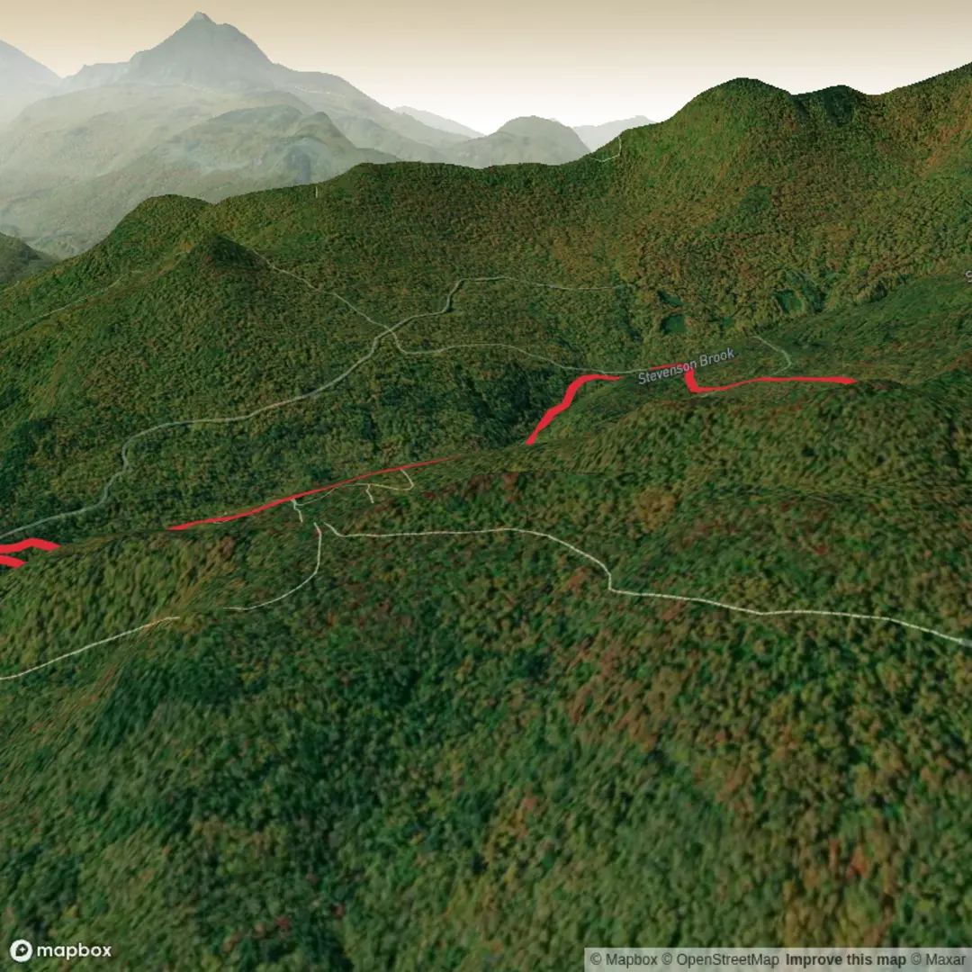
This roughly 8 km / 5 mi outing in Little River State Park near Waterbury, Vermont is a solid medium-grade loop that mixes brookside walking, old woods roads, short steeper pitches, and one of the most interesting historic trail corridors in central Vermont. The route is commonly built from the Stevenson Brook Trail and Dalley Loop, and depending on the exact connector used, hikers should expect about 300 m / 980 ft of climbing overall, with the effort spread across a steady ascent beside the brook and a more rolling return through former farm and logging country. The terrain is varied rather than relentlessly steep, which makes it a good choice for hikers who want a half-day walk with both scenery and substance. (vtstateparks.com)
The walk begins in the Little River State Park trail network above Waterbury Reservoir, with the nearest well-known access point being Little River State Park, 3444 Little River Road, Waterbury, Vermont 05676. The Dalley Loop trailhead itself is described by Vermont State Parks as being about 0.75 miles north of the park office on the road toward campground Area B, with parking on the right and the trailhead on the left. If you are driving, Waterbury is the practical base town, and Little River Road is the road to follow into the park. (camping.org)
Public transport is possible only to a point. Waterbury has an Amtrak station and regional bus connections, but the trailhead is outside the village and not at a standard in-town stop, so most hikers using transit will still need a taxi, rideshare, or bike for the final approach to Little River State Park. That makes a car the simplest option for most visitors. (en.wikipedia.org)
The opening section on Stevenson Brook is the more intimate and natural-feeling part of the hike. The trail closely follows the brook and climbs gradually through mixed forest, with the sound of moving water nearby for much of the ascent. Expect damp ground in places, roots, and small streamside roughness rather than smooth path all the way through. In spring and after rain, this section can feel especially lively, with minor cascades and wet crossings adding interest but also demanding more care with footing. (madrivervalley.com)
Route character and footing
Stevenson Brook Trail is listed by Vermont State Parks at 2.5 miles / 4.0 km in length, and Dalley Loop at 3.54 miles / 5.7 km, so the exact hike distance depends on where you join and leave the loop. A shorter Stevenson Brook–Dalley combination comes out around 4.5 miles / 7.2 km, while extended variants are a little over 6 miles / 10 km. For your planned hike of around 8 km / 5 mi, expect a route that uses part of Stevenson Brook and part of Dalley Loop rather than every possible spur. (vtstateparks.com)
The climb is generally moderate, but there are a few things to watch for. The Cut-Off Trail, which links Dalley Loop and Stevenson Brook, crosses Stevenson Brook and is specifically noted by Vermont State Parks as a dangerous stream crossing during times of high water. If water levels are up, it is wiser to stay on the main trails and avoid forcing the crossing. Parts of Dalley Loop also descend steeply near the end, and some sections are rocky enough that careful foot placement matters, especially on wet leaves or after rain. (vtstateparks.com)
Because this is a forested route rather than an exposed summit hike, the challenge comes more from footing, moisture, and route choices than from altitude or weather exposure. Waterproof footwear or at least shoes that handle mud and shallow water well are a smart choice. Trekking poles can help on the steeper downhill and at brook crossings. For navigation, carrying the route in HiiKER is the best way to keep track of the correct junctions in this fairly interconnected trail system.
Landmarks, nature, and wildlife
One of the biggest draws here is the way the landscape shifts from brook corridor to old settlement country. Along Dalley Loop, hikers pass former farm sites, cellar holes, old roadbeds, and interpretive history points. Vermont State Parks identifies landmarks including the David Hill and Bert Goodell farm sites, the High Bridge area, the Joseph Ricker farm, the Upper Cemetery, the former Ricker School House corner, and the Ricker homestead farther along the loop. These remains give the hike a strong sense of place even

Surfaces
Unpaved
Unknown
Paved
Comments and Reviews
User comments, reviews and discussions about the Steven Brook Trail and Dalley Loop, Vermont.
average rating out of 5
0 rating(s)