Download
Preview
Add to list
More
9.4 km
~2 hrs 49 min
563 m
Out and Back
“A rugged brookside climb culminates in sweeping fire-tower views, rewarding prepared hikers with classic Vermont drama.”
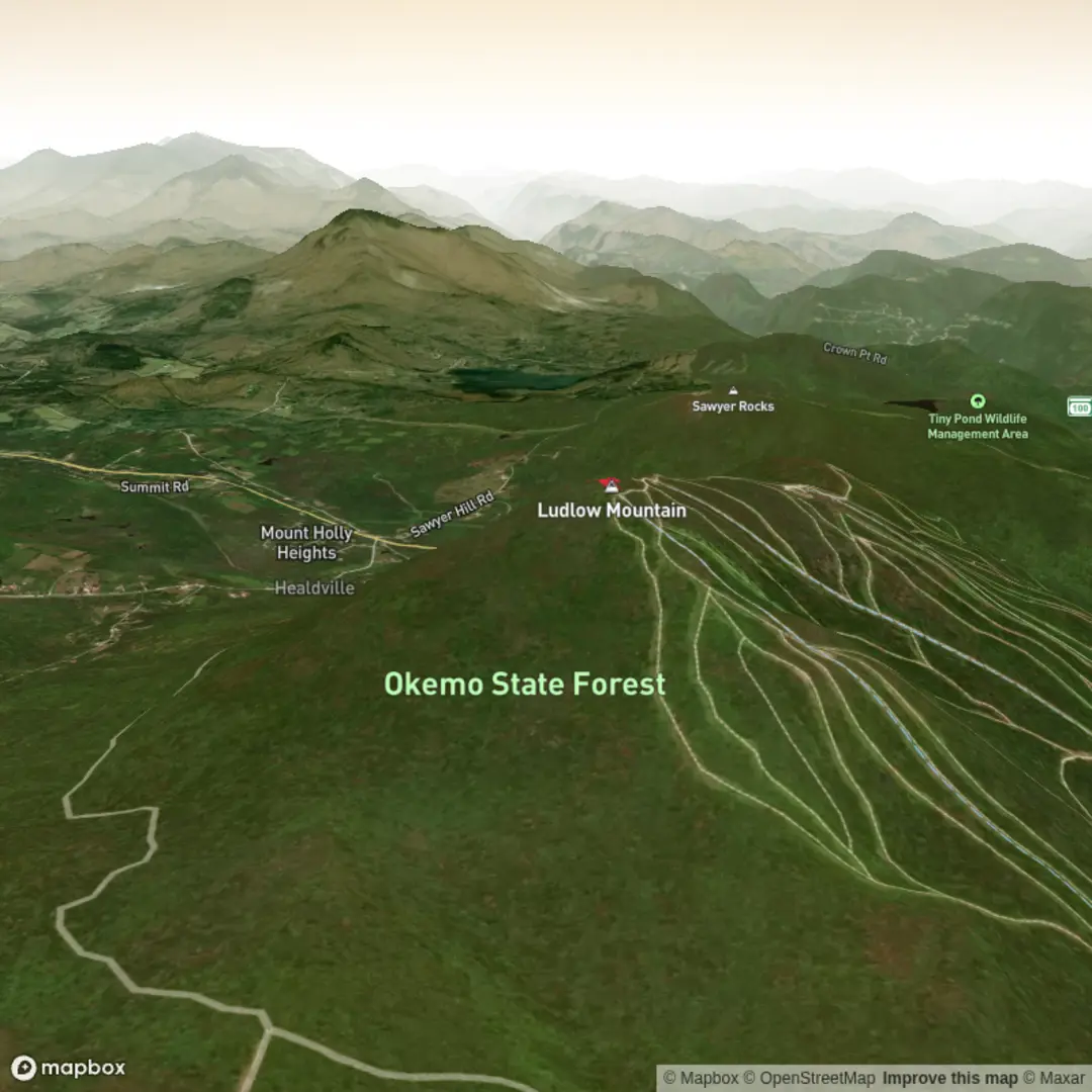
This is a short but demanding out-and-back climb on the west side of Okemo Mountain, gaining roughly 9.5 km / 5.9 miles round trip with about 600 m / 1,970 ft of elevation. The route follows the Healdville Trail from the lower forested slopes to the summit area of Ludlow Mountain, better known locally as Okemo Mountain, and finishes at the historic fire tower near the top. Although the mileage is moderate, the steady ascent, rocky footing, wet roots, and steeper upper pitches make it a difficult hike for many walkers. (trailfinder.info)
The trail begins from the Healdville Trail parking area at the end of a gravel road off Station Road near Ludlow, Vermont. A practical nearest landmark is the Healdville Trail Parking Area off Station Road, west of VT Route 103 near Ludlow/Belmont. Driving directions are straightforward: from the junction of VT 100 and VT 103 in Ludlow, head west on VT 103 for about 4.3 km / 2.7 miles, turn left onto Station Road, then turn left again just after the railroad tracks and continue to the gravel lot at road’s end. The lot is gravel and is not plowed in winter, so shoulder-season and cold-weather access can be more complicated. (trailfinder.info)
For hikers using public transport, the nearest practical transit link is Ludlow. The seasonal Ludlow Route operated by Marble Valley Regional Transit District connects Rutland and Ludlow, but service only runs between Thanksgiving and Easter, so it is not a dependable year-round hiking option. Even when running, it does not place most hikers directly at the trailhead, so expect to need a taxi, rideshare, or local drop-off for the final approach to Station Road. (thebus.com)
What the climb is like
The opening section uses an old logging road and eases you into the route before the trail begins climbing in earnest. Early on, the path crosses small bridges and tracks alongside a brook, which adds some of the most attractive scenery on the hike. Around 0.3 km / 0.2 miles in, you reach a second bridge, and by about 1.1 km / 0.7 miles the trail crosses the brook again. This lower section can be muddy, slick, and rooty after rain, so waterproof footwear and careful foot placement are helpful. (trailfinder.info)
As the trail gains height, the grade becomes more sustained. Switchbacks lead to a flatter plateau at about 2.4 km / 1.5 miles, offering a brief break before the climb resumes. The footing remains classic southern Vermont: rocks, roots, damp soil, and occasional rough tread that can feel more strenuous than the distance suggests. Hikers should budget more time than they might for a smoother trail of similar length. (trailfinder.info)
One worthwhile feature low on the route is the Branch Brook drainage. Side cascades and small falls are found near the trail corridor, and the brook adds both visual interest and extra caution points, especially after wet weather when rocks and streamside surfaces become slippery. (newenglandwaterfalls.com)
Views, summit features, and landmarks
At roughly 3.7 km / 2.3 miles, the trail reaches an overlook with views north and west. This is one of the key landmarks on the ascent and a good place to pause before the steepest upper section. From there, the trail climbs sharply for about 0.8 km / 0.5 miles toward the summit zone. Near 4.7 km / 2.9 miles, you pass the remains of a former ranger cabin, then reach a signed junction near the top. Turning right leads the final short distance to the fire tower at about 4.8 km / 3.0 miles one way. (trailfinder.info)
The summit fire tower is the defining feature of the hike. From the top, views can include the Okemo ski area, Mount Ascutney to the east, Stratton and Bromley to the south, the Taconic Range to the west, and Killington Peak to the north. Visibility depends on weather, but on a clear day this is a

Comments and Reviews
User comments, reviews and discussions about the Ludlow Mountain via Healdville Trail, Vermont.
average rating out of 5
0 rating(s)