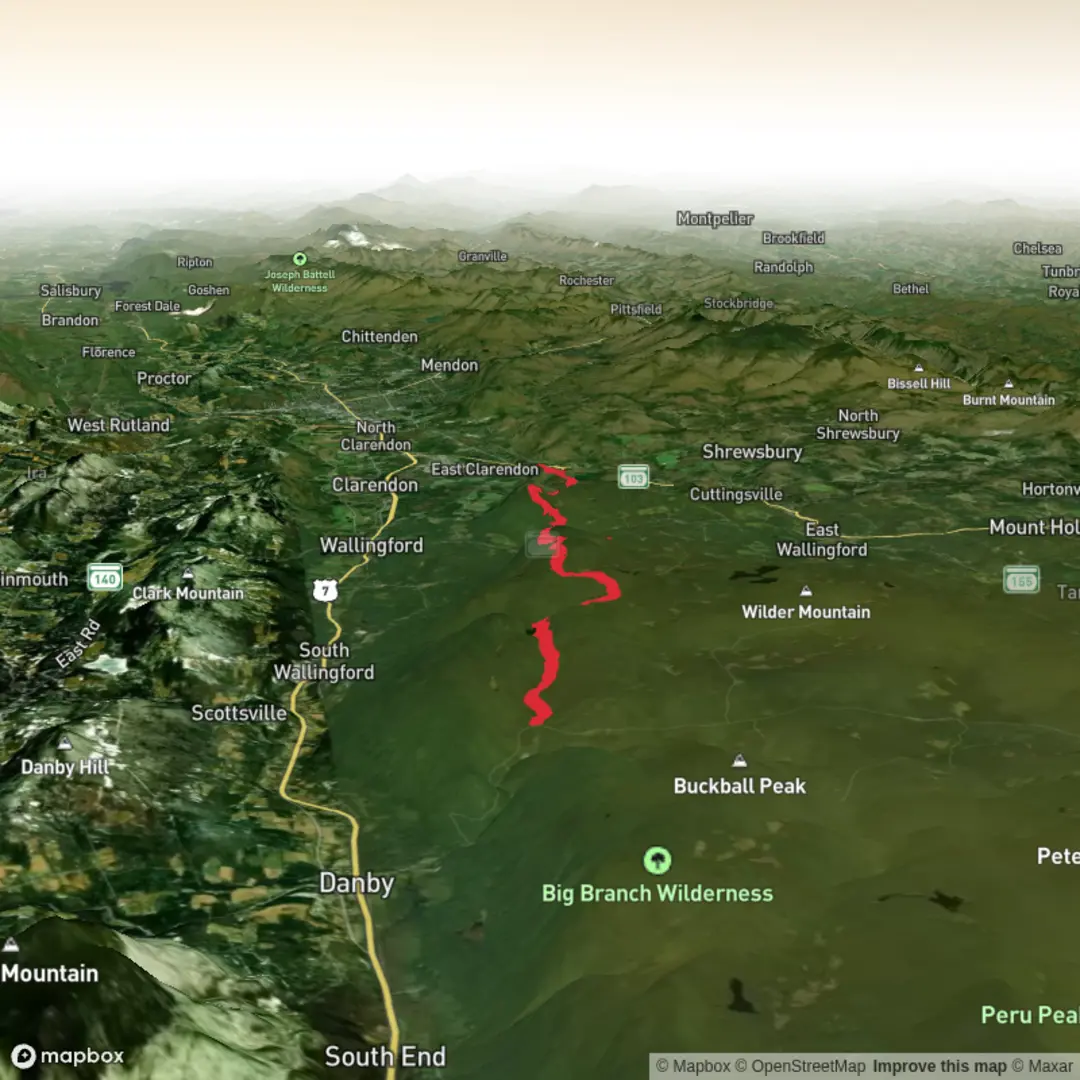
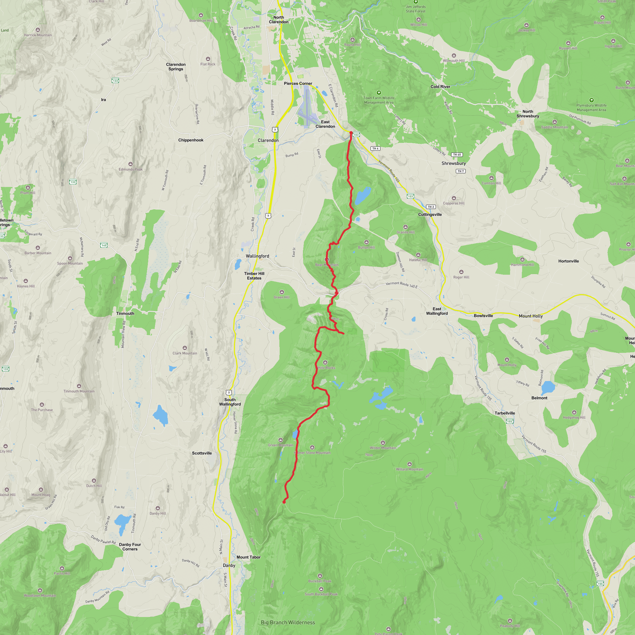
Little Rock Pond, Bear Mountain and Clarendon Gorge via Appalachian Trail
Download
3D Preview
Add to list
More
23.1 km
~5 hrs 56 min
789 m
Point-to-Point
“A pond-side hush gives way to rugged ridge walking and a thrilling gorge-side finale.”
This roughly 23 km / 14.3 mile route links one of southern Vermont’s loveliest backcountry ponds with a long ridge walk, a climb over Bear Mountain, and a dramatic finish at Clarendon Gorge. With about 800 m / 2,625 ft of elevation gain, it fits a solid medium day for experienced hikers, though it can feel harder if the trail is wet, muddy, or covered in leaf litter on the steeper descents. Much of the route follows the shared Appalachian Trail and Long Trail corridor in the Green Mountain National Forest, where the tread is classic Vermont: roots, slick rocks, short punchy climbs, muddy pockets, and long wooded stretches broken by occasional ledges and outlooks. (greenmountainclub.org)
The usual western start for this hike is the Appalachian Trail/Long Trail crossing on Forest Service Road 10, also called Danby–Landgrove Road, east of Danby. The nearest practical landmark for the hike head is the AT/LT trailhead parking on Forest Service Road 10 near Big Branch Day Use Area, about 3.5 miles / 5.6 km east of US 7 in Danby. The Forest Service notes additional parking at Big Branch Day Use Area, about 0.5 miles / 0.8 km west of the AT/LT crossing. (appalachiantrail.org)
By car, the simplest approach is from US 7 in Danby: turn east onto Brooklyn Road/Forest Road 10 and continue about 3.5 miles / 5.6 km to the AT/LT crossing and parking on the south side of the road. Coming from the east, access is possible from Route 100 in Weston via Landgrove Road, Lawrence Hill Road, Forest Road 12, and then Forest Road 10, though that approach is longer and more rural. Roads in this area can be narrow, winding, and seasonally rough, so allow extra time. (fs.usda.gov)
Public transport is limited. The nearest larger service center is Rutland, and hikers typically need a taxi, rideshare, or pre-arranged shuttle from there to reach either the Forest Service Road 10 start or the Clarendon Gorge end near Route 103. There is no regular trailhead shuttle noted by the Forest Service or Green Mountain Club for this route, so point-to-point hikers should plan the return in advance rather than assuming same-day transit options. This is especially important because the route finishes well away from the start. (fs.usda.gov)
What the route feels like
From Forest Service Road 10, the trail heads north on the white-blazed Appalachian Trail/Long Trail and climbs gradually through mixed hardwood forest. The first major landmark is Little Rock Pond, reached at about 3.2 km / 2 miles from the trailhead. The path skirts the eastern shore for roughly another 0.6 km / 0.4 miles, giving intermittent views across the water to the surrounding wooded slopes and boulder-strewn shoreline. This is one of the most scenic and most visited backcountry pond settings in the area, and it often feels calmer and cooler than the lower forest on warm days. (appalachiantrail.org)
Little Rock Pond sits within the Robert T. Stafford White Rocks National Recreation Area, and the setting is notable for its sheltered basin, large glacial-looking boulders, and quiet shoreline forest. Near the south end of the pond are overnight facilities including a shelter, tenting area, and seasonal caretaker presence noted by the Forest Service on related route descriptions, so day hikers should expect to share this section with backpackers. (fs.usda.gov)
Beyond the pond, the route continues north on the AT/LT and begins to feel more committing. The tread alternates between moderate grades and rougher, rockier sections as it works along
Surfaces
Dirt
Unknown
Wood
Comments and Reviews
User comments, reviews and discussions about the Little Rock Pond, Bear Mountain and Clarendon Gorge via Appalachian Trail, Vermont.
average rating out of 5
0 rating(s)
