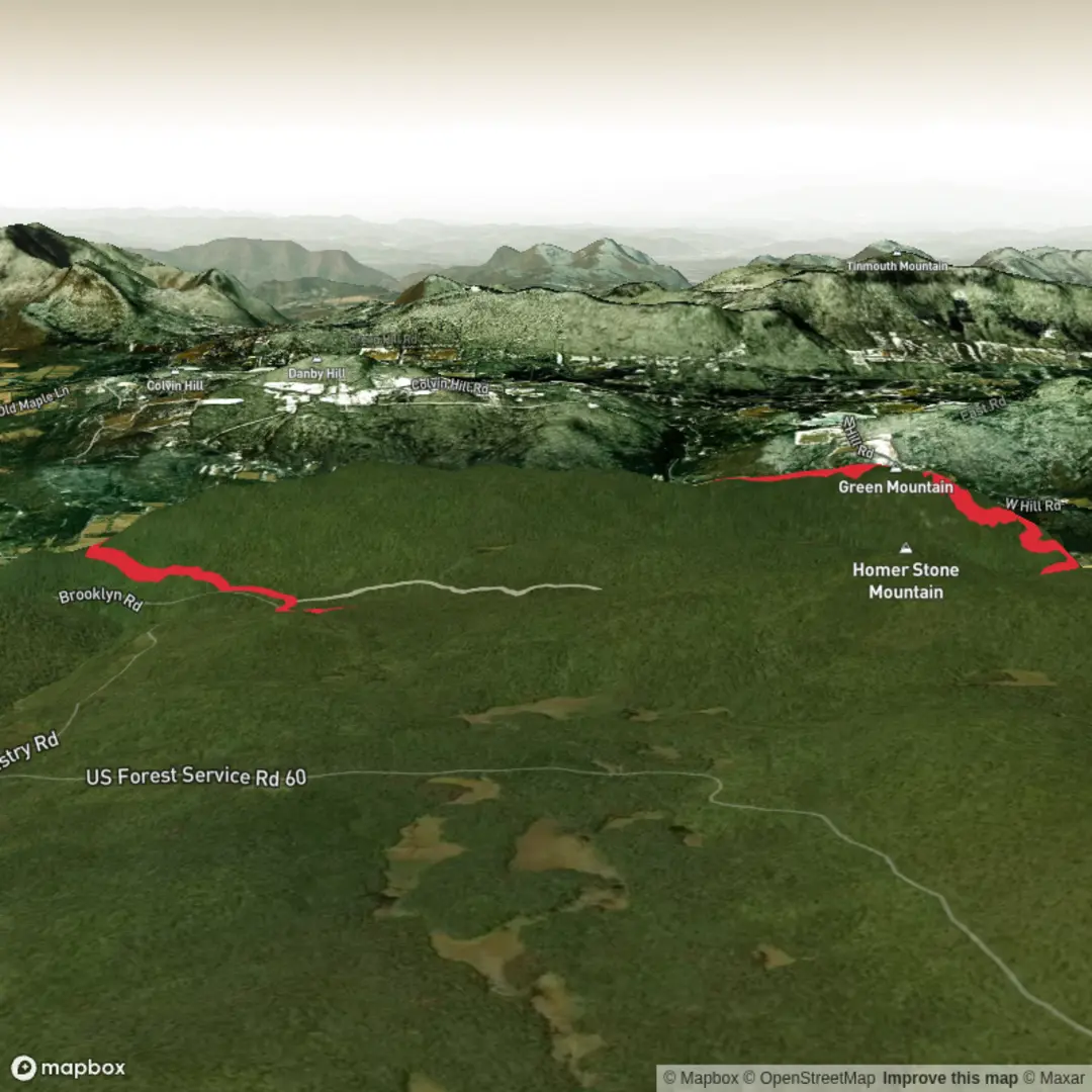
Little Rock Pond and Green Mountain via Appalachian Trail and Green Mountain Trail
Download
3D Flyover
Add to list
More
11.2 km
~2 hrs 46 min
323 m
Loop
“A tranquil pond approach gives way to a rooty, rewarding climb and sweeping fire-tower vistas.”
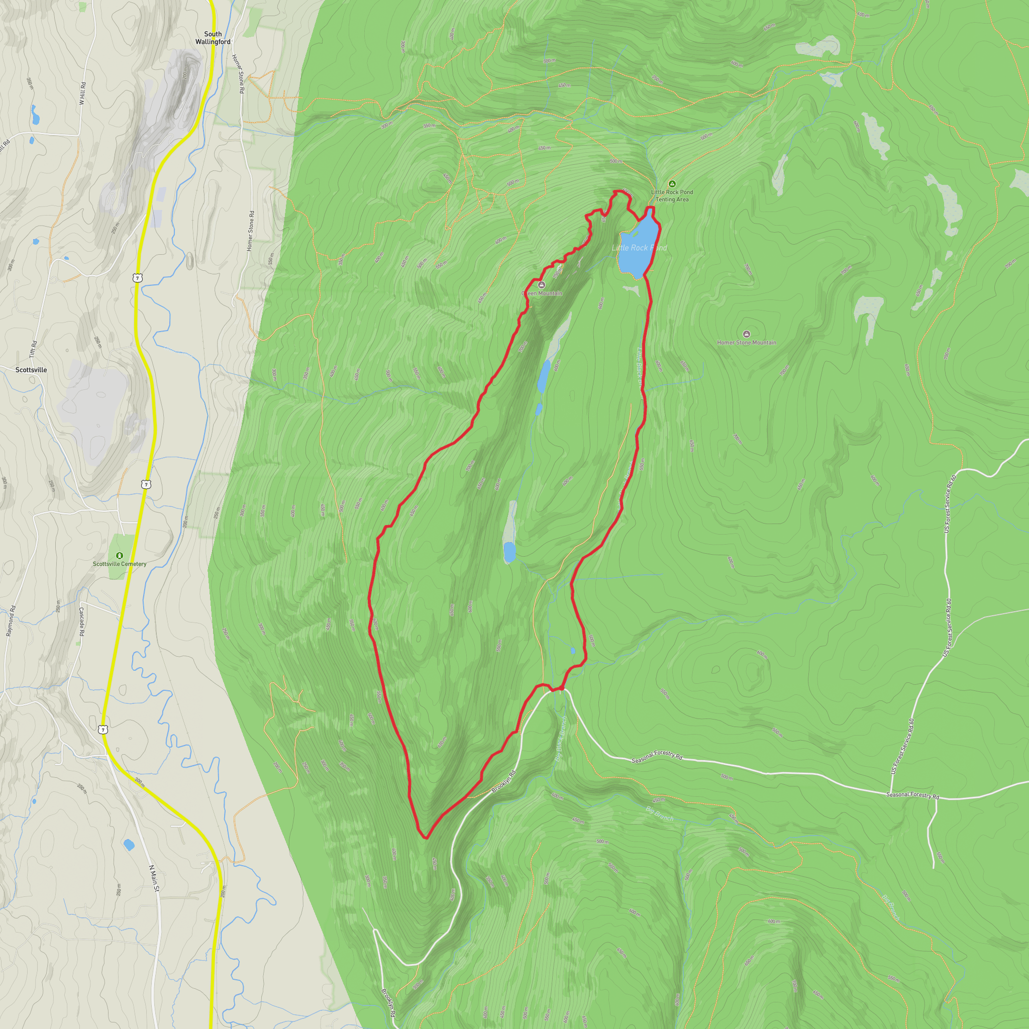
This roughly 11 km / 6.8 mile out-and-back route combines a mellow approach to Little Rock Pond with a steeper climb to the open ledges and fire-tower summit area of Green Mountain, making it a solid medium-difficulty day hike. Expect about 300 m / 985 ft of elevation gain overall, though the effort can feel a little greater if the trail is wet, rooty, or muddy—common conditions in this part of Vermont’s Green Mountains. The walk blends classic Appalachian Trail terrain with pondside scenery, mixed hardwood-conifer forest, and broad summit views.
The hike begins near Little Rock Pond Trailhead on Little Rock Pond Road, Wallingford, Vermont, in the Green Mountain National Forest, west of U.S. Route 7 and not far from Danby and Wallingford. For drivers, the usual access is via local roads branching from Route 7; the final approach is on quieter forest roads, which can be rougher in shoulder seasons or after heavy rain. Parking is typically at or near the trailhead area serving Little Rock Pond and the Appalachian Trail corridor. If arriving by public transport, options are limited: the nearest practical regional access points are usually Rutland, Vermont or communities along the Amtrak Ethan Allen Express / regional bus corridor, followed by a taxi or rideshare to the trailhead area. Because rural transit in this region is sparse, hikers should verify schedules in advance and plan for a car-based approach if possible.
The opening section is generally the gentlest part of the day. The route heads through northern hardwood forest—often maple, birch, and beech—with sections of spruce and fir appearing as elevation increases. Early on, the grade is moderate and the footing can alternate between packed earth, roots, stones, and occasional muddy patches. Within the first part of the hike, the trail reaches Little Rock Pond, one of the more attractive backcountry ponds in southern Vermont. This pond is a notable landmark and a natural pause point, with quiet water, surrounding forest, and a sense of remoteness that feels larger than the mileage suggests.
Around Little Rock Pond
Little Rock Pond sits in a sheltered basin and is one of the scenic highlights of the route. The shoreline area can be damp, buggy in warmer months, and especially lively with amphibians and birdlife. Loons are not guaranteed, but hikers should listen for thrushes, warblers, and other forest birds in spring and summer. The wet ground around the pond also supports typical northeastern woodland species such as ferns, mosses, and moisture-loving understory plants. In autumn, this section can be particularly striking when the hardwood canopy turns.
This area is also part of a broader protected landscape shaped by both natural processes and a long human history. Southern Vermont’s forests were heavily logged and cleared in the 18th and 19th centuries for farming, charcoal production, and timber, then gradually reforested as agriculture declined in the hill country. Today, much of what hikers see is second-growth forest within the Green Mountain National Forest, with the Appalachian Trail preserving an important travel corridor through the region. The Appalachian Trail itself is one of the most historically significant long-distance footpaths in the United States, conceived in the early 20th century and later protected through a major public-land conservation effort.
Beyond the pond, the route continues on or connects with the Green Mountain Trail for the climb toward the summit area. This is where the hike becomes more sustained. The ascent is not enormous by mountain standards, but it is enough to raise the heart rate, especially over short steeper pitches. Hikers should expect uneven footing, embedded rock, roots, and potentially slick surfaces after rain. Trekking poles can help on both the climb and descent.
Climb to Green Mountain
From the pond area to Green Mountain, the trail gains height through denser forest before breaking toward more open terrain near the top. The summit zone is known for its fire tower, one of the defining landmarks of the hike. Fire towers in Vermont are reminders of an era when staffed lookouts were essential for detecting wildfires across the state’s forested ridgelines. Many of these towers date to the early and mid-20th century, when fire observation was a major part of forest management. Where access is permitted and conditions are safe, the tower area can provide expansive views over the Taconic and Green Mountain landscapes.
The final approach may feel steeper than the numbers suggest, especially if hikers have started quickly from the trailhead. Allow time for slower movement near the top, where ledges, exposed roots, and weathered rock can demand more careful foot placement. In cool or windy weather, the summit can feel significantly colder than the trailhead, even on a relatively short hike.
Wildlife in this section may include white-tailed deer, red squirrels, chipmunks, and a variety of songbirds. Black bears do inhabit Vermont’s forests, though sightings are uncommon on busy day hikes; still, hikers should stay aware, keep food secured, and avoid leaving packs unattended. In warmer months, ticks are worth watching for, especially in lower brushy sections, while mosquitoes and black flies can be intense from late spring into early summer.
Because the route includes both pondside low ground and a summit climb, conditions can vary a lot over a short distance. Waterproof footwear or at least shoes with good grip are useful, and hikers should carry layers even for a modest outing. A realistic plan for many walkers is to allow 3.5 to 5 hours, depending on pace, stops, and trail conditions. Families with capable older children or newer hikers with decent fitness can enjoy it, but
Surfaces
Ground
Dirt
Asphalt
Comments and Reviews
User comments, reviews and discussions about the Little Rock Pond and Green Mountain via Appalachian Trail and Green Mountain Trail, Vermont.
average rating out of 5
0 rating(s)
