
Download
3D Flyover
Add to list
More
2.2 km
~32 min
58 m
Loop
“A brief Appalachian Trail ramble to Kent Pond, where slick roots yield to calm shoreline wonder.”
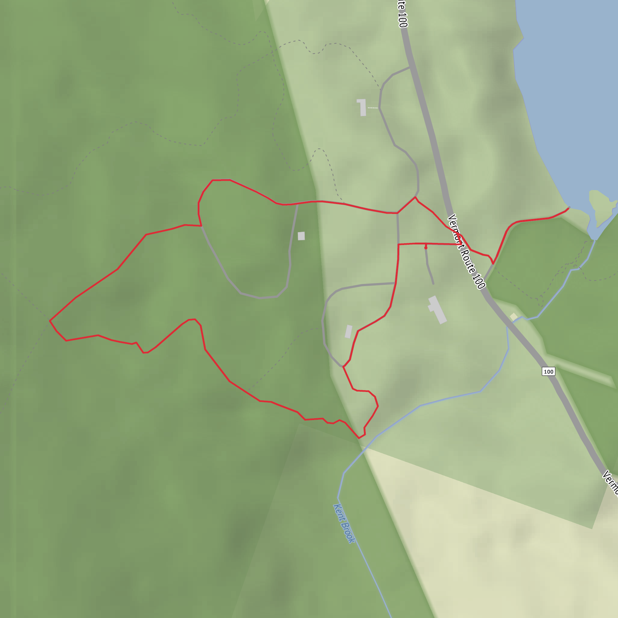
A short, rewarding out-and-back to a classic Appalachian Trail waterside viewpoint, this walk reaches Kent Pond quickly and then lingers along the shoreline for some of the best “big nature for small effort” scenery in the area. Expect roughly 2 km / 1.2 mi total with about 100 m / 330 ft of climbing—enough to feel like a proper hike, but still approachable if you take your time on the steeper pitches.
Getting to the start (car + public transport)
By car:
The most common access is from the U.S. Route 4 corridor near Sherburne Pass between Killington and Woodstock, Vermont. A practical “nearest landmark” to aim for is Kent Pond, which sits just off US‑4; look for Kent Pond Recreation Area / Kent Pond Boat Launch signage. Parking is typically in the small pull-offs/lot near the pond access. Arrive early on weekends—spaces are limited and this is a popular stop for both hikers and paddlers.
By public transport:
Public transit is limited in this stretch of US‑4. The most workable approach is to get to Rutland, VT (regional buses and Amtrak service to Rutland are common options), then use a taxi/rideshare to the Kent Pond / US‑4 area. If you’re staying in the Killington resort area, seasonal shuttles sometimes operate locally, but they rarely drop right at the trail access—plan on a short rideshare or a longer road walk if you’re trying to go car-free.
If you’re navigating to the exact trail access, use HiiKER to confirm the closest AT crossing/side trail connection to the pond and to avoid accidentally starting from a private driveway or a non-trail pull-off.
What the trail is like (surface, grade, and pacing)
From the roadside access near US‑4, the route climbs and dips through mixed northern forest—think maple, birch, and hemlock, with a soft, rooty tread that can turn slick after rain. The elevation gain is modest overall (~100 m / 330 ft), but it’s not evenly distributed: you’ll likely feel a couple of short, steeper ramps early on, followed by gentler undulations as you approach the pond.
- 0.0–0.5 km (0.0–0.3 mi): Settling in—forest walking with a gradual-to-moderate climb.
- 0.5–1.0 km (0.3–0.6 mi): The most “work” per minute—shorter steeper bits where footing can be rooty and damp.
- 1.0 km (0.6 mi) to the turnaround: The woods begin to open toward water, and the hike shifts from “climb” to “arrive,” with more level walking and shoreline feel.
Because the total distance is short, many hikers move quickly and then spend their time at the pond. A better plan is to slow down on the steeper, slicker sections and save your knees for the descent—those same roots and rocks that are manageable going up can be surprisingly slippery going down.
Kent Pond: landmarks, scenery, and where to linger
Kent Pond is the centerpiece: a long, calm body of water tucked into forested slopes, with the Appalachian Trail threading nearby. The shoreline and near-shore forest create excellent “edge habitat,” so it often feels lively even when the trail is quiet.
Look out for:
- Water views through the trees that gradually widen as you near the pond
- Small inlets and marshy margins—great for bird activity
- Classic Green Mountain forest rising above the waterline, especially striking in fall color
If you’re carrying a snack, this is the place to take a break. Choose durable surfaces (rock, packed ground) rather than trampling shoreline plants, and keep a respectful distance from any nesting or feeding wildlife.
Nature and wildlife to expect (and how to hike smart around it)
This area supports a typical Vermont mix of wildlife. You may encounter:
- Loons and other waterbirds on the pond (listen for calls, especially in quieter hours)
- Beaver sign (chewed sticks, small dams in feeder streams)
- White-tailed deer in the forest edges
- Black bear presence is possible anywhere in the Green Mountains—usually shy, but attracted to food smells
Practical precautions:
- Keep food sealed; don’t leave packs unattended at the water’s edge.
- If you see bear scat on trail, give the area extra space and make your presence known with calm voice.
- Ticks can be active in warmer months—do a check after the hike, especially around socks/waistline.
Footing, weather, and seasonal hazards
Even on a short hike, conditions can change quickly near water and in shaded forest:
- Mud and slick roots are common after rain and during spring melt.
- Black ice can linger in shoulder seasons where the trail stays shaded.
- Bugs (mosquitoes/black flies) can be intense in late spring and early summer—bring repellent or a head net if you’re sensitive.
Footwear with decent tread is worth it here; the trail isn’t long, but the “medium” feel comes from traction and uneven footing, not from endurance.
Historical significance of the region
You’re walking in a corridor shaped by both geology and human travel. The Appalachian Trail is one of the most significant long-distance footpaths in the world, and this Vermont
Surfaces
Unknown
Unpaved
Asphalt
Comments and Reviews
User comments, reviews and discussions about the Kent Pond via Appalachian Trail, Vermont.
average rating out of 5
0 rating(s)

