Download
3D Flyover
Add to list
More
71.5 km
5 days
2822 m
Multi Day
“Embark on a majestic yet demanding trek through Vermont's Green Mountains to New Hampshire's scenic vistas.”
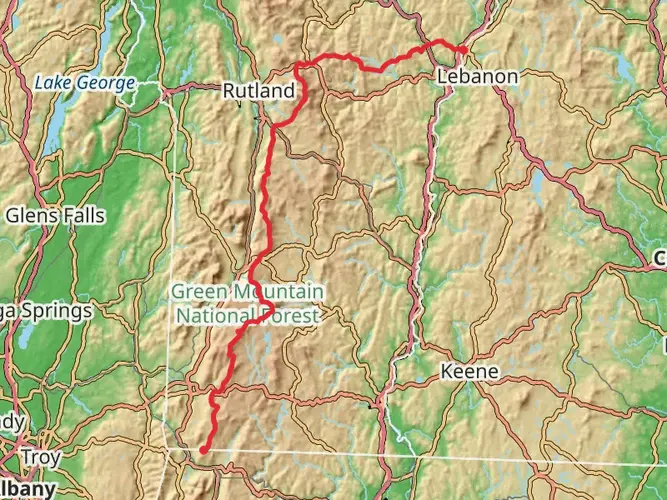
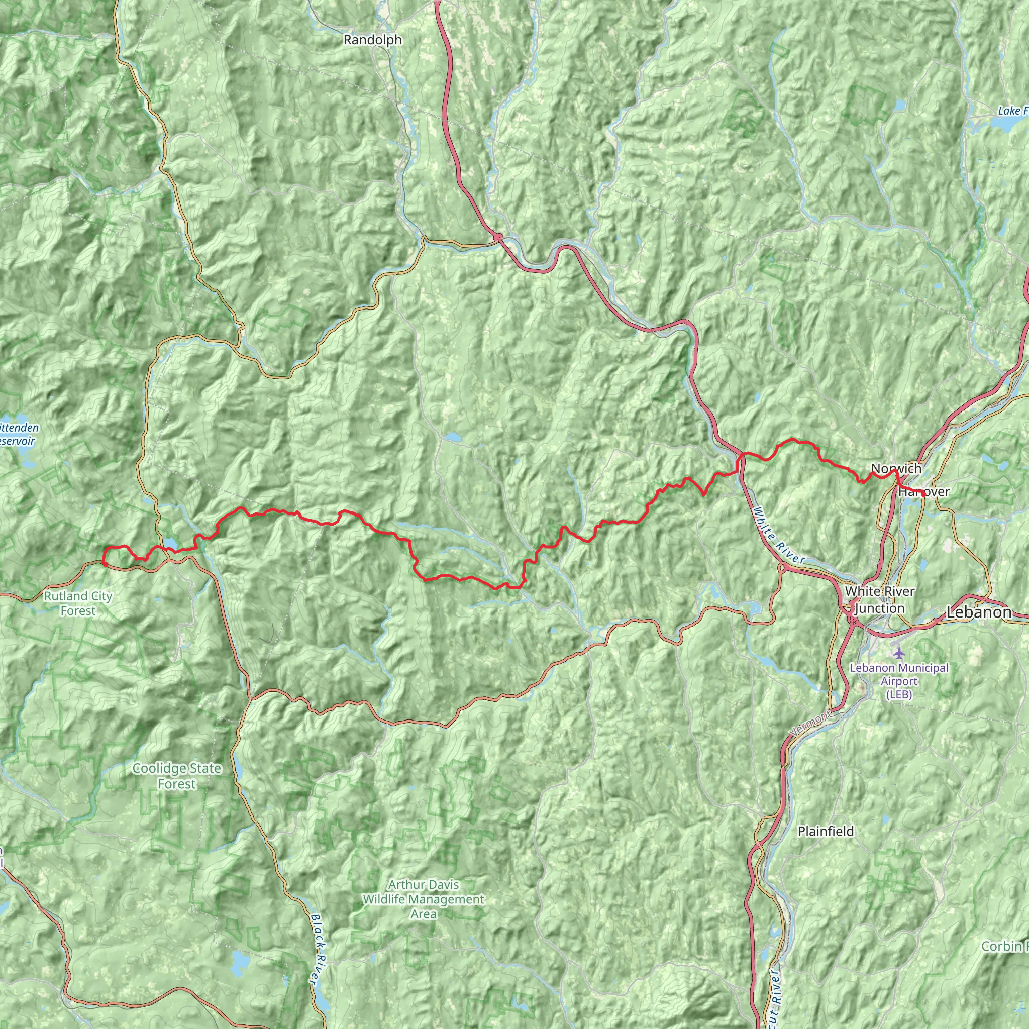
Embarking on the Appalachian Trail Section Hike from Sherburne Pass to Dartmouth offers an immersive experience through the Green Mountains of Vermont, leading into the picturesque landscapes of New Hampshire. This approximately 72-kilometer (45-mile) trek is a challenging adventure, with an elevation gain of roughly 2800 meters (9186 feet), and is best suited for experienced hikers who are well-prepared for the rigors of a difficult trail.
Getting to the Trailhead
The journey begins near Rutland County, Vermont, at Sherburne Pass. For those arriving by car, the trailhead is accessible via US Route 4, which is a main artery through the region. Parking is available near the Inn at Long Trail, a well-known landmark for hikers. If you're using public transportation, Rutland operates a bus service that can get you close to the trailhead, but you may need to arrange a taxi or rideshare for the final leg of the journey.
Navigating the Trail
As you set out from Sherburne Pass, the trail meanders through dense forests, opening up to sweeping views of the surrounding mountains. The use of a reliable navigation tool like HiiKER will be invaluable for staying on course and tracking your progress. The trail is well-marked with the iconic white blazes, but having a digital map can help with planning your stops and overnight camps.
Landmarks and Scenery
One of the first significant landmarks you'll encounter is the Pico Peak, which stands at an elevation of 1,204 meters (3,950 feet). The ascent offers a vigorous start to the hike, with rewarding vistas from the summit. As you continue, you'll traverse through varying landscapes, including lush valleys, serene streams, and rugged ridgelines.
Wildlife and Nature
The region is rich in biodiversity, with a chance to spot wildlife such as white-tailed deer, moose, and black bears. Birdwatchers may also catch glimpses of species like the peregrine falcon and the common loon. The trail cuts through a mix of hardwood and coniferous forests, with opportunities to see a variety of plant life, including wildflowers in the spring and a spectacular display of fall foliage.
Historical Significance
The Appalachian Trail itself is steeped in history, being one of the longest continuously marked footpaths in the world. The section between Sherburne Pass and Dartmouth crosses areas that were once traversed by Native Americans and early European settlers. The trail also passes near historical sites, such as old logging roads and stone foundations, remnants of Vermont's early industries.
Preparation and Planning
Given the trail's difficulty, it's crucial to prepare adequately. Ensure you have a sturdy pair of hiking boots, a map and compass (supplemented by HiiKER for digital navigation), and bear-proof containers for food storage. Weather can be unpredictable, so pack layers of clothing and be ready for sudden changes in temperature and precipitation.
Conclusion
This section of the Appalachian Trail offers a rich tapestry of natural beauty, wildlife, and history. It's a challenging but rewarding experience that requires careful planning and respect for the rugged terrain. With the right preparation and a spirit of adventure, hikers will find this trail to be a memorable journey through the heart of New England's wilderness.
AI Planner
Days planned around your pace, with somewhere to stay each night.
What to expect?
Activity types
Frequently asked questions
How long does the Appalachian Trail Section Hike - Sherburne Pass to Dartmouth usually take?
The Appalachian Trail Section Hike - Sherburne Pass to Dartmouth covers 71.54 km, or about 44.5 miles, with 2,822 m of climbing. Most hikers break a route of this length and difficulty into 3 to 5 days, depending on pace, weather, pack weight, and how much time is spent at shelters or road crossings along the way.
Where do you park for the Appalachian Trail Section Hike - Sherburne Pass to Dartmouth?
The usual western start is at Sherburne Pass on US Route 4 near Killington. There is a large parking area at Sherburne Pass on the south side of Route 4, across from the Inn at Long Trail, and the Appalachian Trail crosses the road nearby, making it a practical place to begin a northbound section hike.
Is the Appalachian Trail Section Hike - Sherburne Pass to Dartmouth difficult?
Yes. The Appalachian Trail Section Hike - Sherburne Pass to Dartmouth is rated Difficult, and the numbers explain why: 71.54 km of distance with 2,822 m of elevation gain. That combination makes it a demanding multi-day route better suited to experienced hikers who are comfortable with long climbs, uneven tread, and back-to-back days on trail.
What are the main landmarks on the Appalachian Trail Section Hike - Sherburne Pass to Dartmouth?
One of the first major landmarks from Sherburne Pass is Pico Peak, reached by a short spur from the Appalachian Trail. Farther north, the route trends toward the Upper Valley and finishes in Hanover, home to Dartmouth College, so this section combines Green Mountain ridgelines, forested Vermont terrain, and a well-known Appalachian Trail town at the eastern end.
Can you do the Appalachian Trail Section Hike - Sherburne Pass to Dartmouth with a dog?
Dogs are generally allowed on much of this route, but control rules matter and conditions can be tough on paws and joints. This is a 71.54 km difficult section with 2,822 m of ascent, so even where dogs are permitted, the length, rough footing, and repeated climbs mean it is best suited only to trail-hardened dogs that handle multi-day mountain travel well.
Is the Appalachian Trail Section Hike - Sherburne Pass to Dartmouth well marked?
Yes. This route follows the Appalachian Trail, which is normally marked with the standard white blazes used along the AT. In Vermont, the Appalachian Trail is maintained by the Green Mountain Club, and the Sherburne Pass area is a recognized AT access point, so navigation is usually straightforward as long as attention is paid at road crossings, side trails, and shelter junctions.
What is the best time of year to hike the Appalachian Trail Section Hike - Sherburne Pass to Dartmouth?
The most reliable season for the Appalachian Trail Section Hike - Sherburne Pass to Dartmouth is late spring through fall, when snow and ice are less likely to complicate travel. Because the route starts in the Killington area and crosses mountain terrain for 71.54 km, mud season in spring and colder, shorter days in late fall can make an already difficult section significantly harder.
Comments and Reviews
User comments, reviews and discussions about the Appalachian Trail Section Hike - Sherburne Pass to Dartmouth, Vermont.
4.45
average rating out of 5
290 rating(s)