
Download
3D Flyover
Add to list
More
4.9 km
~1 hrs 47 min
481 m
Out and Back
“A fierce forest climb bursts into wind-whipped summit views, rewarding prepared hikers with wild northern drama.”
This is a short but demanding summit hike in northern Vermont that climbs Jay Peak by following a section of the Vermont Long Trail. At roughly 5 km / 3.1 miles round trip with about 500 m / 1,640 ft of elevation gain, it packs a lot of steep climbing into a relatively compact outing. Hikers should expect a route that feels much tougher than the mileage suggests, with sustained uphill travel, rocky footing, wet sections after rain, and exposed upper-mountain terrain near the summit. For strong hikers it can be a rewarding half-day objective; for less experienced hikers, the grade and footing can make it feel like a full-value mountain day.
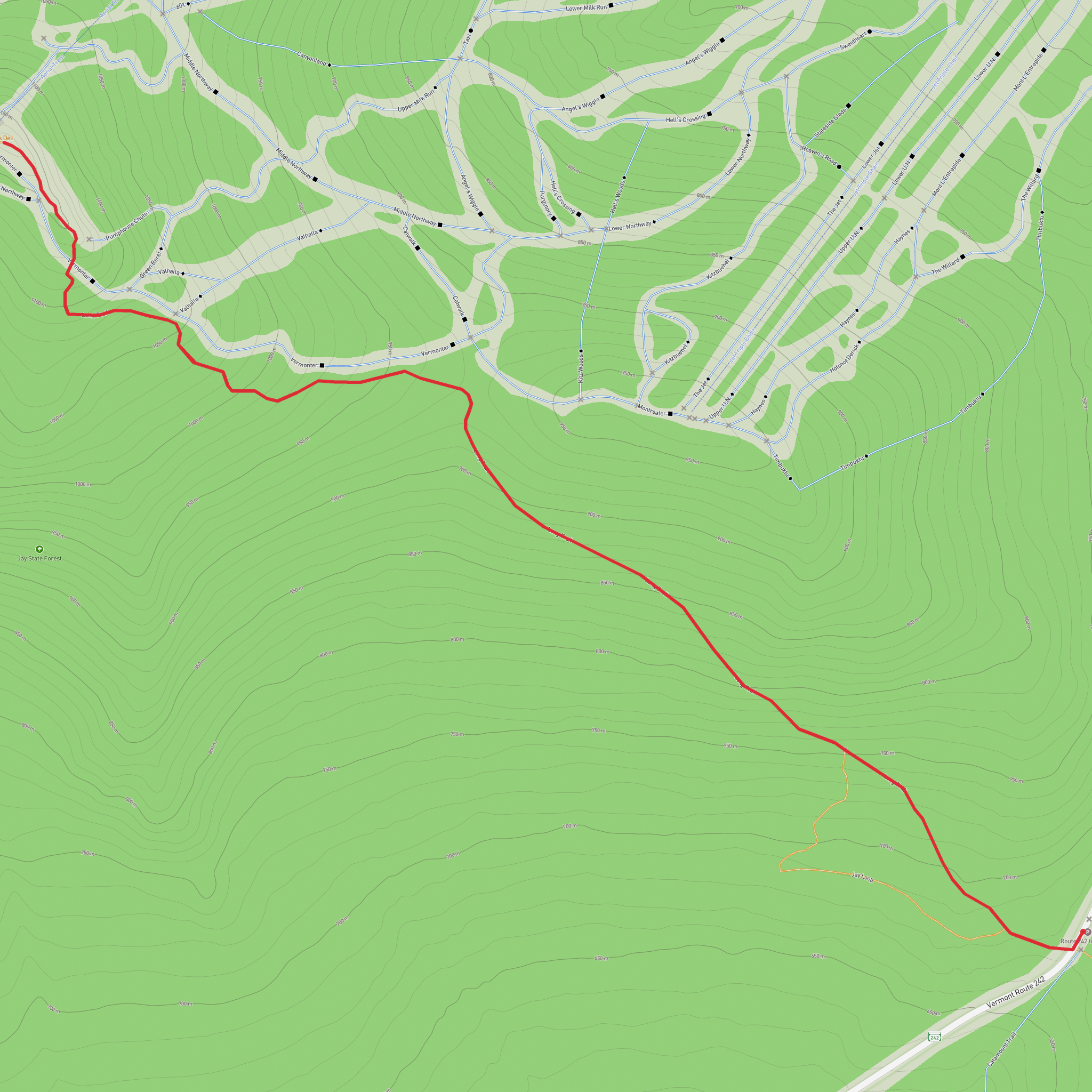
The hike begins near Jay Pass on Vermont Route 242, west of Jay Peak Resort and close to the Long Trail crossing at the pass. If coordinates are being used for planning, the practical landmark to look for is the Long Trail trailhead near Jay Pass on VT-242, in the Jay / Westfield area of northern Vermont, not far from the Canadian border. By car, the usual approach is via VT-242, which connects the area with Montgomery Center and the resort side of Jay Peak. Parking is typically associated with the roadside trail access near the pass, so hikers should arrive prepared for a relatively simple mountain trailhead rather than a developed visitor facility.
Public transport in this part of the Northeast Kingdom is limited. Most hikers reach the trailhead by car, either from Montgomery, Newport, or the Burlington area. Anyone attempting a transit-based approach should expect to combine regional bus service to a nearby town with a taxi or rideshare for the final stretch, and should verify options well in advance because service can be sparse and seasonal. For driving navigation and route planning on foot, HiiKER is the best tool to use for confirming the trail line, junctions, and elevation profile before setting out.
Route character and climb
From the trailhead, the route joins the Long Trail and starts climbing almost immediately through dense northern hardwood and boreal forest. The lower section often feels enclosed and rooty, with a steady grade that quickly establishes the difficulty of the hike. Even though the total distance is modest, the climb is concentrated, so there are few truly easy stretches. Early on, hikers can expect packed earth mixed with rocks, roots, and occasional muddy patches, especially in wetter months or after storms.
As the trail gains height, the forest begins to shift. Hardwood species give way to darker, tighter spruce-fir woods, and the air often feels cooler and damper. This upper forest can hold moisture, making rocks and exposed roots slick. In shoulder seasons, lingering snow, ice, or rime can remain higher up long after lower elevations have thawed. That is one of the main reasons this route earns a difficult rating despite its short length: footing and weather can change quickly with elevation.
The final approach to the summit is the most dramatic part of the hike. The trees thin, views begin to open, and the route reaches more exposed terrain where wind can be a serious factor. Jay Peak is well known for harsh weather, and even on a mild day elsewhere in Vermont, the summit area can be cold, foggy, and gusty. Low cloud can reduce visibility significantly, so hikers should not assume the short mileage removes the need for proper layers and navigation awareness.
Landmarks and views
One of the main attractions of this hike is how quickly it transitions from enclosed forest to broad summit scenery. Near the top, hikers are rewarded with expansive views across northern Vermont, the Green Mountains, and into Quebec on clear days. The summit area has a distinctly alpine feel compared with the wooded lower slopes, and the contrast between the sheltered climb and the open upper mountain is one of the route’s defining features.
Because Jay Peak is also a ski mountain, hikers may notice signs of nearby developed summit infrastructure depending on the exact line taken and visibility conditions. Even so, the Long Trail approach still offers a strong sense of mountain travel, especially in poor weather or when the forest is quiet and the upper slopes are wrapped in cloud. The surrounding ridgelines and valleys give a good sense of how isolated this corner of Vermont can feel compared with more central parts of the state.
Terrain, hazards, and preparation
The biggest thing to prepare for is steepness relative to distance. A 5 km / 3.1 mile hike with 500 m / 1,640 ft of ascent means the route climbs hard for much of the outing. Trekking poles can help on both ascent and descent, especially where the trail is rocky or damp. Good footwear matters here more than on smoother valley trails; shoes or boots with reliable grip are strongly recommended.
Weather is the other major consideration. Jay Peak has a reputation for wind, cloud, and rapidly changing conditions. Hikers should carry an extra insulating layer and waterproof shell even if the forecast looks favorable at lower elevations. In fog, the upper mountain can feel disorienting, and exposed sections become much more serious when visibility drops. Checking the route on HiiKER before departure is a smart way to understand where the steepest sections and any junctions lie.
In wet weather, mud and slick rock can slow progress considerably. In colder months, microspikes may be necessary, and in winter conditions this becomes a much more serious mountain outing than the distance suggests. Lightning is also a concern on exposed upper slopes, so if thunderstorms are possible, this is not a route to underestimate.
Nature and wildlife
This hike passes through classic northern New England mountain habitat. Lower down, hikers move through mixed forest that may include maple, birch, and beech, while higher elevations transition into spruce-fir forest more typical of colder, windier environments. Mosses, ferns, and moisture-loving understory plants are common along shaded sections of trail, especially where drainage crosses the path.
Surfaces
Dirt
Unknown
Asphalt
Comments and Reviews
User comments, reviews and discussions about the Jay Peak via Vermont Long Trail, Vermont.
average rating out of 5
0 rating(s)
