Belvidere Mountain via Forester's Trail, Long Trail and Frank Post Trail
Download
3D Flyover
Add to list
More
11.7 km
~3 hrs 24 min
647 m
Loop
“A rugged Vermont loop through ferny woods and spruce ridges, crowned by sweeping fire-tower views.”
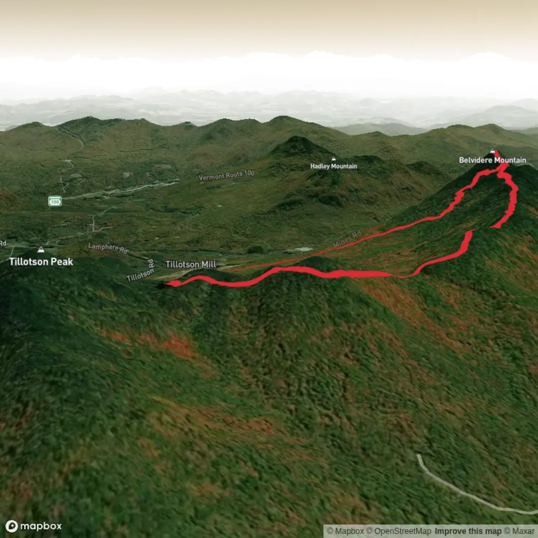
This roughly 12 km / 7.5 mile loop on Belvidere Mountain is a strong intermediate day hike that feels more rugged than the numbers alone suggest. With about 600–665 m / 1,970–2,175 ft of climbing, it combines old woods roads, brook crossings, steeper mountain grades, a stretch of Vermont’s famous Long Trail, and a final push to a summit fire tower with wide northern Green Mountain views. The route is usually described as a loop using the Frank Post Trail, Long Trail, and Forester’s Trail, starting from the Frank Post trailhead at the end of Tillotson Road near Lowell, Vermont. Trail sources place the parking at the very end of Tillotson Road, reached from Mines Road between Lowell and Eden Mills. (trailfinder.info)
For drivers, the most useful landmark is the Frank Post Trailhead parking area at the end of Tillotson Road, Lowell, Vermont, accessed either from VT-58 in Lowell via Mines Road or from VT-100 in Eden Mills via North Road/Mines Road. The final approach is on gravel, and this is the practical destination to plug into a navigation app rather than just “Belvidere Mountain.” Public transport is very limited in this part of northern Vermont; there is no dependable trailhead transit service, so most hikers should plan on arriving by car or arranging a drop-off from Lowell, Eden, or the Morrisville/Johnson area. (trailfinder.info)
The usual loop begins gently enough on the Frank Post Trail, where the first 1 km / 0.6 mile follows and crosses old logging roads before the junction with the Forester’s Trail. If hiking clockwise, staying on Frank Post gives a steadier build-up before the steeper climb to Tillotson Camp and the Long Trail. This lower section is classic northern Vermont forest: mixed hardwoods, ferny understory in season, damp ground after rain, and a few muddy or rooty stretches that can slow the pace. The grade becomes more serious after about 2.5 km / 1.6 miles, where the trail climbs more sharply toward the Long Trail junction. (trailfinder.info)
What the climb feels like
Once on the Long Trail, the character changes. This is one of the oldest long-distance footpaths in the United States, and on Belvidere it delivers the kind of terrain hikers expect from Vermont ridge travel: steeper pitches, ledges, rough tread, and a more enclosed spruce-fir feel as elevation increases. Trail descriptions note a crossing of Frying Pan Brook on the southern approach and steeper grades over ledges near Belvidere Saddle; on the loop from Frank Post, hikers still encounter that same upper-mountain terrain around the saddle and summit spur. Expect the footing to be uneven rather than technical, with wet rock and slick roots becoming the main hazards in damp weather. (trailfinder.info)
From Belvidere Saddle, the summit is close—only about 0.3 km / 0.2 mile farther—but it is still uphill enough to feel earned. The summit itself sits at about 1,024 m / 3,360 ft, and the standout landmark is the fire tower, maintained by the Green Mountain Club. From the tower, views can extend south toward Camel’s Hump, north toward Jay Peak and Big Jay, east toward the White Mountains, and even into Quebec on a clear day. This is the visual payoff of the hike and the reason many hikers choose Belvidere over other medium-length loops in the region. (trailfinder.info)
Landmarks, nature, and wildlife
The route passes through a mix of hardwood and boreal forest, with the upper mountain shifting into the darker, cooler spruce-fir zone that is typical of higher elevations in northern Vermont. Around the ridge and saddle, the forest can feel dense and wind-shaped, while lower down the old roadbeds and brook corridors create more open patches. Birders often rate the area well, and hikers may hear or spot thrushes, warblers, ravens, and woodpeckers depending on season. Larger wildlife in the broader region includes black bear, moose, white-tailed deer, and smaller mammals common to the Green Mountains, though sightings are never guaranteed.

Surfaces
Unknown
Dirt
Comments and Reviews
User comments, reviews and discussions about the Belvidere Mountain via Forester's Trail, Long Trail and Frank Post Trail, Vermont.
average rating out of 5
0 rating(s)