
Download
3D Flyover
Add to list
More
6.6 km
~2 hrs 2 min
431 m
Out and Back
“A punchy forest climb rewards prepared hikers with fire-tower panoramas and a wonderfully wild summit feel.”
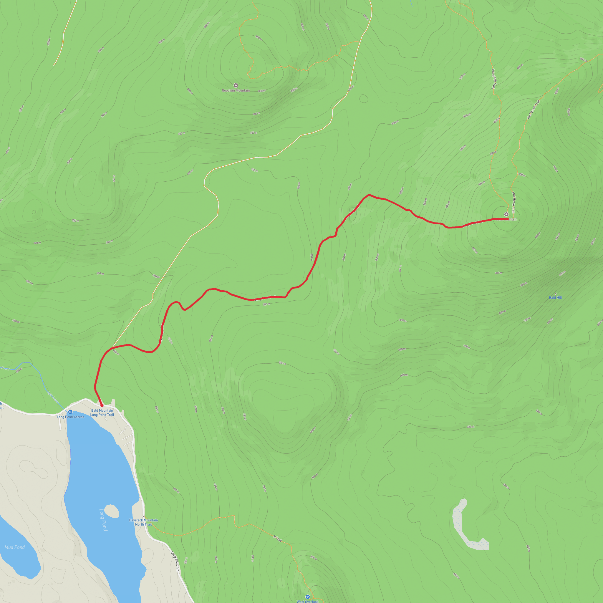
This short but steep climb on Bald Mountain’s Long Pond Trail packs a lot into roughly 7 km / 4.3 miles round trip, with about 400 m / 1,300 ft of elevation gain. Although the mileage is modest, the route earns its difficult rating because most of the climbing is concentrated into a relatively short ascent, and the upper mountain becomes noticeably steeper, rougher, and wetter in places. The trail rises to the summit of Bald Mountain above Westmore in Vermont’s Northeast Kingdom, where a restored historic fire tower opens up one of the broadest views in the region. From the top, hikers can expect sweeping sightlines over Lake Willoughby, Long Pond, Seymour Lake, Lake Memphremagog, parts of the Green Mountains, and even the White Mountains on a clear day. (trailfinder.info)
The hike begins near the Long Pond fishing access area on Long Pond Road, Westmore, Vermont, with the trailhead located about 350 ft / 107 m east of that access point. Parking is on the left side of Long Pond Road when approaching from VT-5A. This is the nearest clear landmark and the most practical place to navigate to. By car, the standard approach is from Lyndonville: follow US-5 north for about 6.7 miles / 10.8 km, turn onto VT-5A north for about 9.9 miles / 15.9 km, then turn right onto Long Pond Road and continue about 2.1 miles / 3.4 km to the parking area. Public transport in this part of the Northeast Kingdom is very limited, so most hikers should plan on driving or arranging a drop-off; if using transit at all, the realistic option is to reach the broader Lyndonville or Orleans area first and then continue by taxi or pre-arranged ride. (trailfinder.info)
What the route is like
From the parking area, the trail starts on a gated logging road and follows blue blazes. Early on, the grade is moderate rather than immediately punishing, which can make the opening section feel deceptively manageable. After a junction, the route bears right and climbs toward an open log landing. This clearing is one of the first places where the landscape opens slightly and gives a sense of the mountain’s working-forest history. Beyond that, the trail turns back into the woods and follows an older woods road and footpath through open hardwood forest. Small stream crossings appear along the way, and these can be slick after rain or during spring runoff. (trailfinder.info)
As the climb continues, the forest shifts from lower-elevation hardwoods into a darker, tighter subalpine spruce-fir zone. That transition is one of the most distinctive features of the hike: the woods become cooler, the footing often rougher, and the trail begins to feel more enclosed and mountain-like. The upper section contains the steepest pitches of the route, along with rock outcrops and wet spots that can slow progress. Even though some sources list the Long Pond Trail itself at about 2.0 to 2.1 miles / 3.2 to 3.4 km one way, the climb is sustained enough that many hikers will want to budget around 2 to 2.5 hours for the ascent, especially in damp conditions. (trailfinder.info)
Landmarks, views, and terrain to expect
The summit is the defining landmark. Bald Mountain’s top is heavily wooded, so the restored fire tower is what transforms the finish into a major viewpoint. Without it, the summit would be far more enclosed; with it, the mountain becomes one of the standout panorama hikes in the Northeast Kingdom. There is also a restored shelter near the summit, adding a bit of historic character to the mountaintop area. The final approach passes large rock outcroppings before emerging at the top, and those upper ledges can be slippery in wet weather or coated with ice in shoulder seasons. (trailfinder.info)
The trail surface varies from gravelly old roadbed to dirt, roots, rock, and occasional muddy patches. Because the route uses old logging roads and woods trails for parts of the ascent, it is worth paying attention at junctions and open areas where the tread can feel less obvious than on a narrow single
Comments and Reviews
User comments, reviews and discussions about the Bald Mountain via Long Pond Trail, Vermont.
average rating out of 5
0 rating(s)
