Download
3D Flyover
Add to list
More
5.0 km
~1 hrs 45 min
459 m
Out and Back
“A short, fiery forest climb ends on airy ledges with sweeping Stowe views and real bite.”
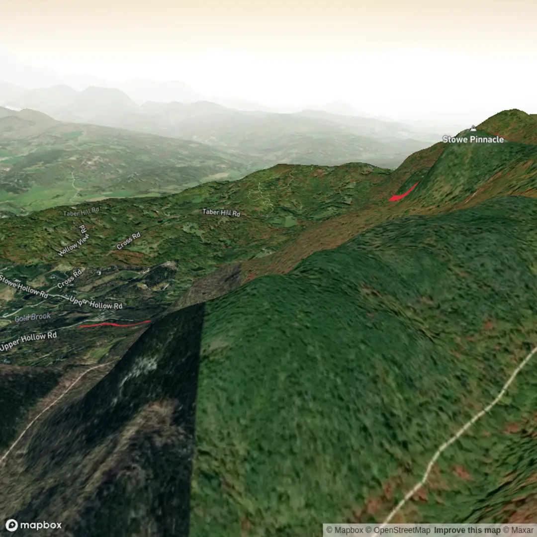
This short but punchy climb in Stowe, Vermont packs a lot into roughly 5 km / 3.1 mi, gaining about 500 m / 1,640 ft. Most hikers use the Upper Hollow Road approach, which is about 5.8 km / 3.6 mi round trip with roughly 463 m / 1,520 ft of ascent, while the Pinnacle Meadows approach is shorter at about 4.2 km / 2.6 mi round trip and starts higher up. Both routes lead to the same exposed summit ledges on Stowe Pinnacle, one of the best-known viewpoints in the area. (gostowe.com)
The usual trailhead is on Upper Hollow Road, Stowe, VT 05672, a short drive east of Stowe village. If you are converting the hike head to a practical starting point, the nearest significant landmark is Stowe village / the historic village center, from which the trailhead is reached by following School Street to Stowe Hollow Road and then Upper Hollow Road. A second access point is the Pinnacle Meadows parking area off Pinnacle Heights Road / Upper Pinnacle Road, which trims off some distance and elevation. (gostowe.com)
By car, the approach is straightforward from downtown Stowe: head out via School Street, bear onto Stowe Hollow Road, then continue onto Upper Hollow Road to the signed parking area on the left. For the shorter option, turn left just before the main trailhead onto Pinnacle Road, continue onto Upper Pinnacle Road, then follow the marked road to the Pinnacle Meadow gate and lot. Parking is limited, so early starts are wise on weekends and during peak foliage. The main lot is noted as plowed in winter, which makes this a year-round objective when conditions allow. (trailfinder.info)
Public transport is much less direct. Stowe has seasonal and regional transit service through local bus operators serving the village and Mountain Road corridor, but there is no standard bus stop at the trailhead itself, so most hikers using transit should expect to ride into Stowe village and then arrange a taxi, rideshare, or a substantial road walk to the start. Current town planning documents note transit service in Stowe through Green Mountain Transit and Rural Community Transportation, with the Mountain Road Shuttle focused on the main visitor corridor rather than Upper Hollow Road. (stowevt.gov)
What the climb is like
From Upper Hollow Road, the trail begins gently enough, warming up on easier grades before steepening into a more sustained forest climb. After about 0.8 km / 0.5 mi, the route starts to feel more like classic northern Vermont hiking: roots, rocks, short step-ups, and sections that climb like a natural staircase. Around halfway up, there is an overlook spur with westward views toward Mount Mansfield, giving an early reward before the final push. Higher up, the trail reaches the Hogback junction, eases briefly, then continues through thinner forest to the open summit rock. (trailfinder.info)
If you start from Pinnacle Meadows, the first section follows an old fire road to an open clearing known as Pinnacle Meadow. This approach is a little easier at first and gives broad valley views before the route narrows into a more rugged footpath with rocky inclines and rooty steps. It joins the main Stowe Pinnacle Trail below the scenic overlook, so the upper mountain experience is essentially the same from either direction. (gostowe.com)
The final approach to the viewpoint is the part that often surprises people. Near the top, the trail steepens again and reaches a set of stairs and rock ledges. In dry weather this is simply hands-on, careful hiking; in rain, frost, or shoulder-season ice, it becomes much more serious. The summit itself is a bald rock outcrop rather than a broad wooded top, so footing, wind exposure, and crowding all deserve attention. This is why a 5 km outing can still feel genuinely difficult. (gostowe.com)
###

Surfaces
Dirt
Unknown
Comments and Reviews
User comments, reviews and discussions about the Stowe Pinnacle Trail, Vermont.
average rating out of 5
0 rating(s)