Download
3D Flyover
Add to list
More
4.8 km
~1 hrs 28 min
311 m
Out and Back
“A punchy forest climb culminating in rugged ledges and sweeping Northeast Kingdom views.”
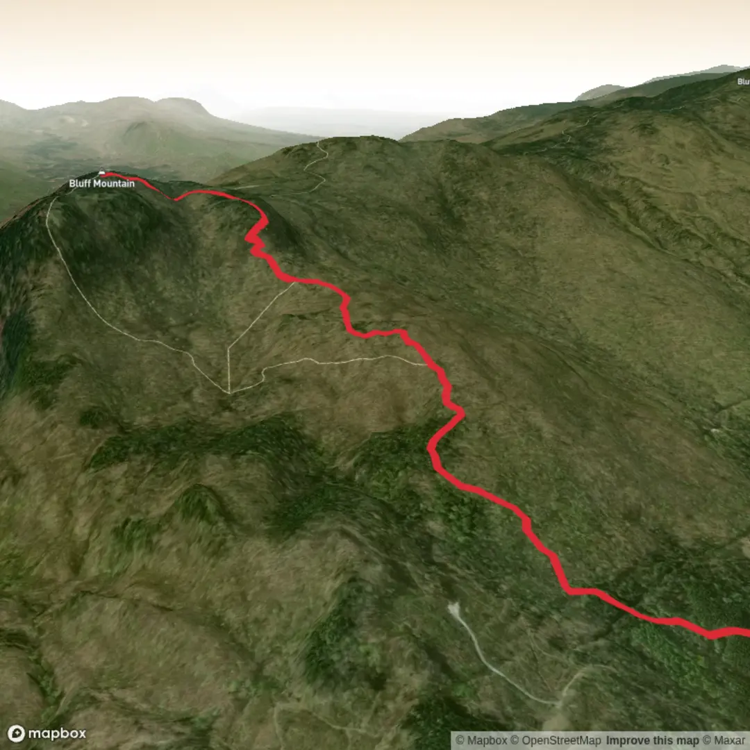
This roughly 5 km (about 3.1 mi) hike above Island Pond is a short route on paper, but it packs in a sustained climb, rocky footing, and a few steeper sections that make the outing feel more serious than the mileage suggests. If you use the longer loop variation that includes the lookout, expect closer to 7.7 km (4.8 mi) with about 458 m (1,502 ft) of elevation gain; the shorter out-and-back or more direct version is often described at around 4.2 km (2.6 mi). Either way, the character of the hike is the same: a steady uphill through forest, then a rougher, more rugged upper mountain section with ledges, stone steps, and broad views over the Northeast Kingdom. (trailfinder.info)
The trailhead is on Mountain Street in Island Pond, Vermont, in the town of Brighton. Driving directions commonly begin from central Island Pond via VT-105/East Brighton Road, then Curran Avenue, then Mountain Street, where a small parking area sits near the start after the road turns to dirt. A practical landmark for navigation is the Mountain Street parking area above the village of Island Pond rather than a formal street-numbered trailhead. Parking is limited, so arriving early is wise on busy fall weekends. (trailfinder.info)
For hikers arriving without a car, Island Pond is the nearest service center, but public transport is limited in this part of Vermont. There is historic rail infrastructure in Island Pond, yet regular modern transit options are sparse compared with larger Vermont towns, so most hikers should plan on driving or arranging a drop-off from the village. If you are piecing together a trip by transit, it is best to get as close as possible to Island Pond first and then use a local taxi, rideshare if available, or a pre-arranged shuttle; for on-trail navigation and route planning, HiiKER is the best tool to check before setting out. (en.wikipedia.org)
What the climb is like
From the start, the route heads into a red pine plantation before transitioning into mixed hardwood forest. The lower trail is usually straightforward but climbs consistently, so even strong hikers will notice the grade early. As you gain height, the path threads across small ridges and rock outcrops, then reaches junctions with the historic Lookout Trail. Higher up, the route steepens with switchbacks and stone steps, and footing becomes more uneven underfoot. (trailfinder.info)
That upper section is where the hike earns its difficult rating. The trail can be rooty, rocky, and slick after rain, and the route to the lookout includes a short steep scramble with metal handholds fixed into the rock. That feature is manageable for many hikers in dry conditions, but it is not ideal for anyone uncomfortable with exposure, wet rock, or using hands to climb. Good traction matters here, and this is not a trail for casual sneakers if conditions are damp. (trailfinder.info)
If you are planning around effort, a useful expectation is that the first half is mostly about climbing through forest with only occasional openings, while the upper mountain delivers the payoff. The route is short enough for a half-day outing, but the grade and terrain can make it feel much bigger than its distance suggests. In shoulder seasons, lingering ice or mud can add difficulty well beyond what the mileage implies. (alltrails.com)
Views, landmarks, and terrain
One of the main highlights is the overlook and summit ridge, where views open toward Island Pond, Burke Mountain, East Mountain, and smaller surrounding peaks. Lower down, the trail passes boulders, small ledges, and seasonal streams; higher up, the ridge walking gives a more open feel and occasional glimpses across the Nulhegan Basin. The lookout itself is the standout landmark, with a clifftop perch that feels much more dramatic than you might expect from a relatively short community trail. (trailfinder.info)
The terrain changes enough to keep the hike interesting. Packed dirt and forest duff dominate the lower trail, while the upper mountain introduces rock ledge, stair

Surfaces
Ground
Unknown
Comments and Reviews
User comments, reviews and discussions about the Bluff Mountain Community Trail, Vermont.
average rating out of 5
0 rating(s)