
Download
3D Flyover
Add to list
More
8.2 km
~2 hrs 39 min
609 m
Out and Back
“A rugged forest climb unfolds to Stark’s Nest, trading quiet sugarbush woods for airy ridgeline drama.”
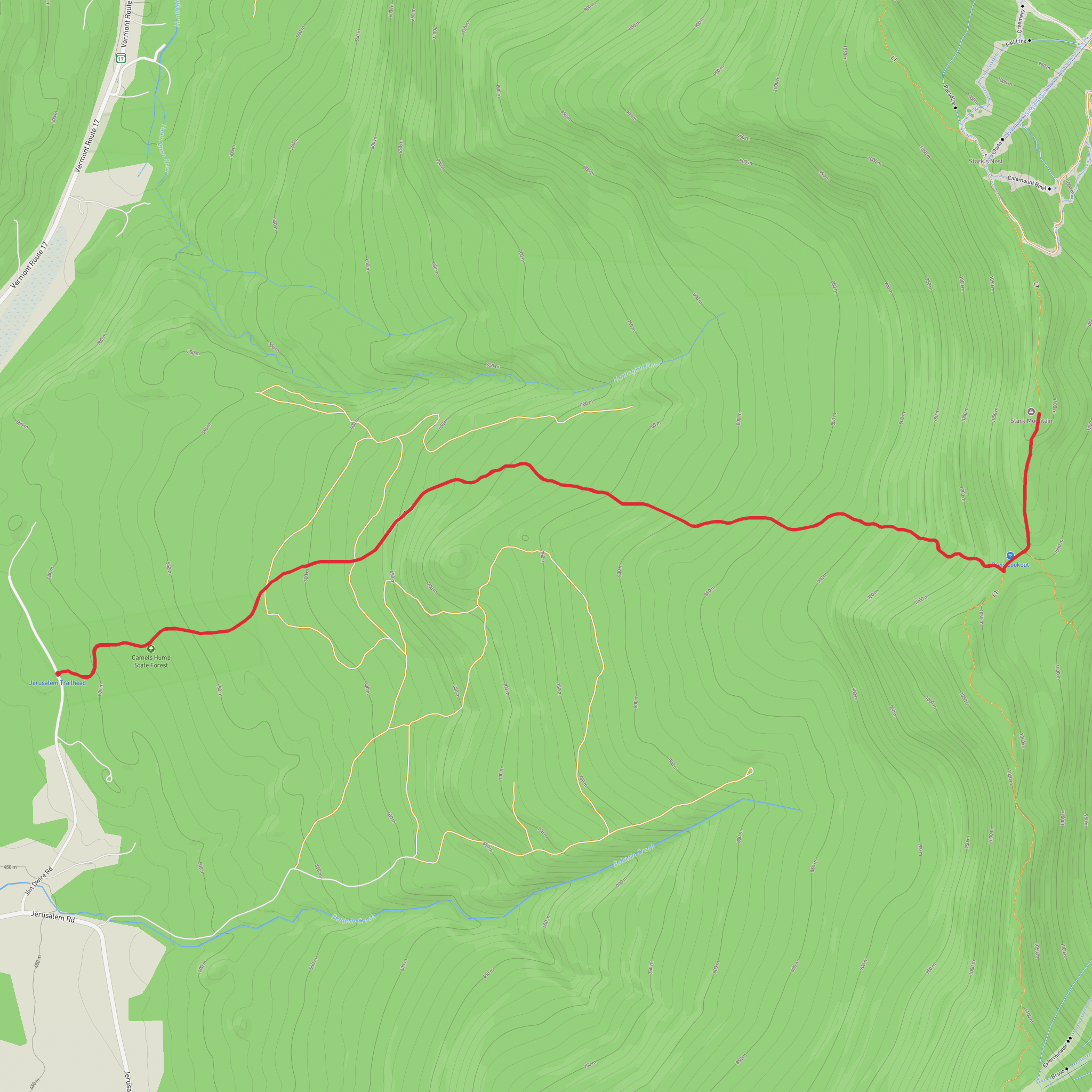
This difficult out-and-back climbs to Stark Mountain from the west side of the Green Mountains on the Jerusalem Trail, packing roughly 8 km / 5 mi to 10 km / 6.2 mi of hiking, depending on exactly where you turn around, with about 600 m / 1,970 ft to 665 m / 2,180 ft of elevation gain. The route starts low in the woods near Jerusalem in Lincoln, Vermont, then works steadily uphill to the Long Trail before turning north toward Stark Mountain and Stark’s Nest, a well-known warming hut perched near the ridgeline. The overall feel is a sustained mountain climb rather than a casual woodland walk: expect a long ascent, rooty and rocky footing, and a noticeably steeper second half once the trail begins to bite into the slope. (alltrails.com)
The usual starting point is the Jerusalem Trail parking area on Jim Dwire Road, Lincoln, Vermont, reached from VT-17 near the Jerusalem Country Store. From Lincoln village, head north on Quaker Street to VT-17, turn right, then turn onto Jerusalem Road and continue to Jim Dwire Road; the dirt parking area is about 0.5 mi / 0.8 km down Jim Dwire Road on the right. TrailFinder also notes that parking is limited and roadside space should be used considerately. (greenmountainclub.org)
For hikers arriving without a car, public transport is limited in this part of rural Vermont. The practical approach is usually to travel to the Mad River Valley or Bristol/Lincoln area by regional bus where available, then arrange a taxi or rideshare for the final road section to Jerusalem Road and Jim Dwire Road. Because service can be sparse and seasonal, it is wise to confirm schedules in advance and plan for a car-based start if possible. This is not a trailhead with frequent direct transit access.
What the climb is like
From the parking area, the Jerusalem Trail begins with a forested ascent through an active sugarbush. Early on, you may cross ATV tracks and notice maple sap tubing, so paying attention to the blue blazes matters. This lower section can feel deceptively moderate, but the grade builds as you continue, and by the time you near the Long Trail junction the climb has become a proper workout. Green Mountain Club guidance places the junction about 2.4 mi / 3.9 km from the trailhead. (greenmountainclub.org)
Once you meet the Long Trail, turn north. From there, the character changes from a straightforward approach trail to a rougher ridgeline route with more rocks, wetter spots after rain, and short, punchy climbs. Green Mountain Club guidance for Stark’s Nest from this side describes another 0.72 mi / 1.2 km to the Stark’s Nest Trail junction, then about 600 ft / 180 m farther to the hut. That makes the full outing longer than the “around 8 km” estimate if you continue all the way to Stark’s Nest, so hikers should check the exact route in HiiKER before setting out and decide whether they are aiming for the mountain area broadly, the hut, or a shorter turnaround point. (greenmountainclub.org)
Terrain, effort, and navigation
Although the mileage is moderate, the effort level is firmly difficult because the elevation gain is concentrated and the footing is often uneven. Expect mud in shoulder seasons, slick roots after rain, and rough tread typical of Vermont mountain trails. In cooler months, snow and ice can linger high on the ridge; recent hiker reports on this route have noted deep snow well into late winter and early spring conditions. (alltrails.com)
Navigation is generally straightforward in good visibility if you stay alert at the Long Trail junction and follow blazes carefully, but this is not a route to underestimate in fog, fresh snow, or leaf-covered autumn tread. Carry the route in HiiKER, and do not rely on cell service for navigation or emergency communication.
Landmarks and views
The most memorable landmark on this hike is Stark’s Nest, a historic warming hut near the summit area. It sits beside the upper mountain terrain associated with Mad River Glen and is one of the more distinctive shelters on this stretch of the Green Mountains. The approach also passes near ski runs once you are on the upper mountain, so the forested climb opens into broader views and a more exposed feel near the top.
Surfaces
Dirt
Unknown
Comments and Reviews
User comments, reviews and discussions about the Stark Mountain via Jerusalem Trail, Vermont.
average rating out of 5
0 rating(s)
