Download
3D Preview
Add to list
More
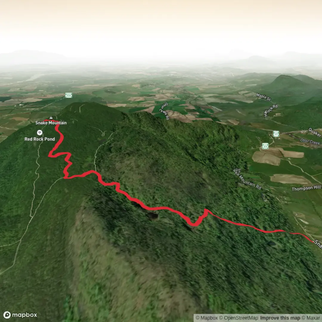
7.3 km
~1 hrs 57 min
305 m
Out and Back
“A steady woodland climb opens to sweeping valley-and-Adirondack views beside traces of Snake Mountain’s wild past.”
This roughly 7 km (4.3 mi) out-and-back route climbs Snake Mountain from the east side through the Snake Mountain Wildlife Management Area in Addison and Weybridge, Vermont, gaining about 300 metres (roughly 1,000 ft) on a steady forest ascent before reaching broad summit views over the Champlain Valley and across to the Adirondacks. Route listings for the East Trail and Summit Trail vary a little by platform, but most place it in the 6.8–7.2 km range with around 318 metres / 1,043 ft of elevation gain, which fits a solid medium outing for hikers comfortable with a sustained uphill walk. (gaiagps.com)
The eastern approach begins near Snake Mountain Road south of Thompson Hill Road, with the mapped access point closest to Snake Mountain Road, Weybridge/Addison, Vermont, within the Snake Mountain Wildlife Management Area. State mapping identifies parking and access from Snake Mountain Road, Mountain Road, and Mountain Road Extension, and the east-side route is the one most closely associated with the Snake Mountain Road approach. (anrmaps.vermont.gov)
For drivers, the simplest approach is from the Vergennes or Middlebury area, using local roads toward Snake Mountain Road and the signed wildlife management area access. Parking is typically at a small roadside trailhead rather than a full-service trail complex, so it is worth arriving early on fair-weather weekends. Public transport is limited in this rural part of Addison County; there is no practical bus-to-trailhead option for most hikers, so the realistic plan is to use a car or combine regional transit to Middlebury or Vergennes with a taxi or rideshare for the final stretch. That last point is an inference based on the rural location and the state access roads shown for the WMA rather than a dedicated transit stop at the trailhead. (anrmaps.vermont.gov)
What the hike is like
From the east-side start, the trail begins in lower forest on the mountain’s gentler flank, where the grade is usually moderate at first and then becomes more sustained as you work upward toward the ridge and summit junctions. Expect a classic woodland climb rather than exposed scrambling: dirt tread, roots, leaf litter, occasional rocks, and sections that can feel slick after rain or during spring thaw. The route is not especially long, but the climbing is concentrated enough that it feels more substantial than the distance alone suggests. (gaiagps.com)
As you gain height, the mountain’s character becomes more obvious. Snake Mountain rises abruptly from the surrounding farmland as an isolated upland block, topping out at about 1,287 ft (392 m). Because it stands apart from the higher Green Mountains, the summit rewards relatively modest effort with unusually expansive views for such a short hike. On a clear day, the main draw is the sweep west across the Champlain Valley toward Lake Champlain and the Adirondack Mountains. (anrmaps.vermont.gov)
Near the upper mountain, the Summit Trail links the final approach to the overlook area. This is where many hikers pause longest, both for the panorama and for the traces of the mountain’s earlier resort era. Some route descriptions refer to a “hotel overlook,” reflecting the historic summit development that once made this a destination for visitors arriving by carriage road. (gaiagps.com)
Landmarks, nature, and wildlife
Snake Mountain is more than a viewpoint. The mountain sits within a 1,215-acre wildlife management area managed by the Vermont Fish & Wildlife Department, and its ecological interest is unusually high because it forms an “island” of upland forest in the middle of the heavily farmed Champlain Valley. The forest here includes northern hardwoods, oak-hickory communities, hemlock stands, red cedar in old pasture areas, cliff and outcrop habitats, and a notable diversity of wildflowers and understory plants. (anrmaps.vermont.gov)
One of the most significant natural features on the mountain is Cranberry Bog, a fragile summit wetland estimated to be more than 9,500 years old, dating back to shortly after the last glacier retreated from Vermont. The bog supports sphagnum moss, pitcher plants, sundew, cotton-grass, bog rosemary, and other specialized plants. If your route or side paths bring you near wetland areas, stay strictly on durable surfaces and avoid stepping onto the bog mat, which is highly sensitive to damage

Surfaces
Unpaved
Unknown
Comments and Reviews
User comments, reviews and discussions about the Snake Mountain via E Trail and Summit Trail, Vermont.
average rating out of 5
0 rating(s)