
Download
3D Flyover
Add to list
More
6.0 km
~1 hrs 18 min
65 m
Loop
“A gentle ramble through lakeside woods and Revolutionary echoes, rich with views and layered history.”
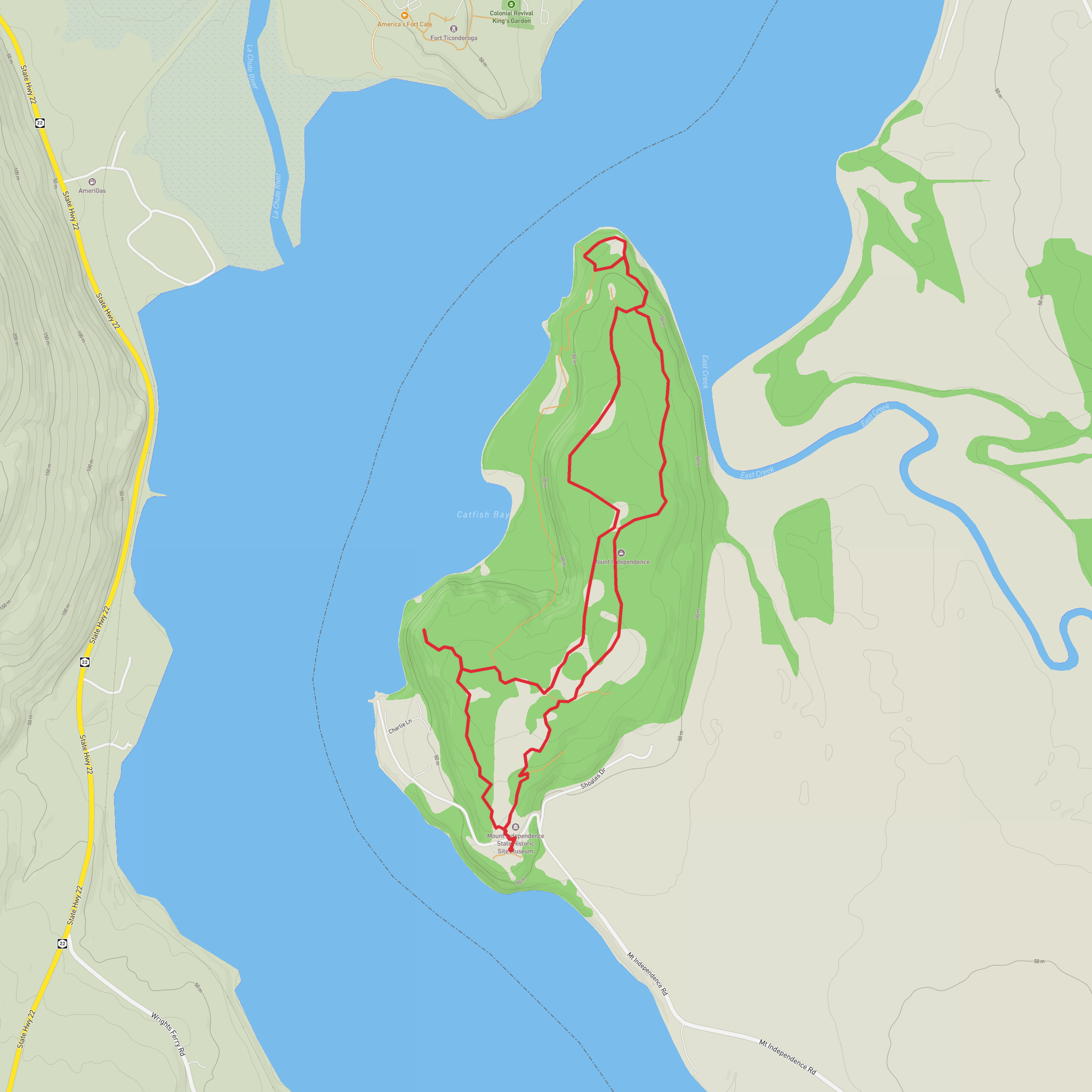
This easy walk at Mount Independence blends shoreline scenery, open woods, and one of the most important Revolutionary War landscapes in the Champlain Valley. Expect roughly 6 km / 3.7 miles overall with about 100 m / 330 ft of elevation gain, though the exact total can vary a little depending on whether you add short spurs or viewpoint detours. The route is generally gentle, with the climbing spread out rather than concentrated into one long ascent, making it a good option for families, casual walkers, and hikers who want history and views without a strenuous day out. The trail network begins near the museum and visitor area at Mount Independence State Historic Site, 497 Mount Independence Road, Orwell, Vermont. (trailfinder.info)
The Orange Trail is one of the longer and more interesting walks on the site. It branches from the Baldwin Trail and loops through a series of historic locations, including the star barracks area, masting point, crane foundation, artificers’ shops area, Horseshoe Battery, shore battery, bridge site, and an observation shelter. Because this is a historic site as much as a hike, the walk feels less like a remote backcountry trail and more like a moving tour through an archaeological landscape, with changing views over Lake Champlain and across to Fort Ticonderoga and Mount Defiance. (trailfinder.info)
Getting to the trailhead
By car, the simplest approach is via Orwell, Vermont. From VT-73, head onto Mount Independence Road and follow signs toward the state historic site. The parking area is beside the visitor center/museum complex at 497 Mount Independence Road. The final approach includes local roads and a gravel section, so drivers should expect a slower last few minutes, but standard passenger vehicles are generally fine in normal conditions. (trailfinder.info)
Public transport is very limited in this part of Addison County. There is no practical regular transit service directly to the trailhead, so most hikers should plan on driving or arranging a taxi/rideshare from a larger nearby town such as Middlebury or the Ticonderoga area. Because rural transport options can be inconsistent, it is wise to confirm current availability before setting out. This is an inference based on the site’s rural location and the absence of direct transit information in visitor materials. (trailfinder.info)
What the walk feels like
From the trailhead kiosk near the museum, the opening section is usually the easiest underfoot. The Baldwin Trail is wider and smoother, and the Orange Trail branches away from it into a more natural footpath. Once on the Orange Trail, expect a moderate walking surface rather than technical hiking: dirt, grass, occasional roots, some uneven ground, and potentially damp or swampy patches. One historical guide notes that parts of the route can be wet and may include boards or a small bridge to help hikers across softer ground. After rain, those sections can feel muddier than the overall easy rating suggests. (trailfinder.info)
The elevation gain is modest, but the route undulates enough to keep it interesting. Instead of a summit-style climb, the trail rises and falls across the peninsula, moving between wooded interior sections and more open historic clearings. Good footwear is still worthwhile, especially because the site mixes packed paths with rougher stretches and occasional wet ground. Carry water even on a short outing, particularly in warm weather, since exposed sections near the batteries and viewpoints can feel hotter than the forested portions. Trail markers and directional signs are used on the site, and HiiKER is the best tool to have open for confirming junctions and keeping track of the loop. (trailfinder.info)
Landmarks and historical features
This is one of the rare easy hikes where the landmarks are as important as the walking itself. Mount Independence was fortified in 1776 as part of the American defense of the Lake Champlain corridor, working together with Fort Ticonderoga across the water. The combined defenses helped control a major north-south route between Canada and the Hudson Valley, and the site later became part of the dramatic 1777 campaign that preceded the Saratoga campaign. Today it is recognized as one of the nation’s best-preserved Revolutionary War archaeological landscapes. (historicsites.vermont.gov)
Along the Orange Trail, hikers pass the remains or locations of military infrastructure rather than standing buildings, so it helps to arrive expecting earthworks, foundations, clearings, and interpretive stops rather than reconstructed fort walls. The star barracks area marks the highest and most strongly defended part of the mount
Surfaces
Unknown
Gravel
Comments and Reviews
User comments, reviews and discussions about the Mount Independence via Orange Trail, Vermont.
average rating out of 5
0 rating(s)
