
Download
3D Flyover
Add to list
More
12.7 km
~3 hrs 32 min
596 m
Out and Back
“A mossy, rugged climb to quiet Mount Grant delivers wild Vermont solitude and hard-earned ridge magic.”
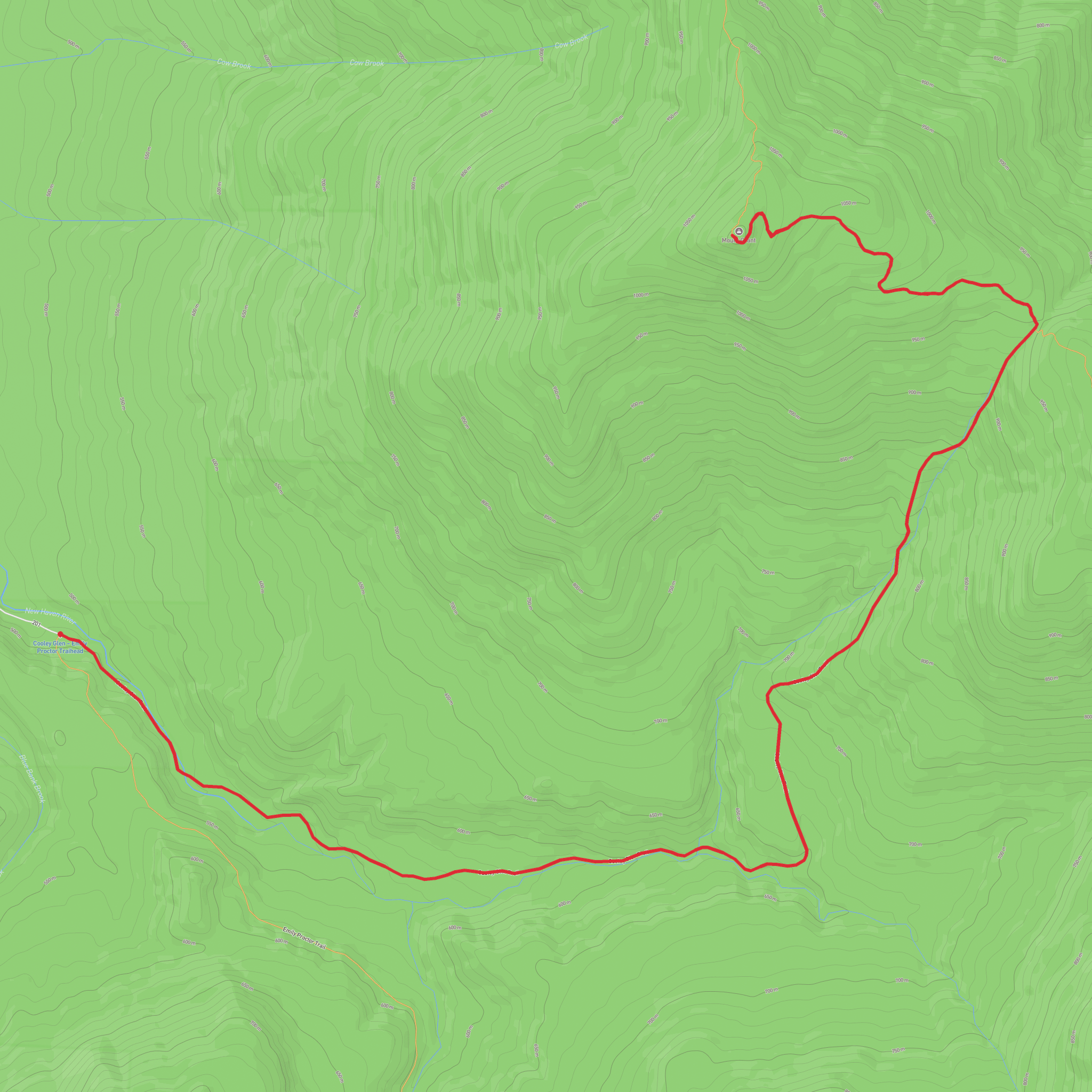
This route climbs into Vermont’s Breadloaf Wilderness on a rewarding out-and-back to Mount Grant, using the Cooley Glen Trail to reach the Long Trail before turning north along the ridge. Expect roughly 13 km / 8.1 miles round trip with about 600 m / 1,970 ft of elevation gain, which fits a solid medium outing for hikers who are comfortable with sustained climbing, uneven footing, and a fairly remote trailhead. The walk begins gently enough on an old woods-road corridor, then becomes steeper and more rugged as it rises toward the Long Trail and the higher ridge. The setting is classic central Vermont: dense northern hardwood forest, mossy ground, stream crossings, and a ridge walk that feels wilder and rougher than the mileage alone might suggest. (fs.usda.gov)
The start is at the Cooley Glen–Emily Proctor Trailhead in Lincoln, Vermont, on Forest Road 201. The nearest clearly identified landmark is the signed trailhead parking area at the end of Forest Road 201, reached from Vermont Route 125 via Forest Road 59 and Forest Road 54. The U.S. Forest Service lists the trailhead location at approximately 44.04026, -72.95361 and notes that Forest Road 201 dead-ends at the parking area. (fs.usda.gov)
By car, the usual approach is from Middlebury: head south on U.S. Route 7, turn east on Route 125, then follow Forest Road 59, Forest Road 54, and finally Forest Road 201 to the trailhead. Coming from Rochester, the approach is north on Route 100, west on Route 125, then onto the same forest roads. These last road sections are backroad forest approaches, so allow extra time and expect a more isolated arrival than at a front-country trailhead. (fs.usda.gov)
Public transport is limited here. Middlebury is the most practical nearby service hub for travelers arriving without a car, but there is no regular public transit that drops hikers directly at the trailhead; the final approach typically requires a taxi, rideshare if available, or a pre-arranged shuttle from the Middlebury or Route 7 corridor. Because the trailhead sits on forest roads in a remote part of Lincoln, it is wise to arrange both drop-off and pickup in advance rather than counting on a same-day ride. This is an inference based on the Forest Service access description and the trailhead’s remote road location. (fs.usda.gov)
What the hike is like
From the trailhead, the Cooley Glen Trail heads left and follows the extension of Forest Road 201, crossing the New Haven River on a bridge before continuing along the north bank and entering the Breadloaf Wilderness. This lower section is usually the easiest walking of the day, with a steady grade through forest and alongside water. It is a good place to settle into pace before the climb steepens. The Forest Service places the junction with the Long Trail just south of Cooley Glen Shelter at about 5.5 km / 3.4 miles from the trailhead. (fs.usda.gov)
Once you reach the Long Trail, the character changes. The tread becomes more typical of Vermont ridge hiking: roots, rocks, mud in wet periods, and short, punchy climbs that can feel harder than the map suggests. Turning north toward Mount Grant, you leave the shelter area and continue along the ridge for roughly 1.3 km / 0.8 miles to the summit area. Mount Grant itself is one of the peaks in Vermont’s Presidential Range, a cluster of summits in this part of the Green Mountains named for U.S. presidents. (en.wikipedia.org)
The summit experience is more about mountain atmosphere than a broad open crown. Depending on foliage and exact stopping points, views can be partial rather than constant, so hikers should come expecting a forested wilderness climb with intermittent outlooks rather than a continuously open alpine ridge. The reward is the sense of remoteness and the satisfaction of reaching one of the quieter presidential summits in Vermont. Because the route retraces the same path, save enough energy for the descent; the rocky and rooty footing can be slower on the way down than many hikers expect. This caution is supported by the Long Trail’s generally rugged character and the Forest Service description of the area’s wilderness conditions.
Surfaces
Unknown
Dirt
Comments and Reviews
User comments, reviews and discussions about the Mount Grant via Cooley Glen Trail and Vermont Long Trail, Vermont.
average rating out of 5
0 rating(s)
