Download
3D Flyover
Add to list
More
6.1 km
~2 hrs 3 min
509 m
Out and Back
“A steep, skyward scramble above Chimgan—wildflowers below, raptors overhead, weather changing fast.”
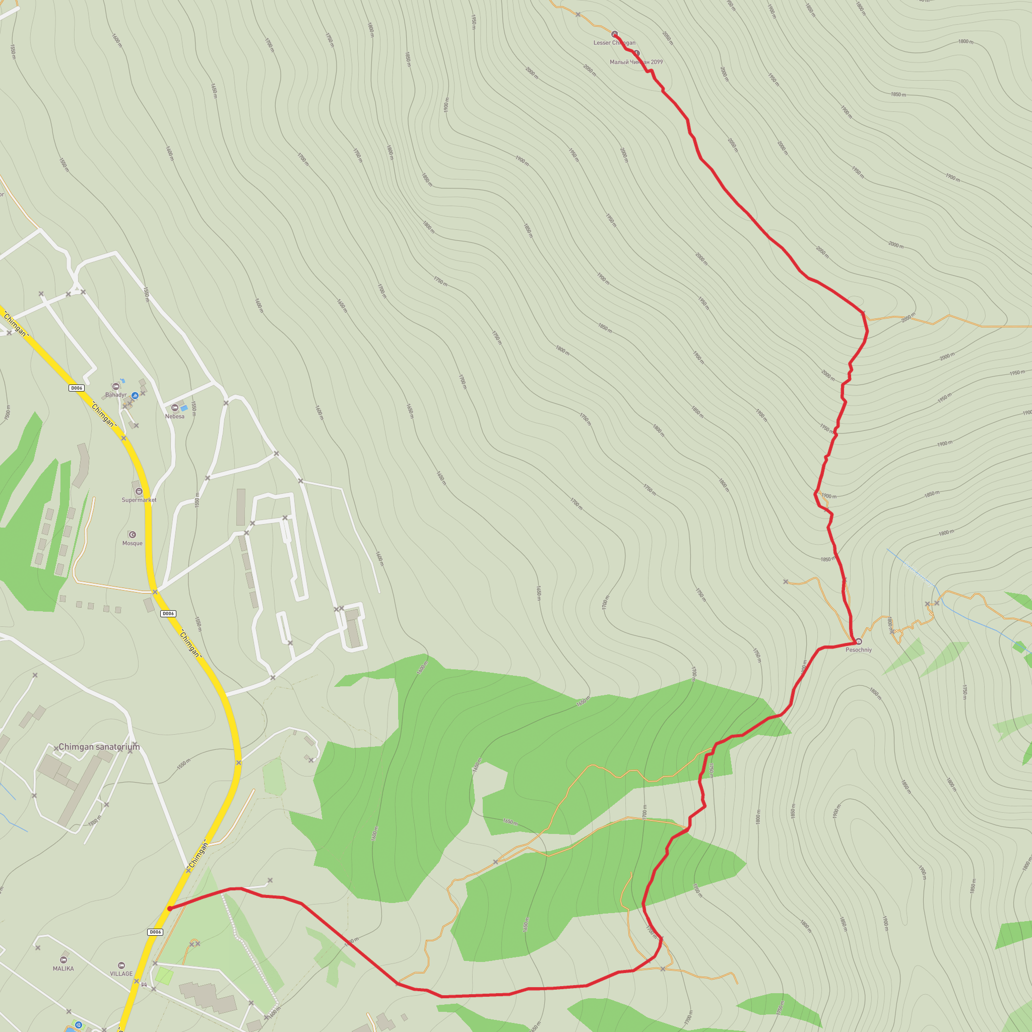
This is a short, steep mountain outing that packs a lot into roughly 3 km (about 1.9 mi). With around 500 m (about 1,640 ft) of elevation gain in such a short distance, expect sustained climbing from the first minutes—more like a “vertical workout” than a stroll. Even though the distance is modest, the effort level is high, and the “Extra Difficult” feel usually comes from a combination of steep grades, loose footing, and fast-changing mountain weather.
Getting to the start (car + public transport)
Where you’re aiming for: the usual access for Lesser Chimgan hikes is from the Chimgan / Beldersay resort area in the Western Tian Shan, northeast of Tashkent. The most recognizable nearby landmark to navigate to is Amirsoy Mountain Resort (a major ski and mountain resort in the Chimgan area). From there, local trailheads and dirt pull-offs commonly serve as starting points for routes toward Lesser Chimgan.
- By car (from Tashkent): Drive northeast toward the Chimgan/Charvak recreation zone. Most people approach via the main road that skirts the Charvak Reservoir and continues toward the Chimgan and Beldersay areas. Parking is typically informal near resort access roads, lift stations, or roadside pull-outs—arrive early on weekends to avoid congestion.
- By public transport + taxi: From Tashkent, shared transport (often marshrutka/shared taxis) commonly runs toward the Charvak/Chimgan recreation corridor, especially in peak season. From the last major drop-off point near the resorts, plan on a short taxi hop to the closest practical trail access (ask for Amirsoy/Chimgan resort access). Build in extra time—return options can thin out later in the day.
If you share the exact lon/lat for “Hike head: near …”, I can convert it to the nearest known landmark/address precisely; without coordinates, the most reliable “nearest known” reference for this hike area is the Amirsoy / Chimgan resort zone.
What the climb feels like (distance + elevation pacing)
Because the route is only ~3 km / 1.9 mi with ~500 m / 1,640 ft gain, the average grade is steep. Plan your effort like this:
- 0.0–0.7 km (0.0–0.4 mi): You’ll usually start on a worn path or rough track leaving the resort-side access area. The climb begins quickly. Footing can alternate between packed dirt and small scree; trekking poles help with traction and knee-sparing on the way down.
- 0.7–1.8 km (0.4–1.1 mi): The slope typically steepens and the trail narrows. This is where many hikers slow to a steady cadence. Expect short breathers at minor benches or flatter traverses. If there’s been recent rain or snowmelt, this middle section is where the trail can become slick and where small rockfall is more likely from above.
- 1.8–3.0 km (1.1–1.9 mi): The final push often feels the most “mountainous”: thinner tread, looser rock, and more exposure to wind. The payoff is broad views over the Western Tian Shan ridgelines and down toward the Charvak area on clear days.
Terrain, landmarks, and what to look for
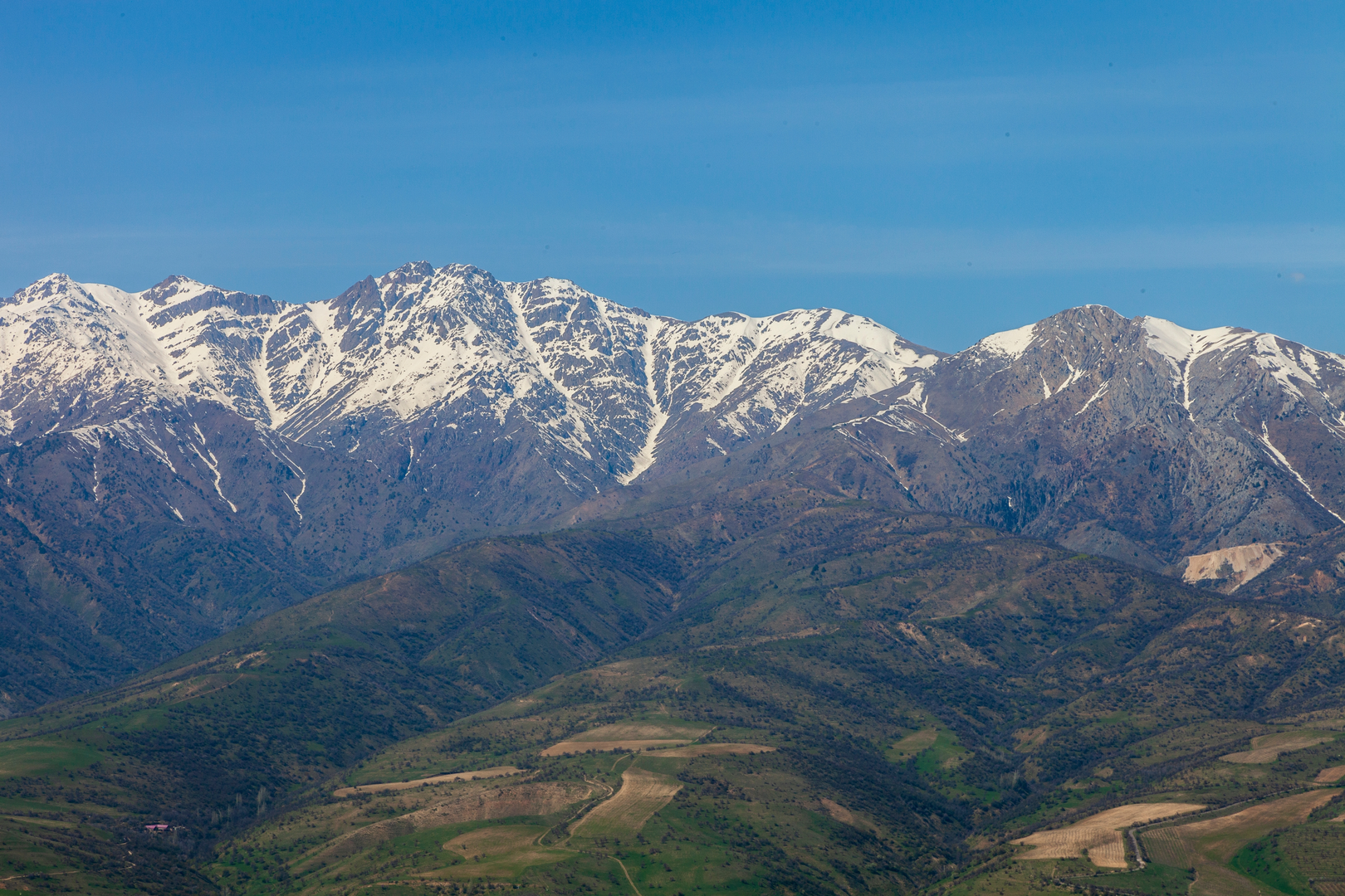
The Lesser Chimgan area sits in the Western Tian Shan, a landscape of sharp ridges, grassy slopes, and rocky outcrops. Even on a short route, you’ll notice distinct bands of terrain:
- Lower slopes: Spring and early summer can bring dense wildflowers and bright green grass on open hillsides. In drier months, the same slopes turn golden and dusty, and the trail surface becomes more slippery on descent due to loose grit.
- Rocky ribs and outcrops: As you gain elevation, the route often threads around rockier features. These are natural “view balconies” and also the places where wind can funnel strongly—keep a layer accessible even if the start feels warm.
- Panoramic viewpoints: Clear-weather visibility can be excellent, with sweeping views across the Chimgan massif and toward the Charvak recreation region. Haze and sudden cloud build-up are common; don’t rely on distant landmarks staying visible.
Nature and wildlife
Wildlife sightings vary by season and time of day, but hikers commonly encounter:
- Birdlife: Raptors (eagles/hawks) riding thermals along ridgelines are a frequent highlight. Listen for calls and watch for circling silhouettes above cliff bands.
- Small mammals: Marmot-like rodents and other small mammals may be seen near rocky areas and meadow edges, especially in quieter hours.
- Livestock and dogs: In grazing seasons, you may pass near sheep/goat herds. Herding/guardian dogs can be protective—give herds a wide berth, stay calm, and avoid sudden movements.
Stay on established tread where possible to reduce erosion on steep slopes and to avoid trampling fragile alpine plants.
Weather and seasonal hazards (why it earns “Extra Difficult”)
Even close to a resort zone, this is real mountain terrain:
- Rapid weather shifts: Warm sun at the base can turn into cold wind higher up. Carry a windproof layer and a warm mid-layer even for a short hike.
- Loose rock and scree: The steepness plus crumbly sections can make descending harder than ascending. Move one at a time through the loosest patches to avoid knocking rocks onto others.
- Snow/ice shoulder seasons: In spring and late autumn,
Comments and Reviews
User comments, reviews and discussions about the Lesser Chimgan, Uzbekistan.
average rating out of 5
0 rating(s)
