Download
3D Flyover
Add to list
More
7.2 km
~2 hrs 27 min
617 m
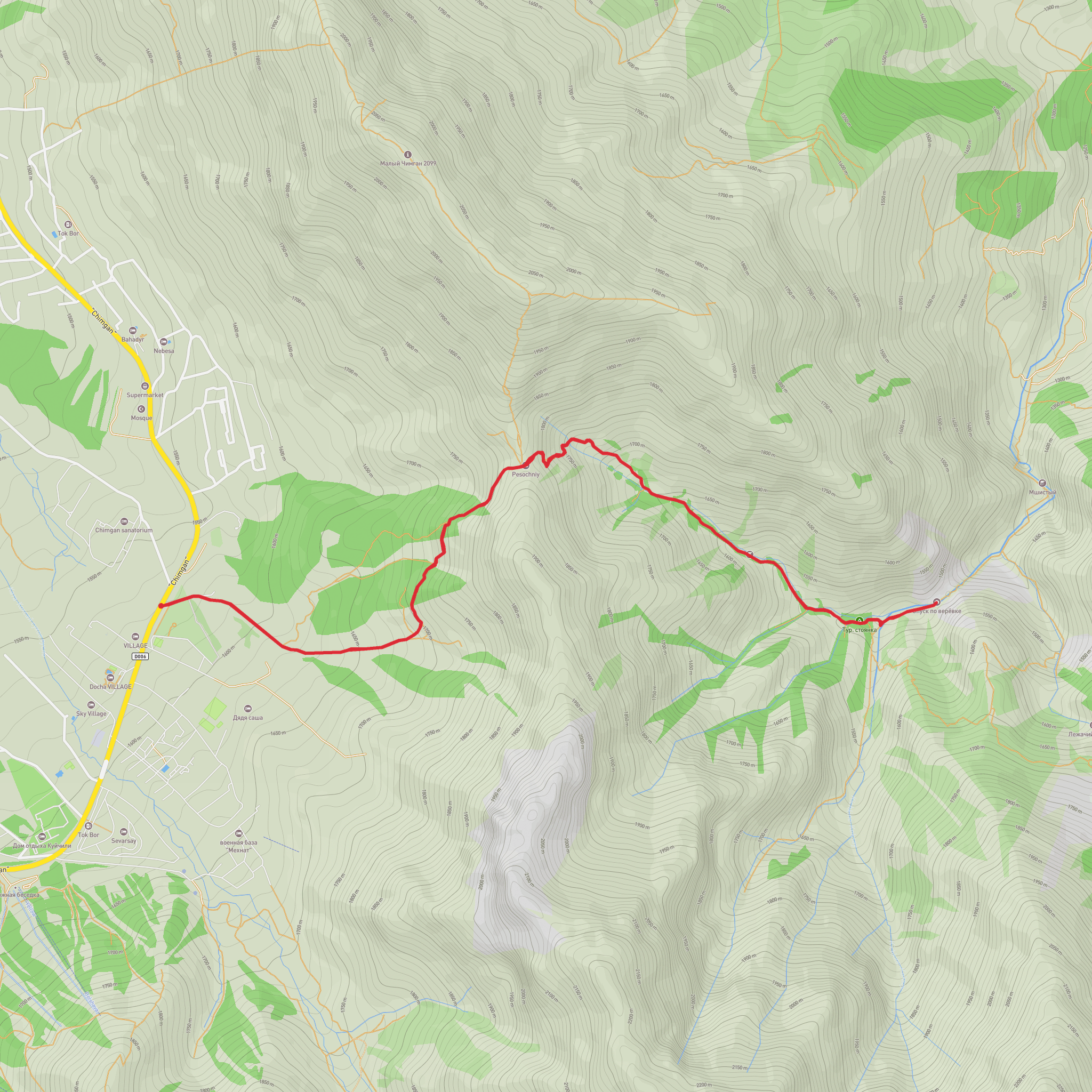
Out and Back
“A vivid gorge-and-river climb with airy edges, loose footing, and hard-won views for confident hikers.”
This is a short, steep gorge-and-river hike that packs a lot into ~7 km (about 4.3 miles), with roughly 600 m of climbing (about 1,970 ft). Expect sustained uphill sections, uneven footing, and a few places where you’ll want steady balance and confident pacing—especially if the route tracks close to the gorge edge or uses narrow, eroded side-trails above the river.
Before I can responsibly convert the start location to the nearest known address/landmark and give accurate “how to get there” directions, I need one of the following:
- the trailhead coordinates (lon/lat), or
- a HiiKER link, or
- the nearest town/region/country (even just the closest settlement name).
If you share that, I’ll pin the start to the nearest recognizable landmark/address and tailor transport options.
What the route feels like (distance + climbing broken down)
0.0–1.5 km (0.0–0.9 mi): settling in along the river
The opening typically follows the Gulkamsay River corridor, where the ground can be damp and compacted, with roots and stones polished by foot traffic. Even early on, plan for small step-ups and short, punchy rises as the path weaves around river bends and minor tributary cuts.
Common hazards: slick rock near water, muddy patches after rain, and ankle-turning cobbles.1.5–3.5 km (0.9–2.2 mi): entering the gorge zone
As the gorge tightens, the trail often becomes more constrained: narrower tread, more side-slope, and occasional short scrambles where the path climbs around rock outcrops. If there are informal viewpoints, they can be tempting but exposed—treat edges as unstable, especially where soil is undercut.
You’ll likely gain a meaningful chunk of elevation here—think 200–350 m (650–1,150 ft) depending on the exact line—often in irregular bursts rather than a smooth grade.3.5–5.5 km (2.2–3.4 mi): the main climb
This is where the “Difficult” rating usually earns its keep. With ~600 m (1,970 ft) total gain on a 7 km route, the average gradient is steep, and the steepest pitches can feel relentless. Expect loose gravel, eroded switchbacks, or short fall-line climbs. Trekking poles can help with rhythm and knee load on the way back down.
Pacing tip: plan micro-breaks at natural benches (flatter spots) rather than stopping on steep slopes where calves tighten quickly.5.5–7.0 km (3.4–4.3 mi): viewpoints / turnaround terrain
Many gorge hikes culminate at a rim, saddle, or open vantage where the river corridor becomes visible below. Wind exposure can increase abruptly at higher, more open points; temperatures can feel cooler than at the river even on the same day. If the route is an out-and-back, remember the descent can be slower than the climb due to loose footing.
Landmarks and natural features to watch for
- Gorge walls and river-cut geology: Look for layered rock faces, boulder fields, and narrow choke points where the river has carved deeper channels. These areas can be spectacular but also where rockfall is most plausible—avoid lingering directly beneath steep, fractured walls.
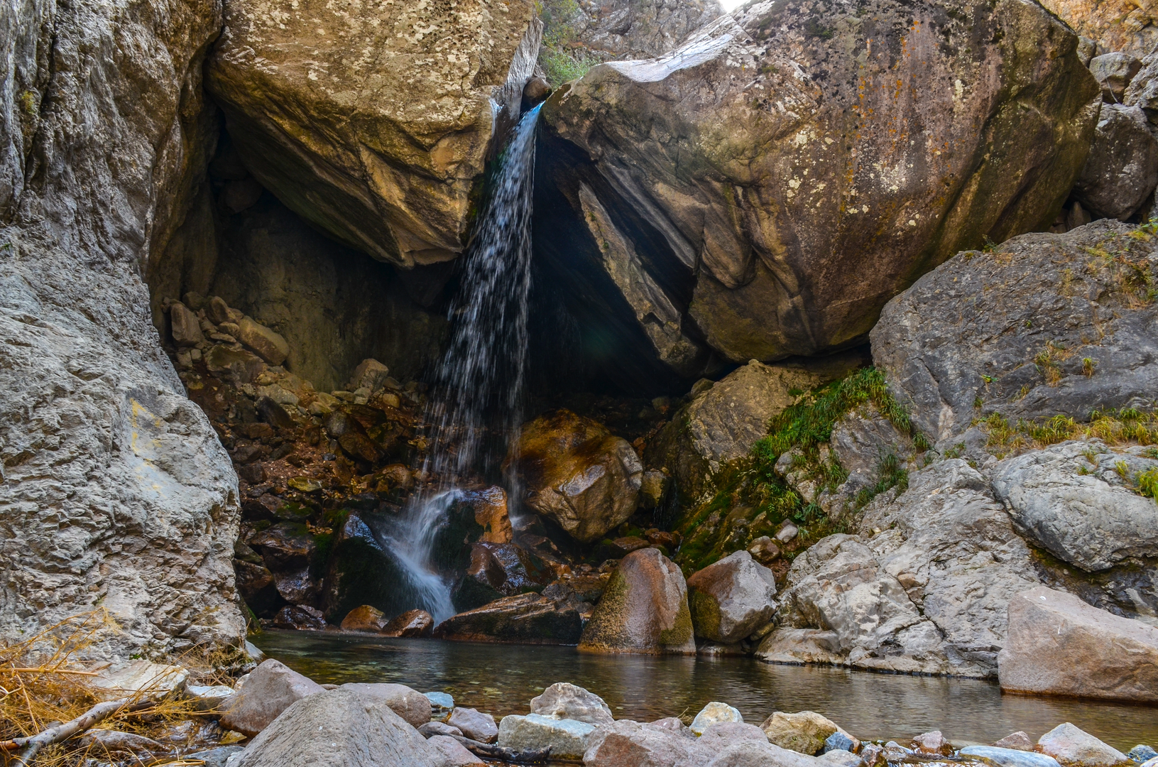
- River features: Small cascades, plunge pools, and gravel bars are common. Crossing points (if any) can change after storms; even shallow water can be pushy over slick stones.
- Vegetation transitions with elevation: You’ll often notice denser, moisture-loving plants near the river shifting to hardier shrubs/trees higher up where soils are thinner and drier.
Wildlife and seasonal considerations
Without the exact country/region I can’t name species with confidence, but gorge-and-river corridors commonly support:
- Birdlife that uses cliff faces and updrafts (raptors) and dense riparian cover (songbirds).
- Small mammals and reptiles/amphibians near water and sun-warmed rocks.
- Insects: expect more near the river in warm months; pack repellent if biting insects are common in your area.
Seasonally, the biggest swing is usually water + footing:
- After rain / snowmelt: higher river levels, saturated soils, and more rockfall risk.
- Hot periods: heat stress can be deceptive in a gorge—still air near the river can feel humid, while exposed upper sections can be sun-baked.
Difficulty: what makes it “Difficult”
- Steep elevation gain: ~600 m (1,970 ft) over ~7 km (4.3 mi) is demanding even for fit hikers.
- Footing: likely uneven, with loose rock, roots, and narrow tread in places.
- Exposure potential: gorge rims and viewpoints can involve real consequences if you slip.
Navigation and planning (HiiKER)
Use HiiKER to: - download the route for offline use before you lose signal in the gorge, - check the elevation profile so you know where the steepest ramps are, - confirm whether the hike is out-and-back, loop, or point-to-point (your details list the type as blank, and that changes logistics a lot).
Safety and gear that match this route
- Footwear: grippy trail shoes or boots with solid edging for side-slope sections.
- Poles: strongly recommended for steep descent and loose gravel.
- Water: for
Surfaces
Unknown
Asphalt
Comments and Reviews
User comments, reviews and discussions about the Gulkamsay River and Gorge Gulkam, Uzbekistan.
5.0
average rating out of 5
1 rating(s)
