Download
Preview
Add to list
More
8.6 km
~2 hrs 14 min
322 m
Loop
“Embark on the Wanlass Hill Loop for a moderately challenging hike rich in natural beauty and history.”
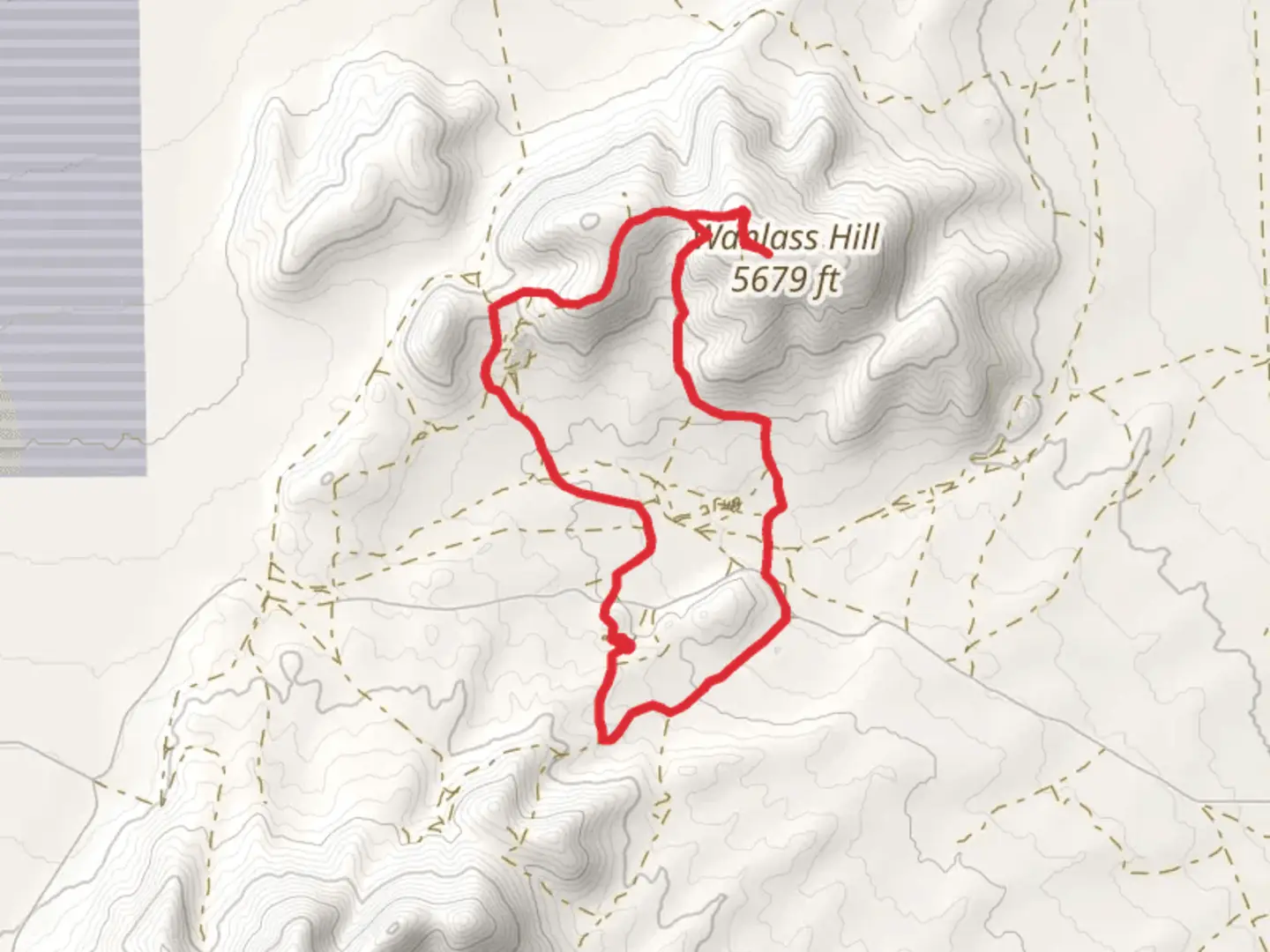
Starting your adventure near Utah County, Utah, the Wanlass Hill Loop offers a moderately challenging hike with a distance of around 9 km (approximately 5.6 miles) and an elevation gain of about 300 meters (roughly 984 feet). This loop trail is perfect for those looking to experience the natural beauty and historical significance of the region.### Getting There To reach the trailhead, you can drive or use public transportation. If you're driving, head towards the nearest known address, which is close to the intersection of 800 N and 800 E in Orem, Utah. From there, follow local roads to the trailhead. For those using public transport, the Utah Transit Authority (UTA) offers bus services that can get you close to the starting point. Check the UTA website for the most current routes and schedules.### Trail Overview The Wanlass Hill Loop begins with a gentle ascent, allowing you to warm up as you gradually climb. The initial part of the trail is well-marked and easy to follow. As you progress, you'll encounter a mix of dirt paths and rocky sections, so sturdy hiking boots are recommended.### Significant Landmarks and Nature Around the 2 km (1.2 miles) mark, you'll come across a scenic overlook that provides stunning views of Utah Valley and the surrounding mountains. This is a great spot to take a break and snap some photos. Continuing on, the trail winds through a forested area filled with native flora such as Gambel oak and sagebrush. Keep an eye out for local wildlife, including mule deer and various bird species.### Historical Significance The region around Wanlass Hill has a rich history. It was once inhabited by the Ute Native American tribe, and you may come across some historical markers along the trail that provide insights into their way of life. Additionally, the area played a role during the westward expansion of the United States, with early settlers using these paths for travel and trade.### Navigation and Safety As you approach the halfway point, the trail becomes steeper and more rugged. This section requires careful footing, especially if the ground is wet. Using a reliable navigation tool like HiiKER can help you stay on track and avoid any potential detours. The app provides detailed maps and real-time updates, ensuring you have a safe and enjoyable hike.### Final Stretch The last 3 km (1.9 miles) of the loop take you through a more open landscape, offering panoramic views of the valley below. The descent is gradual, making it a pleasant end to your hike. As you near the trailhead, you'll pass through a meadow that bursts into color during the spring and summer months with wildflowers like lupine and Indian paintbrush.Remember to pack plenty of water, snacks, and a first-aid kit. Weather can change rapidly in this region, so layers are advisable. Enjoy your hike on the Wanlass Hill Loop, and take in all the natural beauty and historical richness it has to offer.

What to expect?
Activity types
Comments and Reviews
User comments, reviews and discussions about the Wanlass Hill Loop, Utah.
4.78
average rating out of 5
9 rating(s)