Download
Preview
Add to list
More
4.8 km
~1 hrs 29 min
317 m
Out and Back
“Experience the serene beauty and moderate challenge of Scout Falls via Timpooneke Trail in Utah’s Wasatch Range.”
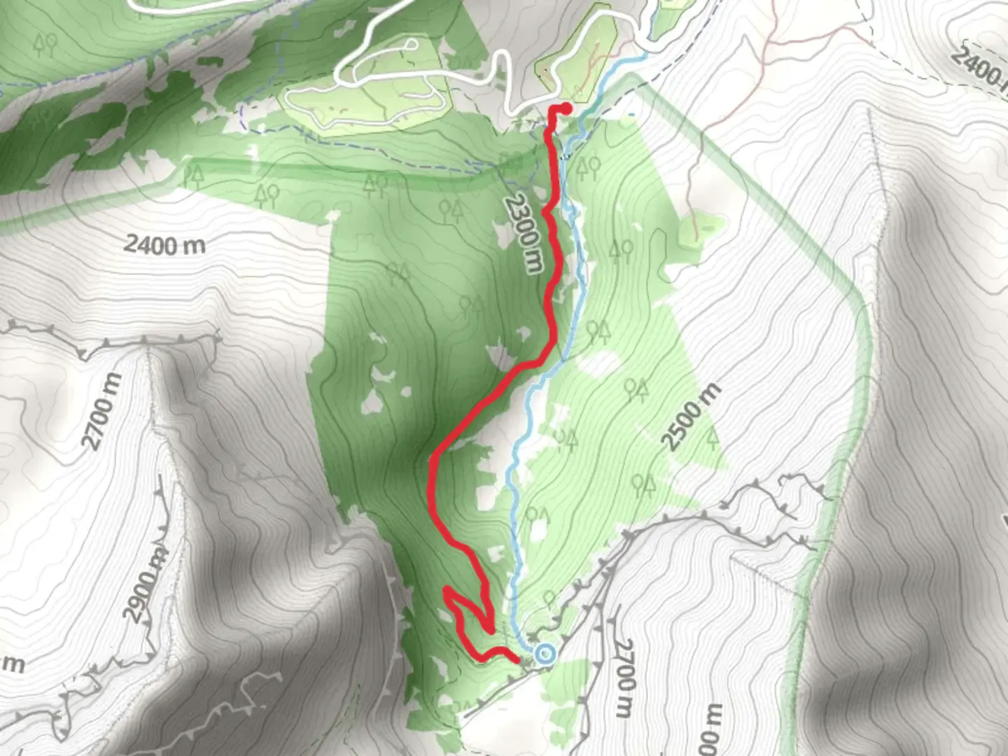
Starting your adventure near Utah County, Utah, the Scout Falls via Timpooneke Trail offers a rewarding out-and-back hike of approximately 5 km (3.1 miles) with an elevation gain of around 300 meters (984 feet). This medium-difficulty trail is perfect for those looking to experience the beauty of the Wasatch Range without committing to a full-day trek.
Getting There
To reach the trailhead, you can drive or use public transport. If driving, head towards the Timpooneke Campground, located off the Alpine Loop Scenic Byway (SR-92). The nearest significant landmark is the Timpooneke Campground, which provides ample parking. For those using public transport, the closest major city is Provo, Utah. From Provo, you can take a bus to the American Fork Canyon area and then a taxi or rideshare service to the Timpooneke Campground.
Trail Overview
The trail begins at the Timpooneke Trailhead, situated at an elevation of approximately 2,133 meters (7,000 feet). The initial section of the trail is relatively gentle, winding through a lush forest of aspen and pine trees. As you progress, you'll encounter a series of switchbacks that gradually increase in steepness.
Significant Landmarks and Nature
Around 1.5 km (0.9 miles) into the hike, you'll come across a picturesque meadow, often filled with wildflowers during the summer months. This is a great spot to take a short break and enjoy the surrounding views. Continuing on, the trail becomes rockier and more challenging, with several small streams crossing your path. Be sure to wear waterproof boots, especially during the spring when snowmelt can make these streams more robust.
Wildlife and Flora
The area is rich in wildlife, including deer, moose, and various bird species. Keep an eye out for the vibrant Western Tanager and the elusive Mountain Bluebird. The flora is equally diverse, with wildflowers such as Indian Paintbrush, Columbine, and Lupine adding splashes of color to the landscape.
Historical Significance
The region holds historical significance as part of the traditional lands of the Ute Tribe. The Ute people have a long history in the area, and their influence can still be felt today. Additionally, the trail is part of the larger Mount Timpanogos Wilderness, which has been a popular destination for hikers and nature enthusiasts since the early 20th century.
Reaching Scout Falls
At approximately 2.5 km (1.55 miles) from the trailhead, you'll reach Scout Falls. The falls are a stunning cascade of water that tumbles down a rocky cliff, creating a refreshing mist. This is the perfect spot to rest, take photos, and enjoy a snack before heading back. The elevation at Scout Falls is around 2,438 meters (8,000 feet), offering breathtaking views of the surrounding mountains and valleys.
Navigation and Safety
For navigation, it's highly recommended to use the HiiKER app, which provides detailed maps and real-time updates. The trail is well-marked, but having a reliable navigation tool can help ensure you stay on track. Always carry sufficient water, snacks, and a first-aid kit. Weather can change rapidly in the mountains, so bring layers and be prepared for sudden temperature drops.
This hike offers a perfect blend of natural beauty, moderate challenge, and historical context, making it a must-do for anyone visiting the Utah County area.

What to expect?
Activity types
Comments and Reviews
User comments, reviews and discussions about the Scout Falls via Timpooneke Trail, Utah.
4.64
average rating out of 5
25 rating(s)