Download
Preview
Add to list
More
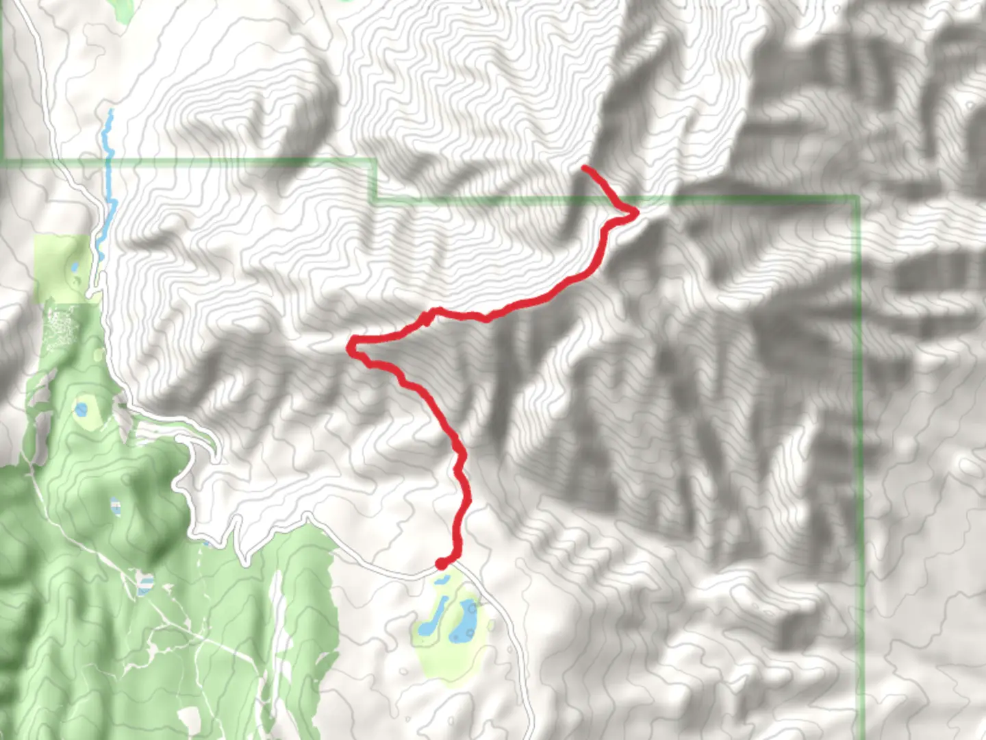
18.3 km
~5 hrs 44 min
1250 m
Out and Back
“The Santaquin Peak via Loafer Mountain Trail offers a rewarding 18 km hike with stunning views and rich history.”
Starting your adventure near Utah County, Utah, the Santaquin Peak via Loafer Mountain Trail is an 18 km (11.2 miles) out-and-back journey with an elevation gain of approximately 1200 meters (3937 feet). This trail is rated as medium difficulty, making it suitable for moderately experienced hikers.
Getting There
To reach the trailhead, you can drive or use public transport. If driving, head towards the Loafer Mountain Trailhead, which is accessible via the Nebo Loop Road. For those using public transport, the nearest significant landmark is Payson, Utah. From Payson, you can take a local taxi or rideshare service to the trailhead.
Trail Overview
The trail begins at an elevation of around 1,800 meters (5,905 feet) and gradually ascends through a series of switchbacks. Early on, you'll traverse through dense forests of aspen and pine, offering ample shade and a cool start to your hike. The first 3 km (1.9 miles) are relatively gentle, with an elevation gain of about 300 meters (984 feet).
Mid-Trail Landmarks and Wildlife
As you continue, the trail opens up to meadows filled with wildflowers during the spring and summer months. Around the 6 km (3.7 miles) mark, you'll encounter a small, serene alpine lake, a perfect spot for a short break. Keep an eye out for local wildlife, including mule deer, elk, and various bird species like the Mountain Bluebird and the American Kestrel.
Historical Significance
The region has a rich history, with Native American tribes such as the Ute and Paiute having inhabited the area for centuries. The trail itself was used by early settlers and explorers, adding a layer of historical significance to your hike.
Final Ascent
The final 3 km (1.9 miles) to Santaquin Peak are the most challenging, with a steep elevation gain of about 600 meters (1,968 feet). The terrain becomes rockier, and the trail narrows, requiring careful footing. As you approach the summit, the tree line thins out, offering panoramic views of the surrounding valleys and peaks.
Summit Experience
Reaching Santaquin Peak, at an elevation of approximately 3,000 meters (9,843 feet), you'll be rewarded with breathtaking 360-degree views. On a clear day, you can see as far as the Great Salt Lake and the Wasatch Range. This is an excellent spot for photography and a well-deserved rest before beginning your descent.
Navigation and Safety
Given the trail's length and elevation gain, it's crucial to be well-prepared. Use HiiKER for accurate navigation and trail conditions. Ensure you have enough water, snacks, and appropriate clothing for changing weather conditions. Always inform someone of your hiking plans and expected return time.
Return Journey
The descent follows the same path, allowing you to revisit the beautiful landscapes and perhaps spot wildlife you missed on the way up. The return trip is easier on the legs but still requires caution, especially on the steeper sections.
This trail offers a mix of natural beauty, historical context, and a rewarding physical challenge, making it a memorable hike for those prepared to take it on.

What to expect?
Activity types
Comments and Reviews
User comments, reviews and discussions about the Santaquin Peak via Loafer Mountain Trail, Utah.
4.65
average rating out of 5
17 rating(s)