Download
Preview
Add to list
More
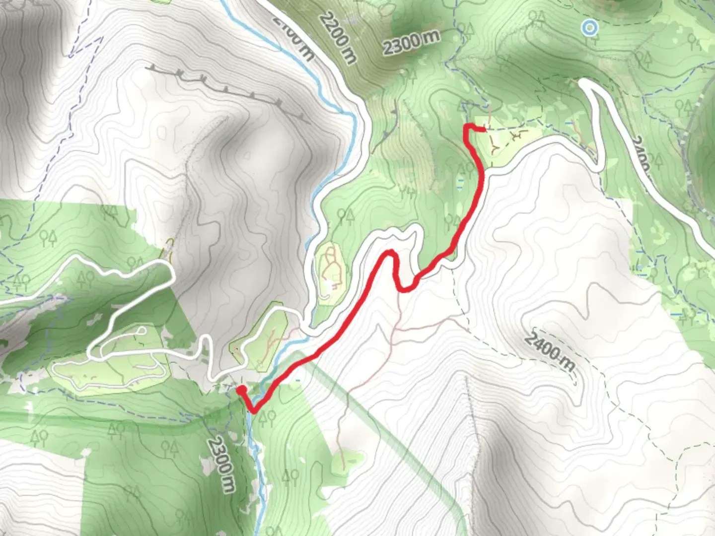
4.2 km
~1 hrs 5 min
157 m
Out and Back
“Embark on the Salamander Flat Trail for a scenic, moderately challenging 4 km hike rich in history and biodiversity.”
Starting near Utah County, Utah, the Salamander Flat Trail is an inviting 4 km (approximately 2.5 miles) out-and-back trail with an elevation gain of around 100 meters (328 feet). This trail is rated as medium difficulty, making it suitable for moderately experienced hikers.
Getting There
To reach the trailhead, you can drive or use public transport. If driving, head towards the Alpine Loop Scenic Byway, and the nearest significant landmark is the Tibble Fork Reservoir. Parking is available near the reservoir, and from there, it's a short walk to the trailhead. For those using public transport, the nearest bus stop is in American Fork, from where you can take a taxi or rideshare service to the trailhead.
Trail Navigation
For navigation, it's recommended to use HiiKER, which provides detailed maps and real-time updates. The trail is well-marked, but having a reliable navigation tool can enhance your hiking experience.
Trail Description
The Salamander Flat Trail begins with a gentle ascent through a mixed forest of aspen and pine trees. The initial 0.5 km (0.3 miles) offers a relatively easy walk, allowing you to acclimate to the surroundings. As you progress, the trail becomes steeper, gaining elevation steadily over the next 1.5 km (0.9 miles).
Flora and Fauna
This trail is rich in biodiversity. During the spring and summer months, you'll encounter a variety of wildflowers, including lupines and Indian paintbrush. The forested areas provide habitat for wildlife such as mule deer, squirrels, and a variety of bird species. Keep an eye out for the occasional salamander, which the trail is named after.
Significant Landmarks
At approximately 2 km (1.2 miles) into the hike, you'll reach a scenic overlook that offers panoramic views of the surrounding mountains and valleys. This is a great spot to take a break and enjoy the natural beauty. The overlook is also a popular spot for photography, so bring your camera.
Historical Significance
The region around the Salamander Flat Trail has a rich history. The trail itself passes through areas that were once used by Native American tribes for hunting and gathering. Additionally, the nearby Alpine Loop Scenic Byway has historical significance as a route used by early settlers and pioneers.
Final Stretch
The final 1 km (0.6 miles) of the trail is a gentle descent back to the trailhead, offering a relaxing end to your hike. The return journey provides a different perspective of the landscape, allowing you to appreciate the diverse flora and fauna from another angle.
Tips for Hikers
- Wear sturdy hiking boots, as the trail can be rocky in sections.
- Bring plenty of water, especially during the warmer months.
- Check the weather forecast before heading out, as conditions can change rapidly in the mountains.
- Use HiiKER for real-time navigation and updates.
Enjoy your hike on the Salamander Flat Trail, and take the time to appreciate the natural beauty and historical significance of this remarkable area.

What to expect?
Activity types
Comments and Reviews
User comments, reviews and discussions about the Salamander Flat Trail, Utah.
4.26
average rating out of 5
19 rating(s)