Download
Preview
Add to list
More
18.0 km
~5 hrs 1 min
859 m
Loop
“Explore Utah's Mill Canyon and Mud Spring Trails: 18 km of scenic beauty and historical intrigue.”
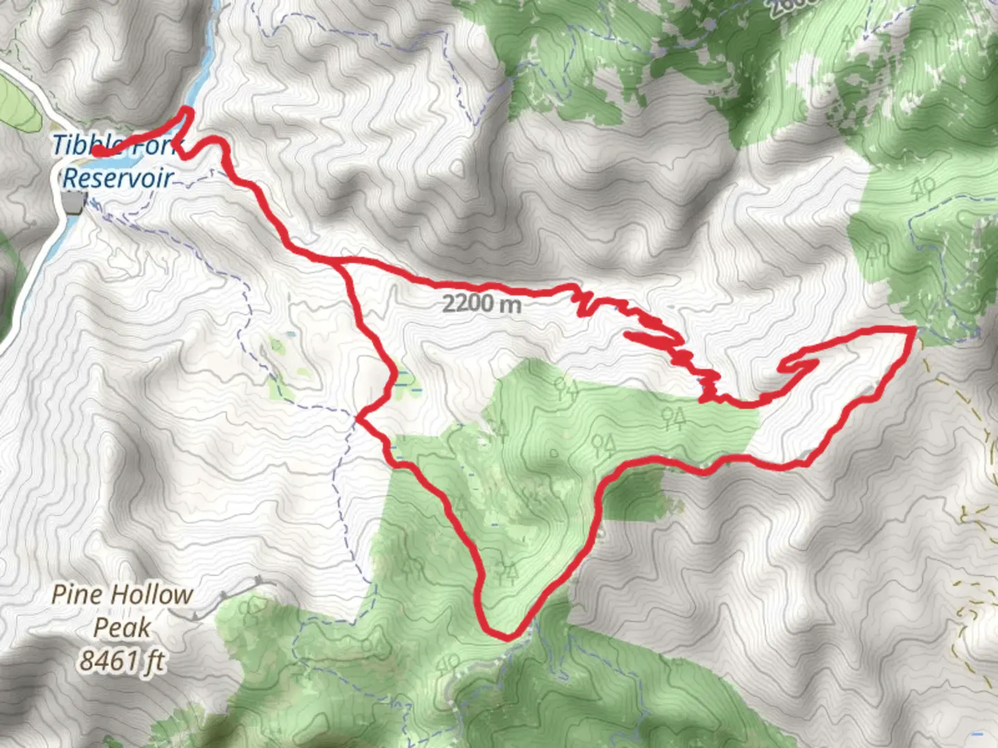
Starting near Utah County, Utah, the Mill Canyon Trail and Mud Spring Trail form a scenic loop that spans approximately 18 kilometers (11 miles) with an elevation gain of around 800 meters (2,625 feet). This medium-difficulty trail offers a diverse hiking experience, blending natural beauty with historical significance.
Getting There
To reach the trailhead, drive to the Tibble Fork Reservoir area, which is a well-known landmark in Utah County. If you're using public transport, the nearest major city is Provo, Utah. From Provo, you can take a bus to American Fork and then a taxi or rideshare service to Tibble Fork Reservoir. The trailhead is located just a short distance from the reservoir, making it easily accessible by car or public transport.
Trail Navigation
For navigation, it's highly recommended to use the HiiKER app, which provides detailed maps and real-time updates. The trail is well-marked, but having a reliable navigation tool will enhance your hiking experience.
Trail Highlights
Mill Canyon
Starting from the trailhead near Tibble Fork Reservoir, the first section of the hike takes you through Mill Canyon. This area is rich in history, as it was once a bustling mining region in the late 19th and early 20th centuries. As you hike, you'll come across remnants of old mining equipment and structures, offering a glimpse into the past. The trail gradually ascends, providing stunning views of the surrounding Wasatch Mountains.
Mud Spring
Approximately 9 kilometers (5.6 miles) into the hike, you'll reach Mud Spring. This natural spring is a great spot to take a break and enjoy the serene environment. The spring is surrounded by lush vegetation, including wildflowers in the spring and summer months. Keep an eye out for local wildlife such as deer, elk, and various bird species that frequent the area.
Flora and Fauna
The trail is home to a diverse range of flora and fauna. In the lower elevations, you'll find groves of aspen and oak trees, while higher elevations feature dense pine forests. During the hike, you may encounter wildlife such as mule deer, mountain goats, and a variety of bird species, including hawks and eagles.
Elevation and Terrain
The trail features a steady elevation gain of around 800 meters (2,625 feet), with some steep sections that require careful footing. The terrain varies from well-trodden paths to rocky and uneven surfaces, so sturdy hiking boots are recommended. The highest point of the trail offers panoramic views of the Wasatch Range, making the climb well worth the effort.
Historical Significance
Mill Canyon has a rich mining history, with several interpretive signs along the trail providing information about the area's past. The remnants of old mining operations serve as historical landmarks, offering a unique blend of natural beauty and cultural heritage.
Preparation Tips
Given the medium difficulty rating, it's important to be well-prepared. Bring plenty of water, especially during the hotter months, and pack snacks or a light meal. Weather can change rapidly in the mountains, so layers are advisable. A first-aid kit and a map on the HiiKER app will ensure you're ready for any situation.
This trail offers a rewarding experience for those looking to explore the natural beauty and historical richness of Utah County. Whether you're a seasoned hiker or a nature enthusiast, the Mill Canyon Trail and Mud Spring Trail provide a memorable adventure.

What to expect?
Activity types
Comments and Reviews
User comments, reviews and discussions about the Mill Canyon Trail and Mud Spring Trail, Utah.
4.41
average rating out of 5
17 rating(s)