Download
Preview
Add to list
More
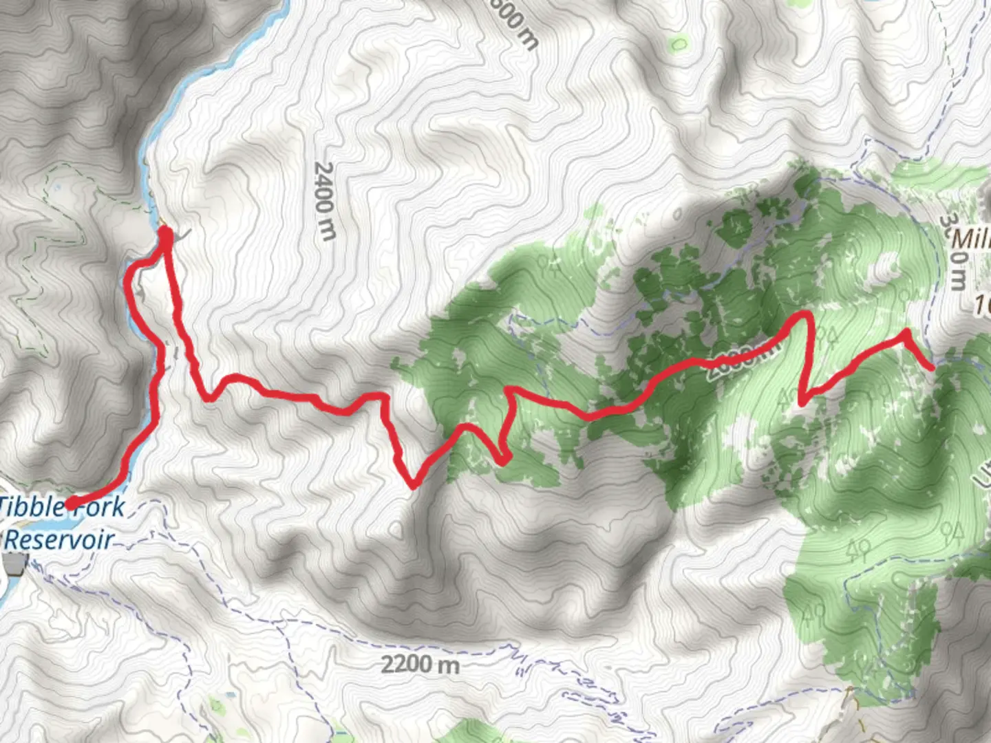
20.3 km
~6 hrs 24 min
1403 m
Out and Back
“The invigorating Holman Trail offers stunning views, rich history, and challenging terrain for experienced hikers.”
Starting near Utah County, Utah, the Holman Trail is an invigorating out-and-back hike stretching approximately 20 kilometers (12.4 miles) with an elevation gain of around 1400 meters (4593 feet). This trail is rated as medium difficulty, making it suitable for hikers with some experience and a good level of fitness.
Getting There
To reach the trailhead, you can drive or use public transport. If driving, head towards the nearest known address, which is the Provo Canyon area. From there, follow the signs to the trailhead parking area. For those using public transport, take a bus or shuttle service to Provo Canyon and then a short taxi or rideshare to the trailhead.
Trail Overview
The Holman Trail begins with a gentle ascent through a mixed forest of pine and aspen trees. The first 3 kilometers (1.9 miles) are relatively easy, with an elevation gain of about 200 meters (656 feet). This section is a great warm-up and offers a chance to enjoy the serene forest environment.
Mid-Trail Landmarks
Around the 5-kilometer (3.1-mile) mark, you'll encounter a small, picturesque waterfall. This is a perfect spot for a short break and some photos. The trail then becomes steeper, with the next 5 kilometers (3.1 miles) gaining approximately 600 meters (1969 feet) in elevation. This section can be challenging, so take your time and stay hydrated.
Wildlife and Nature
As you ascend, keep an eye out for local wildlife. Deer, elk, and various bird species are commonly seen along the trail. The higher elevations also offer a chance to see alpine flora, including wildflowers in the spring and summer months.
Historical Significance
The region around the Holman Trail has a rich history. It was once traversed by Native American tribes and later by early settlers. The trail itself was named after a local pioneer family who contributed significantly to the development of the area.
Final Ascent and Views
The last 2 kilometers (1.2 miles) are the most strenuous, with an elevation gain of about 400 meters (1312 feet). The trail becomes rocky and narrow, requiring careful footing. However, the effort is well worth it. Upon reaching the summit, you'll be rewarded with panoramic views of the surrounding valleys and mountains. On a clear day, you can see for miles, making it an excellent spot for photography.
Navigation and Safety
For navigation, it's highly recommended to use the HiiKER app, which provides detailed maps and real-time updates. The trail is well-marked, but having a reliable navigation tool is always a good idea. Be prepared for changing weather conditions, especially at higher elevations. Pack layers, plenty of water, and some high-energy snacks.
Return Journey
The return journey follows the same path, offering a chance to enjoy the scenery from a different perspective. Descending can be tough on the knees, so consider using trekking poles for added stability.
By planning accordingly and being prepared, the Holman Trail offers a rewarding hiking experience with stunning natural beauty and a touch of historical significance.

What to expect?
Activity types
Comments and Reviews
User comments, reviews and discussions about the Holman Trail, Utah.
4.27
average rating out of 5
15 rating(s)