
Download
3D Flyover
Add to list
More
10.1 km
~2 hrs 56 min
556 m
Loop
“Embark on a scenic 10km hike through Tooele's historic trails, brimming with wildlife and panoramic vistas.”
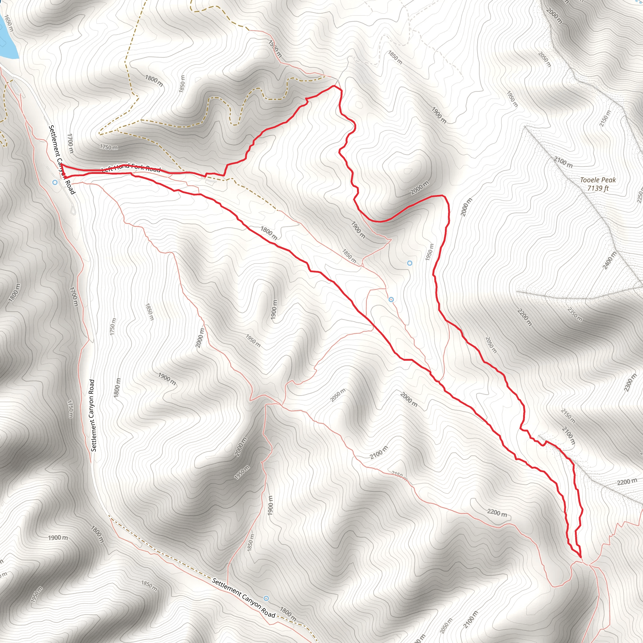
The Bench Trail and Left Hand Fork Trail loop, nestled in the scenic surroundings of Tooele County, Utah, offers hikers a moderately challenging experience with a total distance of approximately 10 kilometers (6.2 miles) and an elevation gain of around 500 meters (1640 feet). This trail is a perfect blend of physical exertion and natural beauty, suitable for those with some hiking experience.
Getting to the Trailhead
To reach the trailhead, if you're coming by car, you'll want to navigate towards Settlement Canyon, which is just a short drive from the city of Tooele. There is a parking area near the mouth of the canyon where you can leave your vehicle before starting your hike. For those relying on public transport, check the local schedules for buses that get you closest to the area, and then you may need to arrange a taxi or rideshare for the final leg to the trailhead.
Navigating the Trail
As you embark on the Bench Trail, you'll find yourself winding through a mix of terrains, including sagebrush flats and juniper woodlands. The trail is well-defined, but it's always wise to have a reliable navigation tool like HiiKER to ensure you stay on the right path. The initial ascent is gradual, allowing you to warm up as you take in the expansive views of the Oquirrh Mountains.
Historical Significance and Landmarks
The region is steeped in history, with the Oquirrh Mountains being known for their rich mining past. As you hike, imagine the early settlers and miners who traversed these mountains in search of precious metals. Keep an eye out for any remnants of old mining operations, which serve as a reminder of the area's historical significance.
Flora and Fauna
The trail offers a chance to witness the diverse flora and fauna of the region. You may spot mule deer, elk, and various bird species that call this habitat home. The spring and summer months bring a colorful display of wildflowers, including Indian paintbrush and lupine, adding a splash of color to the landscape.
Elevation and Terrain
The most challenging part of the hike is the Left Hand Fork Trail, where you'll encounter the majority of the elevation gain. The switchbacks here can be quite steep, so take your time and enjoy the increasingly impressive views as you climb higher. The trail can be rocky in places, so sturdy hiking boots are recommended.
Loop Completion and Descent
After reaching the highest point of the trail, you'll begin your descent back towards the trailhead. The loop design of the trail means you'll be treated to fresh scenery throughout your hike. As you make your way down, the panoramic views of the valley below are truly rewarding.
Preparation and Safety
Before setting out, ensure you have adequate water, as there are no reliable water sources along the trail. Sun protection is also crucial, especially during the hotter months. Weather can change rapidly in the mountains, so bring layers to adapt to any shifts in temperature. Lastly, always let someone know your hiking plans and expected return time for safety.
By following these guidelines and being prepared, your hike on the Bench Trail and Left Hand Fork Trail should be an enjoyable and memorable experience, offering a glimpse into the natural and historical tapestry of Tooele County.
What to expect?
Activity types
Comments and Reviews
User comments, reviews and discussions about the Bench Trail and Left Hand Fork Trail, Utah.
4.42
average rating out of 5
12 rating(s)
