
Download
3D Flyover
Add to list
More
4.1 km
~1 hrs 5 min
164 m
Loop
“The RTS Loop in Summit County offers a scenic, moderately challenging 4 km hike with rich wildlife and history.”
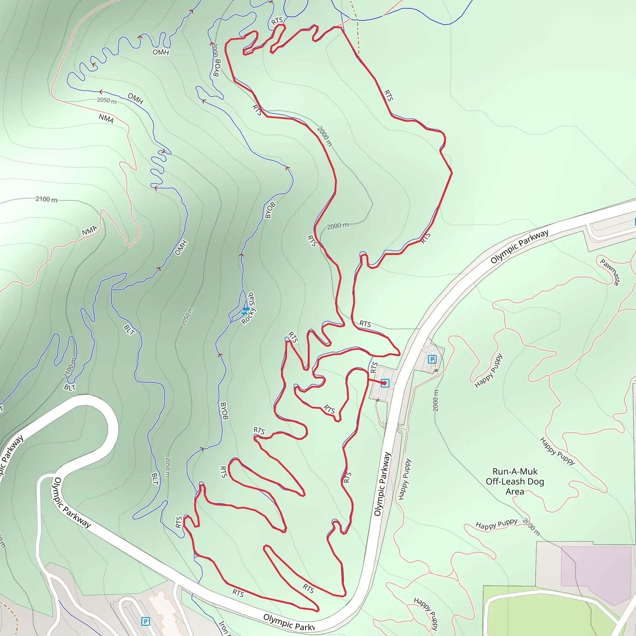
Starting near Summit County, Utah, the RTS Loop is a captivating 4 km (approximately 2.5 miles) trail with an elevation gain of around 100 meters (328 feet). This loop trail is rated as medium difficulty, making it suitable for moderately experienced hikers looking for a rewarding outdoor adventure.
Getting There
To reach the trailhead, you can drive or use public transportation. If driving, head towards Summit County and look for parking near the well-known landmark, the Uinta-Wasatch-Cache National Forest. For those using public transport, the nearest bus stop is at the Kimball Junction Transit Center. From there, you can take a local taxi or rideshare service to the trailhead.
Trail Navigation
For navigation, it’s highly recommended to use the HiiKER app, which provides detailed maps and real-time updates. This will help you stay on track and make the most of your hiking experience.
Trail Highlights
As you embark on the RTS Loop, you'll first encounter a gentle ascent through a mixed forest of aspen and pine. The initial 1 km (0.6 miles) offers a gradual climb, gaining about 50 meters (164 feet) in elevation. This section is perfect for warming up your legs and getting into the rhythm of the hike.
Scenic Overlook
At approximately 1.5 km (0.9 miles) into the hike, you'll reach a scenic overlook. This spot provides stunning views of the surrounding valleys and distant mountain ranges. It's an ideal place to take a break, snap some photos, and enjoy the natural beauty of the area.
Wildlife and Flora
The RTS Loop is home to a variety of wildlife, including deer, elk, and numerous bird species. Keep an eye out for these animals, especially in the early morning or late afternoon. The trail is also rich in flora, with wildflowers blooming in the spring and summer months, adding vibrant colors to your hike.
Historical Significance
The region around Summit County has a rich history, with roots tracing back to Native American tribes and early settlers. As you hike, you'll pass by several historical markers that provide insights into the area's past. These markers are located at key points along the trail, offering a glimpse into the lives of those who once inhabited this land.
Final Stretch
The last 1 km (0.6 miles) of the trail is a gentle descent back to the trailhead. This section is relatively easy, allowing you to cool down and reflect on the hike. The loop nature of the trail ensures that you end up right where you started, making logistics simple and straightforward.
Practical Tips
- Wear sturdy hiking boots, as the trail can be rocky in some sections.
- Bring plenty of water, especially during the warmer months.
- Check the weather forecast before heading out, as conditions can change rapidly in the mountains.
- Use the HiiKER app for navigation and to stay updated on trail conditions.
The RTS Loop offers a perfect blend of natural beauty, wildlife, and historical significance, making it a must-visit for any hiking enthusiast.
What to expect?
Activity types
Comments and Reviews
User comments, reviews and discussions about the RTS Loop, Utah.
4.35
average rating out of 5
17 rating(s)
