Download
Preview
Add to list
More
23.9 km
~6 hrs 33 min
1074 m
Out and Back
“Explore diverse landscapes and rich history on the Middle Fork Weber River Trail, perfect for seasoned hikers.”
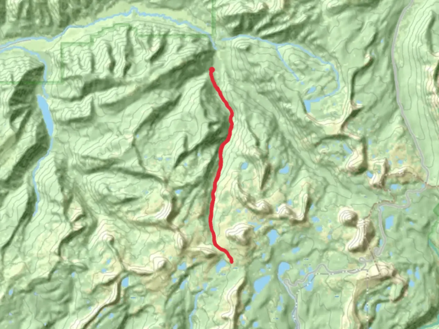
Starting near Summit County, Utah, the Middle Fork Weber River Trail is an out-and-back trail that spans approximately 24 kilometers (15 miles) with an elevation gain of around 1000 meters (3280 feet). This trail is rated as medium difficulty, making it suitable for moderately experienced hikers.
Getting There
To reach the trailhead, you can drive or use public transportation. If driving, head towards the town of Kamas, Utah, and follow the Mirror Lake Highway (UT-150) until you reach the trailhead near the Smith and Morehouse Reservoir. For those using public transport, the nearest significant landmark is the Kamas Park and Ride, from where you can arrange a taxi or rideshare to the trailhead.
Trail Overview
The trail begins at the Smith and Morehouse Reservoir, a popular spot for fishing and picnicking. As you start your hike, you'll follow the Middle Fork of the Weber River, which provides a soothing soundtrack of flowing water. The initial section of the trail is relatively flat, making it a good warm-up for the more challenging sections ahead.
Flora and Fauna
As you progress, you'll notice a diverse range of flora, including aspens, pines, and wildflowers, especially vibrant in the spring and summer months. Wildlife is abundant, with chances to spot deer, elk, and various bird species. Keep an eye out for moose, particularly in the early morning or late afternoon.
Significant Landmarks
Around the 8-kilometer (5-mile) mark, you'll come across a picturesque meadow, an ideal spot for a short break. The meadow offers panoramic views of the surrounding Uinta Mountains, a perfect backdrop for photos. Continuing on, the trail becomes steeper and more rugged, gaining significant elevation as you approach the 12-kilometer (7.5-mile) point.
Historical Significance
The region has a rich history, once inhabited by the Ute Native American tribe. The trail itself follows part of the route used by early trappers and settlers in the 19th century. Remnants of old cabins and mining equipment can occasionally be spotted off the main path, offering a glimpse into the area's past.
Navigation and Safety
Given the trail's moderate difficulty, it's advisable to use a reliable navigation tool like HiiKER to keep track of your progress and ensure you stay on course. The trail is well-marked, but weather conditions can change rapidly, especially at higher elevations. Always check the weather forecast before setting out and be prepared for sudden changes.
Final Stretch
The final section of the trail leads you to a high alpine area with stunning views of the surrounding peaks. This is the turnaround point for the out-and-back trail. Take a moment to enjoy the scenery and perhaps have a snack before retracing your steps back to the trailhead.
Practical Tips
- Wear sturdy hiking boots with good ankle support.
- Carry plenty of water and snacks.
- Bring layers of clothing to adapt to changing weather conditions.
- A first-aid kit and a map or GPS device like HiiKER are essential.
- Be mindful of wildlife and maintain a safe distance.
This trail offers a rewarding experience with its mix of natural beauty, historical significance, and moderate challenge, making it a must-visit for hikers in the Utah area.

What to expect?
Activity types
Comments and Reviews
User comments, reviews and discussions about the Middle Fork Weber River Trail, Utah.
4.55
average rating out of 5
11 rating(s)