Download
3D Preview
Add to list
More
29.4 km
~7 hrs 8 min
763 m
Out and Back
“Embark on the Henry's Fork Basin Trail for a scenic, moderately challenging adventure through Utah's Uinta Mountains.”
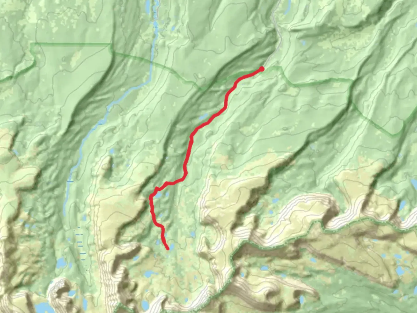
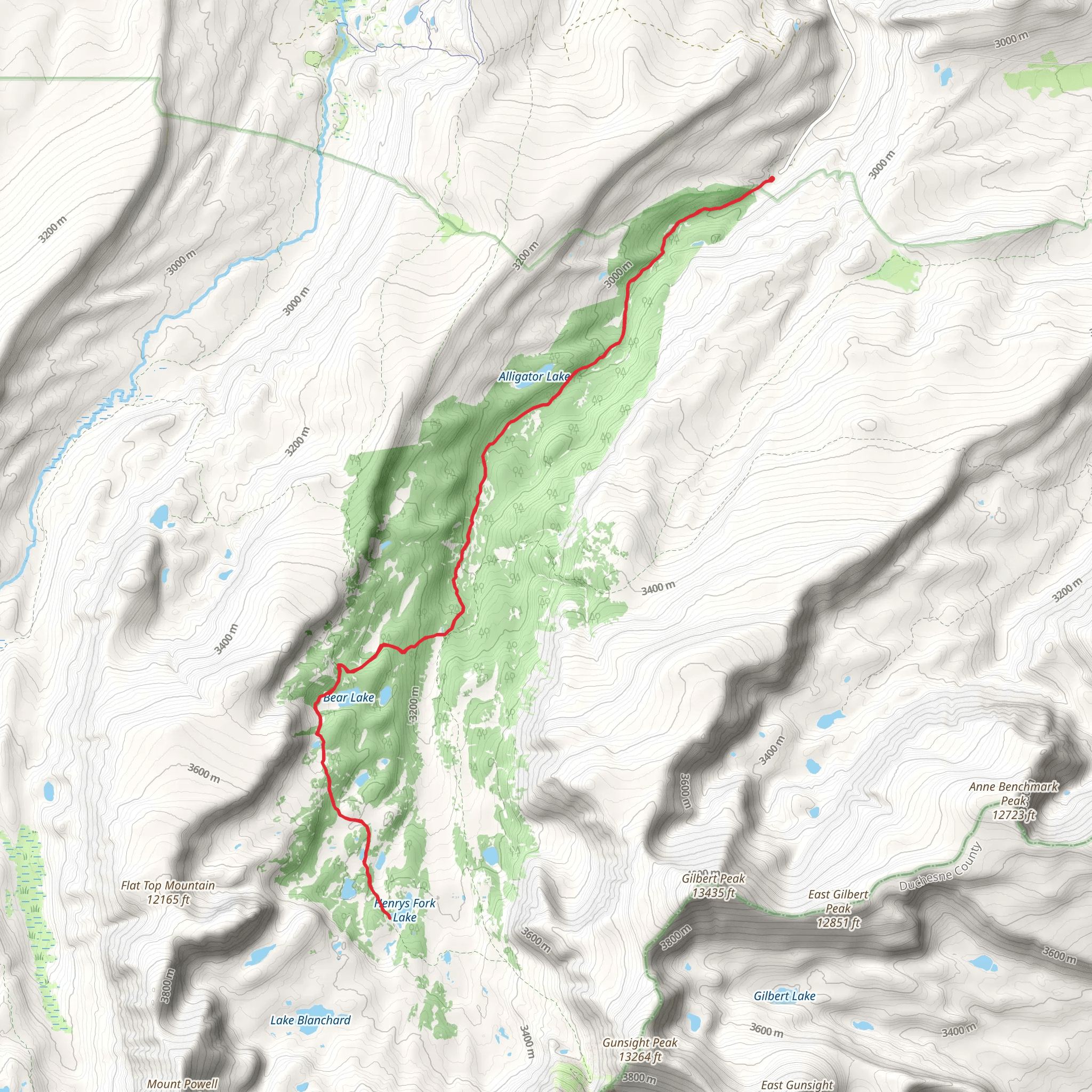
Starting your adventure near Summit County, Utah, the Henry's Fork Basin Trail offers a captivating journey through the Uinta Mountains. This out-and-back trail spans approximately 29 kilometers (18 miles) with an elevation gain of around 700 meters (2,300 feet), making it a moderately challenging hike suitable for those with a reasonable level of fitness.
Getting There
To reach the trailhead, you can drive or use public transport. If driving, head towards the Henry's Fork Campground, which is the nearest significant landmark. For those relying on public transport, the nearest major city is Salt Lake City. From there, you can take a bus or shuttle service to Evanston, Wyoming, and then arrange for a local taxi or shuttle to the Henry's Fork Campground.
Trail Overview
The trail begins at the Henry's Fork Campground, situated at an elevation of approximately 2,500 meters (8,200 feet). The initial section of the trail is relatively gentle, winding through dense forests of pine and aspen. As you progress, the trail gradually ascends, offering glimpses of the surrounding peaks and valleys.
Significant Landmarks and Points of Interest
- Elkhorn Crossing (4 km / 2.5 miles in): This is one of the first major landmarks you'll encounter. It's a picturesque spot where the trail crosses the Henry's Fork River. The area is known for its lush meadows and abundant wildflowers during the summer months.
- Alligator Lake (8 km / 5 miles in): Continuing along the trail, you'll reach Alligator Lake, a serene alpine lake surrounded by towering peaks. This is a great spot for a rest and to take in the stunning scenery.
- Gunsight Pass (12 km / 7.5 miles in): As you approach the halfway point, the trail becomes steeper, leading you to Gunsight Pass. The pass offers panoramic views of the surrounding mountains and valleys, making the challenging ascent well worth the effort.
Flora and Fauna
The Henry's Fork Basin Trail is rich in biodiversity. The lower elevations are dominated by pine and aspen forests, while higher elevations feature alpine meadows and tundra. Wildlife is abundant, with chances to see deer, elk, and even the occasional moose. Birdwatchers will also find plenty to admire, including eagles, hawks, and various songbirds.
Historical Significance
The Uinta Mountains, where the Henry's Fork Basin Trail is located, have a rich history. The area was originally inhabited by the Ute and Shoshone tribes, who used the mountains for hunting and gathering. In the 19th century, the region became a popular route for trappers and explorers. Today, the trail offers a glimpse into this storied past, with remnants of old campsites and historical markers along the way.
Navigation and Safety
Given the trail's moderate difficulty, it's essential to be well-prepared. Ensure you have a reliable navigation tool like HiiKER to keep you on track. Weather in the Uinta Mountains can be unpredictable, so pack layers and be prepared for sudden changes. Water sources are available along the trail, but it's advisable to carry a water filter or purification tablets.
Final Stretch
The trail culminates in the Henry's Fork Basin, a stunning alpine basin surrounded by some of the highest peaks in Utah, including Kings Peak, the state's highest point. The basin is an excellent spot for camping, fishing, and simply soaking in the natural beauty before retracing your steps back to the trailhead.
Embarking on the Henry's Fork Basin Trail promises a rewarding experience filled with natural beauty, historical intrigue, and a sense of accomplishment.
What to expect?
Activity types
Comments and Reviews
User comments, reviews and discussions about the Henry's Fork Basin Trail, Utah.
4.67
average rating out of 5
12 rating(s)
